
Official websites use .gov
A .gov
website belongs to an official government organization in the
United States.
Secure .gov websites use HTTPS
A lock
(
) or https:// means you've safely
connected to the .gov website. Share sensitive information only
on official, secure websites.


Fossil Creek Recreation Site Tour
Fossil Creek
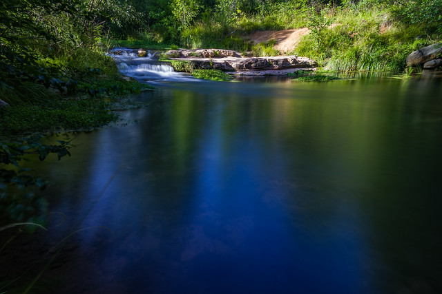
There are ten recreation sites and trails along Fossil Creek Wild and Scenic River. Each site features deep pools and beautiful scenery.
April 1 - Oct. 1
Spring-summer season.
Parking permit required.
No camping allowed.
Oct. 2 - March 31
Fall-winter season.
No permit required.
Some camping allowed.*
Never allowed
Campfires and glass containers are never allowed in the area.
Fossil Creek Sites
Sites in this tour are broken down into two location types: creekside and trails.
Creekside along Fossil Creek
These sites offer easy access to Fossil Creek, with parking lots just a short walk to the creek. These sites are accessed via Fossil Creek Road (Forest Road 708) from SR 179 near Camp Verde, Ariz. The 14-mile drive down unpaved Fossil Creek Road is beautiful but very rough. A high clearance vehicle is highly recommended. Passenger cars are frequently damaged on this rough road. Sites are presented here from west to east.
Select a site to learn more about it.
Creekside

Creekside

Creekside

Creekside

Creekside

Creekside
Creekside
Hiking Trails at Fossil Creek
These hiking trails provide a more vigorous experience at Fossil Creek, with two to ten mile round-trip hikes into untamed areas. Trailheads are accessed from either Camp Verde or Strawberry, Arizona.


Creekside Sites along Fossil Creek
Mazatal
Map | Book a permit for Mazatzal
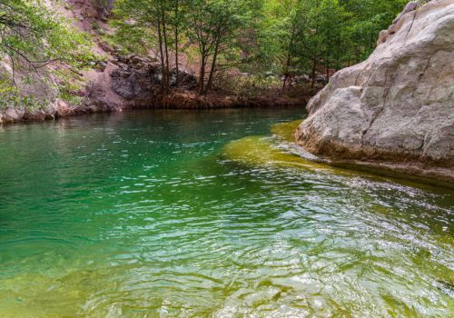
Family-friendly, quiet and serene. The Mazatzal site on Fossil Creek Wild and Scenic River is a fun, family adventure site with a great swimming hole with striking canyon views. The short (0.2 miles) trail to the creek is smooth and well traveled, offering an easy kid-friendly "hike" into the Mazatzal Wilderness. The trail ends at a solid rock ramp down to the shallow end of a deep swimming hole. The gravel creek bottom here gives small children a place to splash, and easy access to the water. The rock ramp offers room for sunbathing and relaxing, and the bank above the creek is a great spot to spread out a picnic blanket.
Adventurers can find more nearby pools by exploring up the creek from access point at the end of the trail. The Mazatzal site offers something to delight every member of the family.
Purple Mountain

Map | Book a permit for Purple Mountain
This lesser visited location in Fossil Springs is a hidden gem. The Purple Mountain site at Fossil Creek Wild and Scenic River offers a short walk to the creek. Dense trees provide plentiful shade with many grassy picnic spots. There are several shallow pools with gravel bottoms and easy entry points. It's a beautiful, relaxing area perfect for kicking back in a hammock to read a book, take a siesta, or simply enjoy nature. With long banks to explore, it's easy to find your own little slice of heaven.
Look for bits of history from the days when the Childs-Irving Hydroelectric Facilities provided power to nearby communities. The facilities were decommissioned and removed between 2005 and 2008, but many structures and foundations remain. The Purple Mountain area was originally a work camp in 1908 for workers who constructed the nearby hydroelectric power plant facilities.
Sally May
Map | Book a permit for Sally May
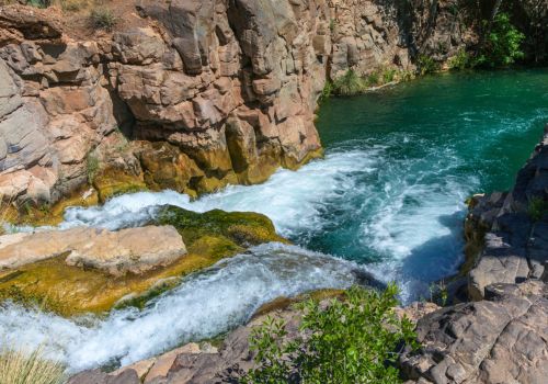
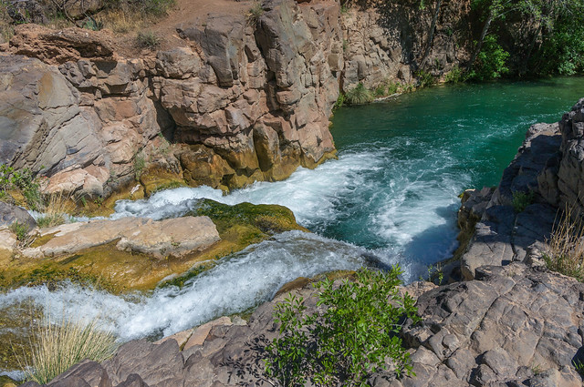
The Sally May site on Fossil Creek Wild and Scenic River offers some of the best swimming along the entire creek. There are two parking areas on either side of the bridge, which crosses Sally May Wash, on FR 502 (the Childs Power Road). Each lot has a path leading to separate pools along the creek.
On the east (upstream) side of the bridge, the path leads to a large, deep pool at the base of a steep water feature. Rock shelves and cliff walls provide a lot of great spots for sunbathing and enjoying the canyon views. A smooth rock outcrop makes a great jumping-in spot. A small sandy beach at the far end of the pool offers shallow water entry and a good spot for smaller children to play.
On the west (downstream) side of the bridge, there's a large open area above the parking lot that makes a great spot for a family picnic. The path to the creek leads to another swimming hole at the base of beautiful water feature. There are rocky banks to relax on, and a shallow sandy entry point not far downstream near a gravel-bottomed section of creek that is a great place to wade and splash. A bit of the creek's history remains along the banks here, structures from the days the Childs-Irving hydroelectric power plants used the creek to generate power for nearby mining communities like Jerome, Arizona.
Homestead

Map | Book a permit for Homestead
As the name suggests, this area, until 1990, was the site of a working homestead. The only remaining evidence of the property is a rock root cellar and several sections of water pipe. Remnants of an old orchard are also evident. Homestead is an excellent area for bird and wildlife viewing, and offers a large parking lot for permit holders.
Fossil Creek Bridge
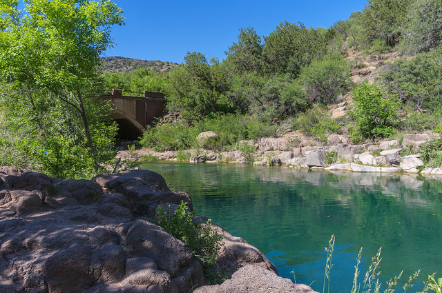
Map | Book a permit for Fossil Creek Bridge
The Fossil Creek Bridge site is a popular site for swimming, sunbathing, fishing, photography, and picnicking. The large, deep pool just below the bridge offers some of the best swimming along the creek, with large flat rock benches to relax and sunbathe on. The bridge shades a rocky area with a spectacular view of rapids and water features upstream and swimmers downstream, making it a perfect spot to throw down a picnic blanket and enjoy the scenery, particularly for parents monitoring their children swimming in the pool.
Tonto Bench

Map | Book a permit for Tonto Bench
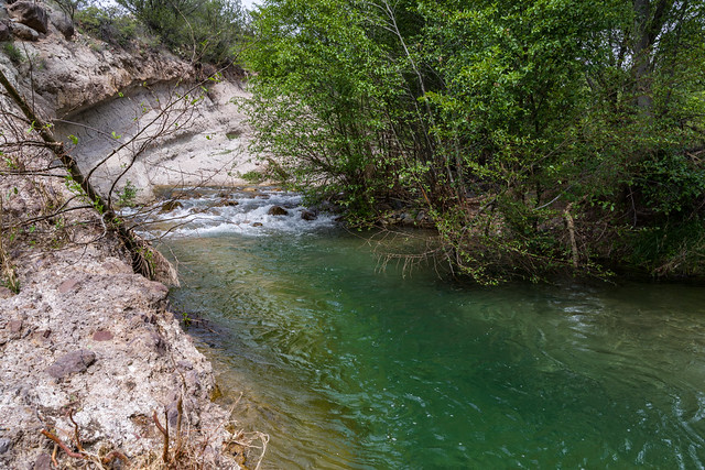
The Tonto Bench site at Fossil Creek Wild and Scenic River offers a deep swimming hole and shady creek banks to explore. Two short paths lead out of the parking area. The path to the left leads to shady, shallow pools and interesting water features. The righthand path leads straight out of the parking area to a deep pool. There are rock benches and walls all around the area, providing plenty of places to relax out of the water. A few sandy entries make it easy to get in and out of the water.
Look for bits of history along the canyon wall above the creek where pilings from the old flume used to transport Fossil Creek's water to the Childs hydroelectric power plant before the Childs-Irving Hydroelectric Facilities were decommissioned and removed between 2005 and 2008.
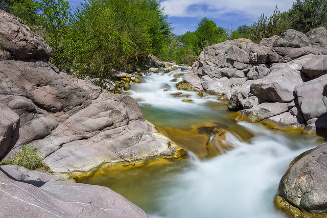
Irving
Map | Book a permit for Irving
Irving has many small pools and one large pool to enjoy. This was once the site of the Irving power plant. Through the 20th century, the Irving-Childs hydroelectric facilities along Fossil Creek provided power to local mining communities. The facilities were built around 1912. The power plant, flume, diversion dam, and other structures were decommissioned and removed between 2005 and 2008. Foundations, flume footings, and other bits of the historic structures remain and can be seen in the open area on the north side of the creek.
Fossil Creek is one of two "Wild and Scenic" rivers in Arizona. This designation was achieved when the Irving power plant was decommissioned, and removal of flume and dam on the creek allowed the creek to flow free.
Hiking Trails at Fossil Creek
Flume Trail
Map | Book a permit for the Flume Trailhead (at Irving)
This demanding trail starts at the old Irving Power Plant location. This trail follows the line of the now-removed flume that carried the water from the dam to the power plants for generating electricity. The trail ends at the old Fossil Creek Dam, a four and a half mile trek one way. The trail ascends steadily about 500 feet from an elevation of 3769 foot at the trailhead over the first mile. For the next three and a half miles, the trail rolls gently several times in approximately 150 foot elevation changes before arriving at the Old Fossil Creek Dam. The dam was decommissioned and partially removed between 2005 and 2008, allowing the creek to flow freely, earning it the designation "Wild and Scenic River." See Flume Trail for detailed information.
The Forest Service urges safety and caution when hiking this trail in the summer. Search and Rescues are common on the Flume Trail due to heat stroke and heat exhaustion of unprepared visitors. Be advised that you will not have cell phone service, and your only means of hailing emergency help would be through a SPOT device or something similar, or self-evacuation.
Fossil Springs Trail
Map | Book a permit for Fossil Springs Trail Park-and-Hike.
This steep and strenuous trail descends approximately 1500' over 4 miles to the springs for which Fossil Springs Wilderness was named. The trail starts off wide and smooth, but becomes progressively rockier and steeper as it winds its way down into the canyon. At approximately 4 miles, the trail finally arrives at Fossil Creek. The trail reaches the Old Fossil Creek Dam at 4.75 miles, where the trail ends a the junction with the Flume Trail. See Bob Bear (formerly Fossil Springs) Trail for detailed informtion.
The Forest Service reminds users to be mindful of heat related illnesses. Multiple Search and Rescues occur on this trail every year due to unprepared hikers.
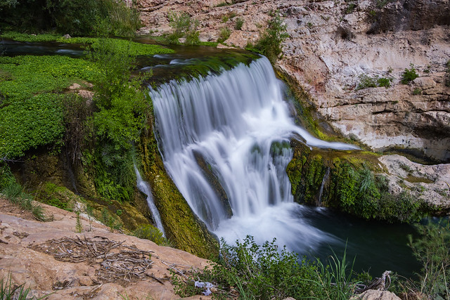
Dixon Lewis Trail
Map | Book a permit for Dixon Lewis Trailhead
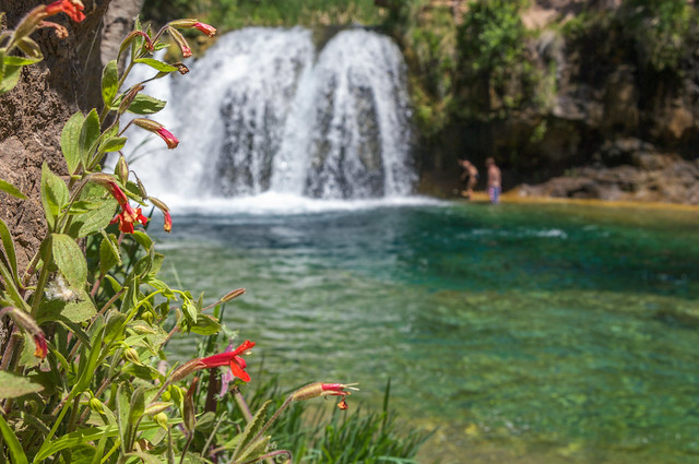
The Dixon Lewis Trail is one of the most popular areas in Fossil Creek. This one-mile trail follows the creek to a natural waterfall. While this trail is easy to follow, there are areas with wet rock and unavoidable obstacles, so the Forest Service encourages use of sturdy, closed toe shoes for the hike. Fossil Creek boasts what has been described as the most diverse riparian area in Arizona. Over thirty species of trees and shrubs and over a hundred species of birds have been observed in this unique habitat.
The waterfall area is very popular, and very crowded (especially on weekends). There are several deep and beautiful swimming holes along the trail where swimmers can find more solitude away from the crowd. Users looking for a serene experience in Fossil Creek should look at the other parking areas the Forest Service offers. Learn more about hiking to the waterfall on Fossil Creek.
Download Fossil Creek Seasonal Permit Area Guides
These are scans of our brochures. If you need help accessing information please contact us.
English

Spring-Summer Guide
April 1 - October 1
(PDF, 1.7 MB)
Fall-Winter Guide
October 2 - March 31
(PDF, 1.6 MB)
Español

Guía para la primavera y el verano
1 de abril - 1 de octubre
(PDF, 220 kB)
Guía para el otoño e invierno
2 de octubre - 31 de marzo
(PDF, 250 kB)