Official websites use .gov
A .gov
website belongs to an official government organization in the
United States.
Secure .gov websites use HTTPS
A lock
(
) or https:// means you've safely
connected to the .gov website. Share sensitive information only
on official, secure websites.


Day Hiking
Day Hiking Areas
- Ava/Cassville/Willow Springs Ranger District
- Bar-K Wrangler Camp
- Swan Creek Non-Motorized Area
- FS Road 150 Trailhead
- Devils Backbone Wilderness
- Collins Ridge Trailhead
- McGarr Ridge Trailhead
- Raccoon Hollow Trailhead
- Glade Top National Forest Scenic Byway
- Hercules Glades Wilderness
- Blair Ridge Trailhead
- Coy Bald Trailhead
- Hercules Tower Trailhead
- Noblett Lake Recreation Area
- North Fork Recreation Area
- Blue Spring
- Blue Spring Trailhead
- OT - North Fork Section
- Blue Hole Trailhead
- Pomona Trailhead
- Piney Creek Wilderness
- Pine View Tower Trailhead
- South Piney Trailhead
- Ridge Runner NRT
- Hay Hollow Trailhead
- Horton Trailhead
- Noblett Lake Trailhead
- Noblett Trailhead
- Eleven Point/Doniphan Ranger District
- Current River
- Float Camp Recreation Area
- White Oak and Wood Chuck Trails
- OT - Current River Section
- Watercress Recreation Area
- Songbird Hike
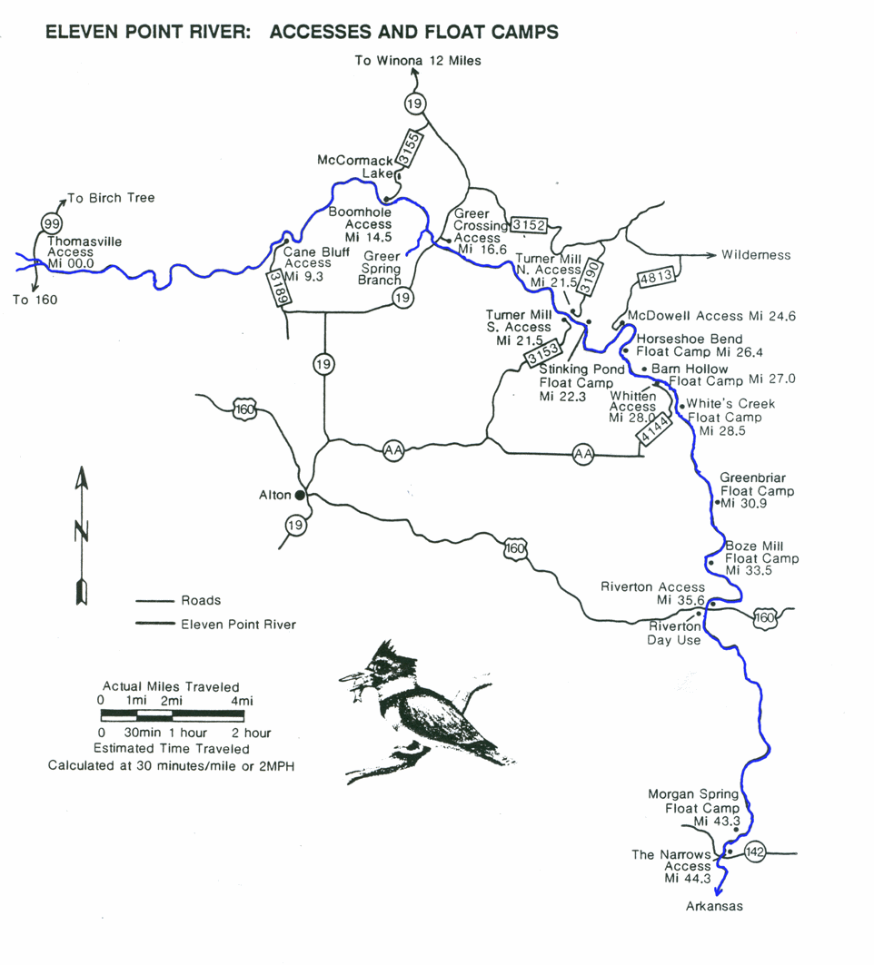
- Eleven Point National Wild and Scenic River
- Greer Crossing Recreation Area
- Greer Spring
- Morgan Spring Float Camp
- Turner Mill North River Access
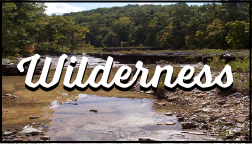
- Irish Wilderness
- Whites Creek Trl
- Brawley Pond Trailhead
- Camp Five Pond Trailhead
- Lazy C
- McCormack Lake Day Use Area
- McCormack Lake Recreation Area
- OT - Between the Rivers Section
- Highway 60 trailhead (OT)
- Katy Trailhead (OT)
- Sinking Creek Trailhead (OT)
- OT - Eleven Point River Section
- Paty Pond trailhead (OT)
- Houston/Rolla/Cedar Creek Ranger District
- Big Piney
- Big Piney River
- Slabtown Recreation Area
- Big Piney equestrian camp
- Cedar Creek Trl System
- Boydsville North Trailhead
- Moon Loop Trailhead (On Barnes Chapel Rd.)
- Moon Loop Trailhead (on Ginn Rd.)
- Paris Chapel Trailhead
- Cole Creek
- Kaintuck Hollow
- Kaintuck Hollow natural bridge trailhead
- Kaintuck Hollow southeast trailhead
- Lane Spring Recreation Area
- Blossom Rock trailhead
- Cedar Bluff trailhead
- Mill Creek Recreation Area
- Paddy Creek Wilderness
- Paddy Creek trailhead
- Pine Ridge Recreation Area
- Roby Lake
- Poplar Bluff Ranger District
- Markham Springs Recreation Area
- Markham Springs - hiking
- OT - Victory Section and trailhead
- Brush Arbor trailhead (OT)
- Brushy Creek trailhead (OT)
- Upalika trailhead (OT)
- Wrangler Trailhead (OT)
- OT - Wappapello Section
- F Highway Trailhead (OT)
- Highway 172 trailhead (OT)
- Pinewoods Lake Recreation Area
- Pinewoods Lake trailhead
- Wolf Creek
- Wolf Creek south trailhead
- Potosi/Fredericktown Ranger District
- Bell Mountain Wilderness
- Lindsey Mountain Trailhead
- Berryman Campground
- Brazil Creek Trailhead
- Council Bluff Recreation Area
- Council Bluff Lake Trailhead
- Enough Boat Launch and Trailhead
- Wild Boar Boat Launch and Trailhead
- Crane Lake Recreation Area
- Hazel Creek Campground
- John J. Audubon Trl System (and West TH)
- John J. Audubon Bidwell Creek Trailhead
- John J. Audubon East Trailhead
- Marble Creek Recreation Area
- OT - Courtois Creek Section
- Harmon Springs Trailhead
- Highway 8 (Berryman) Trailhead
- OT - Marble Creek/Crane Lake section
- OT - Middle Fork Section
- OT - Taum Sauk Section
- Bell Mountain Ottery Creek Trailhead
- Red Bluff Recreation Area
- Red Bluff - hiking
- Rockpile Mountain Wilderness
- Rockpile Mountain Trl
- Silver Mines Recreation Area
- Summit Loop Trailhead (Silver Mine Rec Area)
- Trace Creek Section of the Ozark Trail
- Salem Ranger District
- Huzzah Ponds
- Loggers Lake Recreation Area
- Loggers Lake - hiking loop
- OT - Blair Creek Section
- OT - Karkaghne Section
- OT Sutton Bluff Trailhead
- Sutton Bluff Recreation Area