
Official websites use .gov
A .gov
website belongs to an official government organization in the
United States.
Secure .gov websites use HTTPS
A lock
(
) or https:// means you've safely
connected to the .gov website. Share sensitive information only
on official, secure websites.


Paddy Creek Wilderness
Wilderness recreation is a unique experience that requires special skills and techniques, such as no-trace camping, to ensure that the character of the land truly remains wild. Emphasis in a wilderness area is on the primitive. Signing and trail marking will be minimal; developed campsites, footbridges, and garbage collection are non-existent. A wilderness is a special area set aside by Congress which “generally appears to have been affected primarily by the forces of nature with the imprint of man’s work substantially unnoticeable…” Before you start, be prepared with adequate supplies; water sources with the wilderness are not recommended for drinking, and must be purified if used. Group size is limited to 10 persons.
This 7035-acre wilderness is located in northwestern Texas County. In the early 1800’s Sylvester Paddy began the first logging of the area, transporting timber from this area by river to St. Louis. Until the 1930’s the area was homesteaded and grazed as open range. It became federally designated wilderness in 1983.
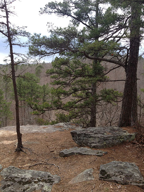
Big Paddy and Little Paddy Creeks characterize the Paddy Creek Wilderness with steep cliffs and rock outcrops along the drainages. These creeks have water in them throughout most of the year. In the Wilderness are a few old fields in drainages but the rest is forested. Black, white, and post oaks, hickories and shortleaf pine are the main trees. Throughout the area, wildlife typical of the Missouri Ozarks is present. White-tailed deer, wild turkey, squirrel, rabbit, fox, coyote and bobcat are common.
Brochures and Maps
- A printable brochure (pdf format) is available for download.
- Trail System Map (printable) and Trail System Map available on the Avenza app.
Trails: There are 18 miles of designated trails within the wilderness. The elevation of the area changes 500 feet between a point near Roby Tower on the western edge of the area, and Paddy Creek as it meets the eastern boundary of the Wilderness. Signs and trail marking are minimal or non-existent and the use of maps and compass is recommended. Travel is by foot or on horseback; No Motorized or Mechanized vehicles are permitted.
At a Glance
| Restrictions: | Forest Order 09-05-12-07: Wilderness
|
|---|
Activities
Dispersed Camping
Recreation areas with activity Dispersed Camping:Dispersed camping is the term used for free camping anywhere in the National Forest OUTSIDE of a designated campground. Dispersed camping means there are no toilets, no structures, no trash cans, no treated water, and no fire grates. There are extra responsibilities required for this type of camp. It's a must to educate yourself before you try it, but we hope the adventure of dispersed camping in the Mark Twain National Forest calls to you!
- Pick a Campsite and follow the Leave No Trace Principles
- Camp 100 feet away from trails and water sources.
- Treat any water found in the area before consuming it.
- Human waste (Feces) must be buried at least 6 inches deep and covered.
- Pack out all of your garbage.
General Info:
Safety InformationWilderness has inherent dangers, and is a primitive setting where you meet nature on its own terms. Bring a map and compass, and first aid kit. During temperate months, be prepared for biting insects, poison ivy and high temperatures. Be advised of hunting seasons. Avoid using the trail during excessively wet periods. Be sure to tell someone your plans, don’t hike the wilderness alone and carry extra supplies so you are prepared to take care of yourself in case you get lost, injured, or delayed.
Day Hiking
Recreation areas with activity Day Hiking:General Info:
Directions
From Roby MO take Hwy 17 north for 2 miles, turn right on Slabtown Road (watch for the Forest Service campground sign), go 6 miles, turn right on Forest Road 220 and go two Miles to Paddy Creek Recreation Area which is adjacent to the Wilderness Area.
Backpacking
Recreation areas with activity Backpacking:Horse Riding
Recreation areas with activity Horse Riding:Quick Links
Highlights
Location


