
Hiking
Grab your boots, water bottle, a snack, and maybe the bug repellent. There are over 400 miles of hiking trail in the Superior National Forest, so you could be gone a long time. You can discover scenic vistas, clear lakes, carnivorous plants, historic railroads, and more all along the trail. There are short hikes, day hikes, and backpacking trails; rugged uphills, long flat stretches, and steep descents. It's all up to you.
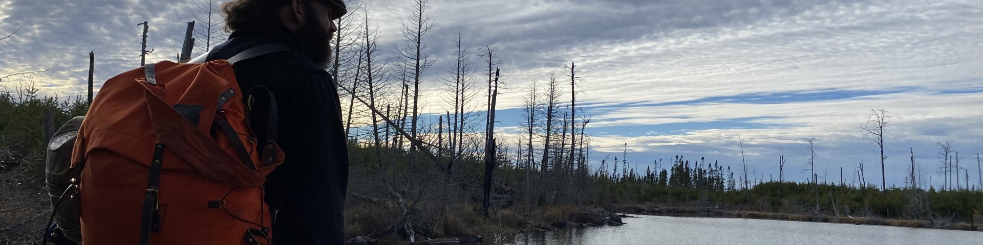
Backpacking
Backpacking the Superior can be a wonderful experience. You'll be a part of history as you hike on trails that may have been traveled for hundreds of years, or even longer. You could see moose, black bears, or hear wolves howl in the night.
There are several trails in the Superior National Forest that offer world class backpacking opportunities. The Superior Hiking Trail runs from Duluth to Grand Portage passing though the eastern edge of the Superior on its way. The Superior Hiking Trail Association maintains a website with current conditions and trail information. The Border Route Trail follows portions of the 'Voyageurs' Highway' traversed by fur traders at the turn of the 18th century. Along with the Border Route Trail, several other trails travel into the Boundary Waters Canoe Area Wilderness. Be sure to look for more information on the Boundary Waters Canoe Area Wilderness portion of the website before planning a trip on those trails.
Backpackers should be sure to practice the seven principles of Leave No Trace Outdoor Ethics. While 'Pack It Out, Pack It In' is an important part of Leave No Trace, good LNT goes far beyond that. Visit the Leave No Trace website for information on how to Leave No Trace as you travel.
When preparing for your backpacking trip, here are some things to keep in mind. Much of the Superior National Forest lacks reliable cell phone coverage, so don't count on your cell phone for emergencies. Take it with, but have a back up plan for emergency contact. Weather on the Superior can change rapidly. Summer thunderstorms and high winds are common, so be ready to handle the weather. Bring a map and compass, and know how to use them, even if you have a GPS. Leave your route and an expected return date with someone when you leave.
Lastly, be prepared to have a great trip!
Day Hikes
There are many shorter trails available for day hiking, as well as trailheads for longer trails that can be used for day hikes.
If you are day hiking, be sure to be prepared. Many of our trails see little use, so your party needs to be able to take care of itself. Bring adequate water for everyone, snack food, and rain gear if there is the least chance of rain. Hats, sunscreen, and insect repellent are also often useful. The trails are usually a single-width foot path, and may have rocks and uneven ground. Wear appropriate footwear for these conditions. Day hiking may not require a map and compass, but if there is a trail map available, you will want to bring it. Don't forget binoculars, field guides, and a camera too!
Remember to Leave No Trace in the woods by following the seven principles of Leave No Trace Outdoor Ethics. For more information on Leave No Trace, follow this link.
The areas and trails listed below are all suitable for day hikes. Many of these will link to brochures with trail maps. Have a great day out in the woods!