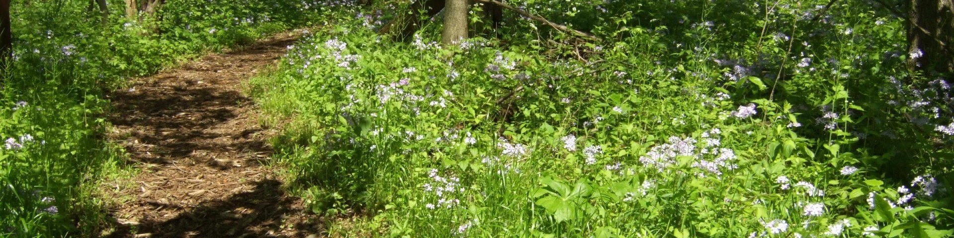
Hiking
Today, about half of the 18,225 acres of Midewin are open to the public, including over 34 miles of trails. About 22 miles of trail are for shared use by hikers, bicyclists, and equestrians. Over 12 miles of trails are for hiking only. Bicycles, horses, and leashed dogs are restricted to designated trails at all times. Visitors and trail users are welcome to the open areas of Midewin every day of the year from 4 am until 10 pm.
Picnic tables and portable toilets are available at all trailheads. There are currently no sources of water at Midewin other than at the Midewin Welcome Center. Bulletin boards located at all trailheads are regularly updated with important information. Please check for the latest news before heading out on the trail. Enjoy your visit.
Self-guided hikes
Self-guided hikes through these areas & trails are a screen-tap away on your smartphone. View our self-guided hike app.
Trailhead Coordinates
- Iron Bridge Trailhead: 41°22'43.9"N 88°07'23.0"W
- River Road Seedbeds: 41°20'32.2"N 88°10'16.5"W
- Wauponsee Trailhead: 41°23'36.5"N 88°00'23.4"W
- Hoff Road Trailhead: 41°23'35.5"N 88°04'38.0"W
- Buttonbush Pond: 41°20'42.2"N 88°10'39.8"W
- Prairie Creek Woods Trail:
- Beginning of trail: 41°20'37.6"N 88°10'18.5"W
- End of trail: 41°20'53.3"N 88°10'19.0"W
- Turtle Pond: 41°22'45.0"N 88°04'31.6"W
- Explosives Road: 41°22'02.9"N 88°08'37.1"W
Search for Hiking Opportunities
Showing: 1 - 10 of 14 results
Bailey Bridge Trail
The Bailey Bridge Trail is a 2.5-mile trail that begins near the Twin Oaks Trail and ends at the junction that connects the Wauponsee Glacial Trail with Twin Oaks Trail. Unlike other hikes at…
Blodgett Marsh Trail
Blodgett Marsh Trail is a 4.5 mile mowed grass trail, looping through the Blodgett Marsh restoration project.Hikers will walk through fields of grasses, both native and non-native, crossing over two…
Explosives Road Trailhead
The Explosives Road Trailhead provides access to the 1.6 mile Newton Loop trail. This is a great bird watching area for Henslow sparrows, loggerhead shrikes, bobolinks, eastern meadowlarks, and…
Group 63 Interim Trail
The Group 63 Interim Trial is a 3.6 mile dirt road that loops around the former ammunition bunkers. Many of the bunkers are sealed and not open to visitors, however Bunker Group 63-1 is open.Although…
Hedgeapple Trail
Rows of hedgeapple trees (also called Osage orange trees) connect Twin Oaks Trail to Group 63 Trail.The trail begins at the northwest corner of the Twin Oaks Trail, parallels Hoff Road and turns…
Hoff Road Trailhead
The Hoff Road Trailhead provides direct access to several trails and areas:Twin Oaks TrailOld Chicago RoadTurtle Pond (picnic area)Chicago Road Seedbed, (native Illinois seeds)Bailey Bridge…
Iron Bridge Trailhead
Adjacent to the Iron Bridge Trailhead is Midewin’s second largest restoration prairie. This Trailhead currently provides the only connection between the East and West side trails via the Henslow…
Prairie Creek Woods Trail
The Prairie Creek Woods trail will take visitors along the edge of the restored tallgrass prairie, at times hugging the treeline before taking you to Buttonbush Pond. After passing through the gate…
River Road Seedbeds
Like most of Illinois, very little of Midewin consists of natural prairie – less than 200 acres, scattered in little remnants across the site. To restore the remainder of Midewin to tallgrass…
River Road Trailhead
The River Road Trailhead provides direct access to several trails and areas:Prairie Creek Woods TrailButtonbush PondRiver Road SeedbedsSouth Patrol Road Prairie RestorationTo access the trails from…