
Official websites use .gov
A .gov
website belongs to an official government organization in the
United States.
Secure .gov websites use HTTPS
A lock
(
) or https:// means you've safely
connected to the .gov website. Share sensitive information only
on official, secure websites.


Diamond Peak Wilderness: Willamette
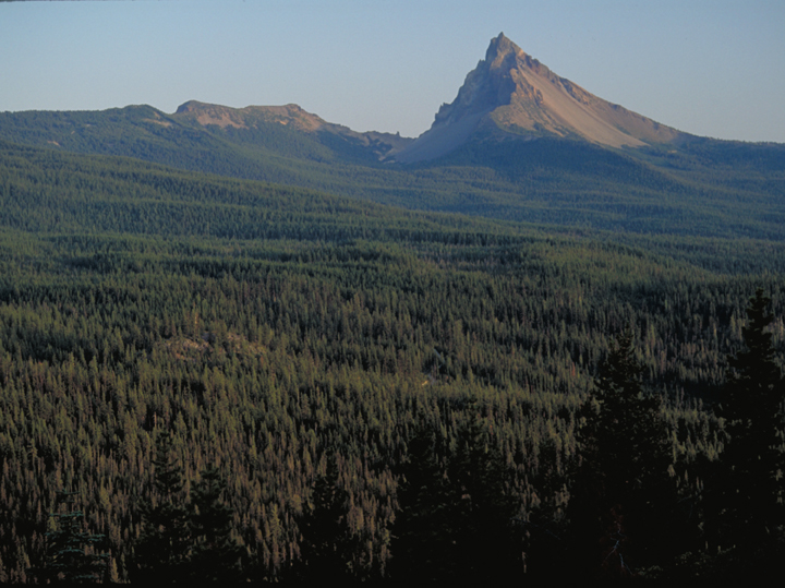
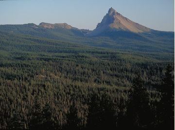
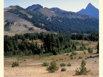
Diamond Peak Wilderness straddles the Cascade Mountains. Diamond Peak was formed as the entire land mass of the Cascades was undergoing volcanic activity and uplift. Great glaciers carved the large volcanic peak and when they receded, the bulk of the mountain remained, with snowfields near the summit and dozens of small lakes surrounding the peak.
Diamond Peak Wilderness area covers 52,611 total acres. Lakes from one to 28 acres in size dot the landscape. Approximately 14 miles of the Pacific Crest National Scenic Trail pass through this wilderness. Another 38 miles of trail, including the 10-mile Diamond Peak Trail, stretches the length of the west side of the peak.
Nearly the entire area is covered with mixed stands of mountain hemlock, lodgepole and western white pine, and silver, noble and other true firs.
Know Before You Go
- Wilderness Permits are required when visiting the Diamond Peak Wilderness between the Friday of Memorial Day weekend and October 31.
- Learn about Wilderness Regulations, including special area regulations in the Diamond Peak Wilderness.
- "Leave No Trace" techniques are encouraged in Wilderness areas, including properly disposing of human and pet waste and carrying out all trash; click here for more information.
- There are no facilities within the Diamond Peak Wilderness.
- Find out about the Weed Free Feed Requirement and other good Know Before You Go tips.
At a Glance
| Permit Info: | Wilderness Self-Issue Permit required for both day use and overnight stays from June 15 through October 15. Free permits are self-issued at the trailhead. |
|---|---|
| Usage: | Medium-Heavy |
| Restrictions: |
|
| Water: | Always carry water or a way to purify water. |
| Passes: | Some trailheads require a recreation pass.
|
| Information Center: | Middle Fork Ranger District |
General Information
Directions:Access: State Highway 58 to the Pengra Pass trailhead, Hwy 58 to Road 23 and Road 2149, Hwy. 58 to Road 5810 to the Yoran Trailhead. Hwy. 58 to Road 60 to the Whitefish, Fawn Lake and Windy-Oldenburg Trailheads. Hwy. 58 to Road 60 to Road 6010 to the Snell Lake and Summit Lake Trailheads.
General Notes:
For trail information see:
Topo Maps
Cowhorn Mountain, Diamond Peak, Emigrant Butte, Groundhog Mountain, Rigdon Point. Download free U.S. Forest Service Topo maps here.
Buy maps online
Go to the National Forest Store.
Wilderness.net
Go to Wilderness.net for online maps and other important Wilderness information.
Activities


Related Information
Highlights
- Accessible Adventures Videos
See accessible adventures at Detroit Lake & the McKenzie River Valley
Location