
Official websites use .gov
A .gov
website belongs to an official government organization in the
United States.
Secure .gov websites use HTTPS
A lock
(
) or https:// means you've safely
connected to the .gov website. Share sensitive information only
on official, secure websites.


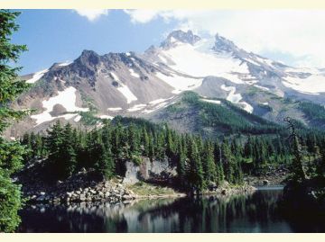
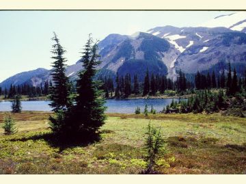
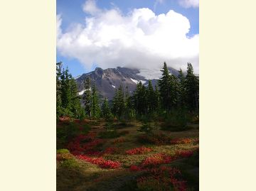
Mt. Jefferson Wilderness: Willamette
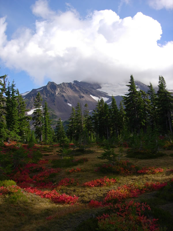
Mt. Jefferson is the dominant feature of this High Cascades area, along with Three Fingered Jack (7,841 feet). Mt. Jefferson's slopes are mantled by five glaciers: Whitewater, Waldo, Milk Creek, Russell, and Jefferson Park. Other geographic features include steep talus slopes, rock outcrops, and alpine meadows. There are over 150 lakes, many stocked with trout.
Mt. Jefferson Wilderness covers 104,523 total acres. There are 163 miles of trail within this wilderness including a 40 mile stretch of the Pacific Crest Scenic Trail.
Vegetation is predominantly Douglas-fir, silver fir, sub-alpine fir, mountain hemlock, lodgepole pine, ponderosa pine, several species of cedar as well as species like vine maple, huckleberry and rhododendron.
For trail information see:
Jefferson Park Trail Area
Marion Lake Trail Area
Maxwell Trail Area
Pamelia Lake Trail Area
Pacific Crest National Scenic Trail
Know Before You Go
- Visitors to the Mt. Jefferson Wilderness require a Central Cascades Wilderness Permit for all overnight use and some day-use between June 15 and Oct. 15.
- Learn about Wilderness Regulations, including special area regulations in the Mt. Jefferson Wilderness.
- "Leave No Trace" techniques are encouraged in Wilderness areas, including properly disposing of human and pet waste and carrying out all trash.
- There are no facilities within the Jefferson Park area or the Wilderness area.
- Find out about the Weed Free Feed Requirement and other good Know Before You Go tips.
At a Glance
| Current Conditions: | Visitors to the Mt. Jefferson, Mt. Washington, and Three Sisters Wilderness areas require a Central Cascades Wilderness Permit for all overnight use and some require one for day-use. |
|---|---|
| Fees: | Trails in the Mt. Jefferson Wilderness area require a Central Cascades Wilderness Permit for ALL overnight use and SOME require one for day-use sites between June 15 and October 15. Recreation.gov processing fees are $1/permit for day use, $6/permit for group/overnight use. Reserve a permit at Recreation.gov or by calling 1-877-444-6777. |
| Permit Info: | There are two types of entry permits required between June 15 and October 15 for entering all designated wilderness areas.
|
| Usage: | Heavy |
| Restrictions: |
|
| Water: | Always carry water or a way to purify water |
| Restroom: | No |
| Passes: | Some trailheads require a recreation pass. Check our Recreation Passes & Permits page for details |
| Information Center: | Detroit Ranger District 44125 North Santiam Highway SE Detroit, OR 97342 503-854-3366 |
General Information
Directions:Access: The most popular entry points are the Pacific Crest National Scenic Trail #2000 and Summit Trail #4041 from Highway 20 at the south end; Marion Lake Trail #3436 off Road 2255; Pamelia Lake Trail #3439 off Road 2246, 13 miles southeast of Detroit Ranger Station; Pacific Crest National Scenic Trail #2000 from Breitenbush Lake in the north; Duffy Lake Trail #3427, off Road 2267.
Popular east side entry points are Cabot Lake Trail #3437 and Road 1234 at Jack Lake; Jefferson Lake Trail #4001, from Road 1292;
Whitewater Trail #3429, off Road 2243 comes in on the west side 12.2. miles east of the Detroit Ranger Station.
General Notes:
Topo Maps
Breitenbush Hotsprings, Candle Creek, Lions Head, Marian Forks, Marion Lake, Mt Bruno, Mt Jefferson, Olallie Butte, Santiam Junction, Three Fingered Jack. Download free U.S. Forest Service Topo maps here.
Buy maps online
Go to the National Forest Store.
Wilderness.net
Go to Wilderness.net for online maps and other important Wilderness information.
Activities


Related Information
Highlights
- Accessible Adventures Videos
See accessible adventures at Detroit Lake & the McKenzie River Valley
Featured Events
- 2025 Earth Day District Clean-up
Date(s): Apr 19, 2025
Location