
Official websites use .gov
A .gov
website belongs to an official government organization in the
United States.
Secure .gov websites use HTTPS
A lock
(
) or https:// means you've safely
connected to the .gov website. Share sensitive information only
on official, secure websites.


High Knob Lookout
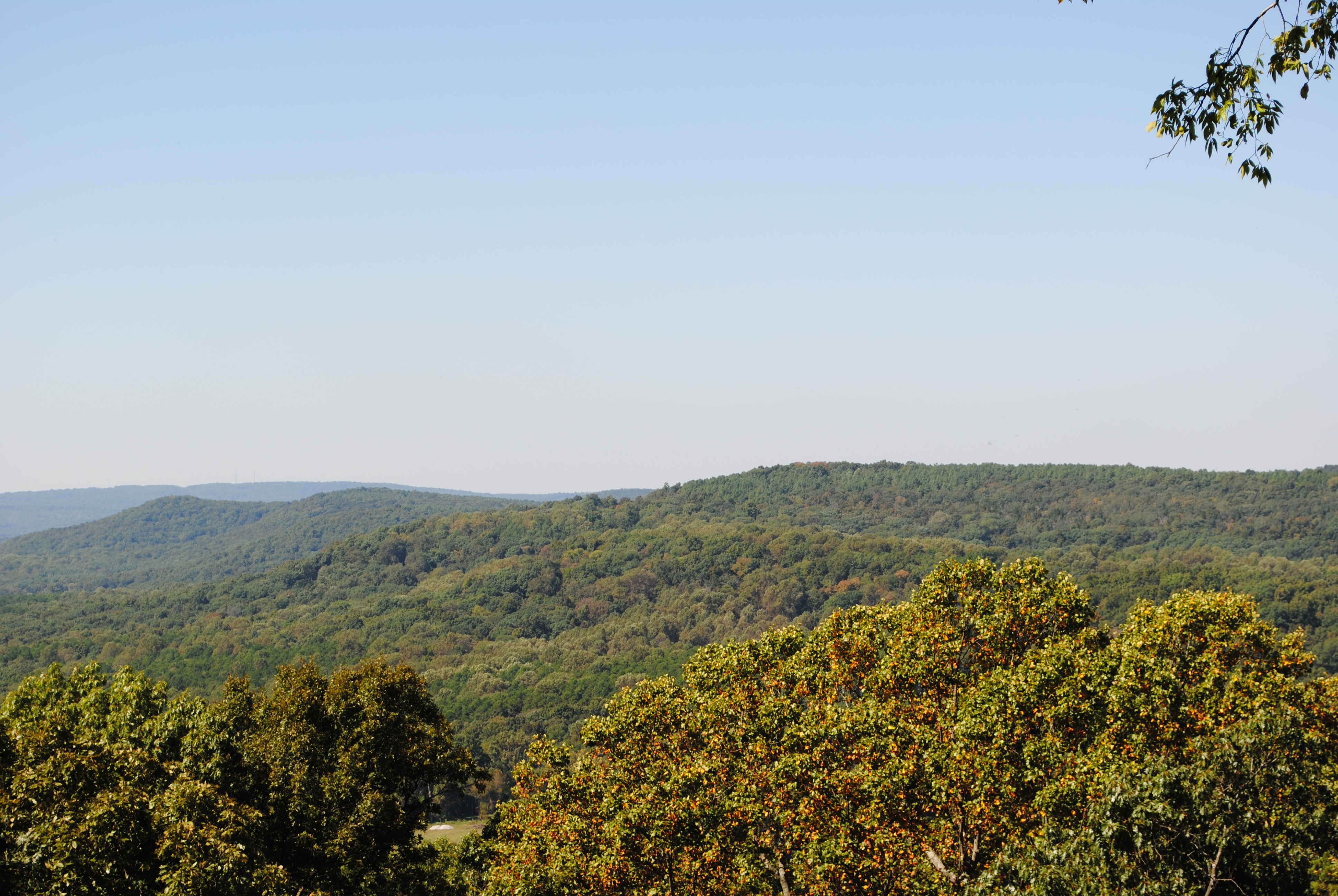
Once the site of a fire lookout tower, high knob was staffed by the Camp Cadiz Civilian Conservation Corpsmen (CCC) during the early days of the Shawnee National Forest. The old tower's concrete footings still remain. A picnic area provides daytime parking and trailhead for the 5-miles of interconnecting trails below the Knob. Forty foot cliffs, clear creeks and deciduous forest are just a few of the features along the path.
At a Glance
| Operational Hours: | All Year - 6:00 a.m.-10:00 p.m. |
|---|---|
| Restrictions: | This is a day-use area; parking is allowed 6:00 a.m.-10:00 p.m. Overnight parking is allowed outside the recreation site, near the stone pillar entrance, at the trail crossing. Backpackers can also find overnight parking at the trailhead on the west side of High Knob Road where it intersects Knob Hill Lane. |
| Closest Towns: | Harrisburg, IL 62946 |
| Water: | No |
| Information Center: | Forest Headquarters (618) 253-7114 or 1-800-My-Woods |
General Information
Directions:From Harrisburg: Take Highway 145 south 5 miles, to Highway 34, then take 34 south for 10 miles. Then turn east (left) onto Karbers Ridge Road 4 miles to High Knob Road. Turn north (left) onto High Knob Road, go 2 miles turn east (right) onto Knob Hill Lane for half a mile to High Knob Lookout. Note: Knob Hill Lane leads through High Knob Ranch/campground.
Parking:
This a day-use site open 6:00 a.m.-10:00 p.m. No overnight parking.
Overnight parking is allowed outside the recreation site, near the stone pillar entrance, at the trail crossing. Backpackers can also find overnight parking at the trailhead on the west side of High Knob Road where it intersects Knob Hill Lane.
Activities
Day Hiking
Backpacking
Viewing Scenery
Picnicking
Scenic Driving
Location

