
Official websites use .gov
A .gov
website belongs to an official government organization in the
United States.
Secure .gov websites use HTTPS
A lock
(
) or https:// means you've safely
connected to the .gov website. Share sensitive information only
on official, secure websites.


Fork Mountain Trail
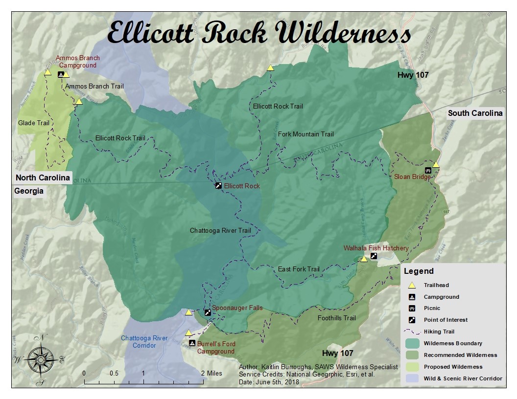
The moderately difficult 6.4-mile trail starts in South Carolina at the Sloan Bridge Picnic Area and ends in North Carolina where it joins the Bad Creek Trail in the Ellicott Rock Wilderness Area. From here, the trail eventually becomes the Chattooga Trail and continues southwest to Burrells Ford. The hike plunges almost immediately into a dense canopy of mountain laurel and rhododendron, where you’ll stay cool and shady most of the way. The trail also weaves along the northern flanks of Fork Mountain, ascending and descending through numerous coves and ravines. Rust blazes guide you from the trailhead at Sloan Bridge, but be aware that trail markers are some distance apart. Since the trail is lightly used, fallen trees and occasional undergrowth may present some problems. At the junction that includes the Bad Creek Trail, you can return or extend your hike approximately 1.3 miles to Ellicott Rock.
Click here for a printable guide and vicinity map.
At a Glance
| Open Season: | All year |
|---|---|
| Restrictions: | Primitive camping is allowed, but campsites must be greater than 50 feet from streams and trails, and greater than .25 mile from roads. Fallen trees and occasional undergrowth may present some problems. |
General Information
Directions: From Walhalla, SC, drive northwest on SC 28 for 7.5 miles and bear right onto SC 107. Continue on SC 107 got 14.5 miles to the junction of Oconee County S-413. The Sloan Bridge Picnic Area is approximately 0.5 mile ahead on the left. From the parking lot, walk north across the highway culvert that crosses East Fork Creek.Activities
Day Hiking
Travel time 3 hoursBackpacking

Related Links
Highlights
Location