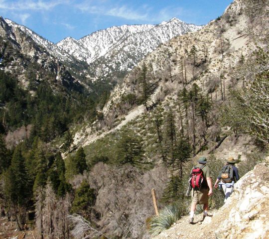
Middle Fork Trail 6W01

Hiking at high elevations (Cucamonga Peak, Ice House Canyon, San Gorgonio Peak, etc..) in winter, spring and even early to mid-summer requires experienced mountaineering skills and IS NOT recommended for those unprepared for extreme conditions that can change very quickly.
The trail climbs steeply for the first 1/2 mile and is unshaded. At the top of the ridge the trail splits (unsigned trail junction). The lower trail leads to Stonehouse Camp and is not maintained any further.
The upper trail contours around a steep rocky hillside, crosses a small seasonal stream, then leads further to the Cucamonga Wilderness Boundary sign. Here the trail becomes more shaded. Shortly before Third Stream Crossing Camp hikers will have to cross the creek (2.3 miles from trailhead). After Third Stream Crossing the trail switchbacks up to Comanche Camp (3.8 miles from trailhead), and eventually reaches Icehouse Saddle (5.5 miles from trailhead). Total elevation gain from the trailhead to Icehouse Saddle is 3,600 feet.
Once at the saddle hikers can choose to hike up Cucamonga Peak and/or Ontario Peak, over to the Three T's (Timber, Telegraph, and Thunder Peaks), or hike down to the Icehouse Trailhead on the Angeles National Forest.
At a Glance
| Current Conditions: | Some sections of Middle Fork Rd are rough for high clearance vehicles but still passable. This is NOT an OHV route. Street legal vehicles only. Maps available at Lytle Creek Ranger Station for OHV routes.
|
|---|---|
| Area Amenities: | Picnic tables, Toilets, Parking |
| Fees: | |
| Permit Info: | Wilderness Permits required when entering wilderness areas on the San Bernardino National Forest. Permits can be obtained via online at SGWA.org .
|
| Restrictions: |
|
| Information Center: | Front Country Ranger District 1209 Lytle Creek Road Lytle Creek, CA 92358 1-909-382-2851 Thursday thru Monday. (Closed Tuesdays and Wednesdays) |
General Information
General Notes:Middle Fork Trailhead is accessible via FSR 2N58 (Middle Fork Road), which is unpaved and high-clearance vehicles are highly recommended. This road closes to vehicle traffic seasonally and during high fire restrictions – Please call the Lytle Creek Ranger Station for current closures or check the Alerts & Notices – Forest Orders section of this website.


