
Official websites use .gov
A .gov
website belongs to an official government organization in the
United States.
Secure .gov websites use HTTPS
A lock
(
) or https:// means you've safely
connected to the .gov website. Share sensitive information only
on official, secure websites.


Bachelor Loop Interpretive Tour
This 17-mile self-guided driving tour loops through Creede’s historic silver mining district and ghost towns. The tour’s first interpretive stop is just north of Creede in Willow Creek Canyon at the juncture of East and West Willow creeks. A high clearance vehicle with low gears can traverse the graded gravel road uphill to the Equity Mine and then return to Creede via Bachelor Road (FS Road 504) and the old town site of Bachelor. There are 14 interpretive pullouts along the scenic route. The Creede Underground Mining Museum is adjacent to the tour route at the north end of Creede. Stop by the Creede Forest Service Information office at 304 South Main Street for a guide handout to the attraction stations. There is information available online Bachelor Historic Tour. Another option for vehicles that cannot climb steeper grades is to travel the loop in reverse and brake carefully down the steeper parts. Please call 719-658-2374 for current information on this attraction and the road conditions.
At a Glance
| Operational Hours: | This self guided tour loop is open night and day, year around except when heavy winter snows make the road impassible. Most years it may be snowed in from November 15 through May 15. |
|---|---|
| Fees: | No fee. Donations are appreciated for interpretation materials. |
| Usage: | Medium |
| Best Season: | June - September |
| Busiest Season: | July/August |
| Restrictions: | High Clearance, Low Geared Vehicles Recommended. Gravel road is quite steep traveling up West Willow Creek to Nelson Creek and Allens Crossing. |
| Closest Towns: | Creede, CO |
| Water: | No |
| Restroom: | No |
| Operated By: | Creede Chamber of Commerce |
| Information Center: |
|
General Information
Directions: From downtown Creede, travel north on Main Street until it turns into Forest Road 503. Follow 503 up West Willow Creek all the way to the Equity Mine. To complete the loop return to town on Forest Road 504 through the Bachelor Town Site.Activities
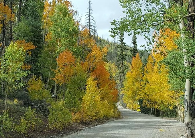
Viewing Scenery
Excellent views of Creede from above and looking up the Rio Grande River Valley. Be on the lookout for mule deer and the occasional moose.
Interpretive Areas
Interpretive stops offer views of the historic mining structures and explain clearly what you are looking at.
Scenic Driving
This scenic drive gives you great views up the West Willow Canyon and after you get on top, you can look down on Creede and see all the way up the Rio Grande River Valley toward the Continental Divide.

Current Conditions
- UTV Travel Etiquette Video
This excellent video explores numerous ways to enhance your OHV experience while making you a better land steward and respectful OHV user. - Colorado Avalanche Information Center
- Dispersed Camping Etiquette Video
This great video guides campers through the basics of being a good camper in areas away from the developed recreation sites. Learn how to be a respectable, conscientious camper. - Fire Conditions
- Multiple-use National Forest Video
- Conejos Peak District Roads

- Divide District Roads
- Saguache District Roads
-
Cumbres & LaManga Winter Recreation

Location
