
Official websites use .gov
A .gov
website belongs to an official government organization in the
United States.
Secure .gov websites use HTTPS
A lock
(
) or https:// means you've safely
connected to the .gov website. Share sensitive information only
on official, secure websites.


San Carlos Ranger District
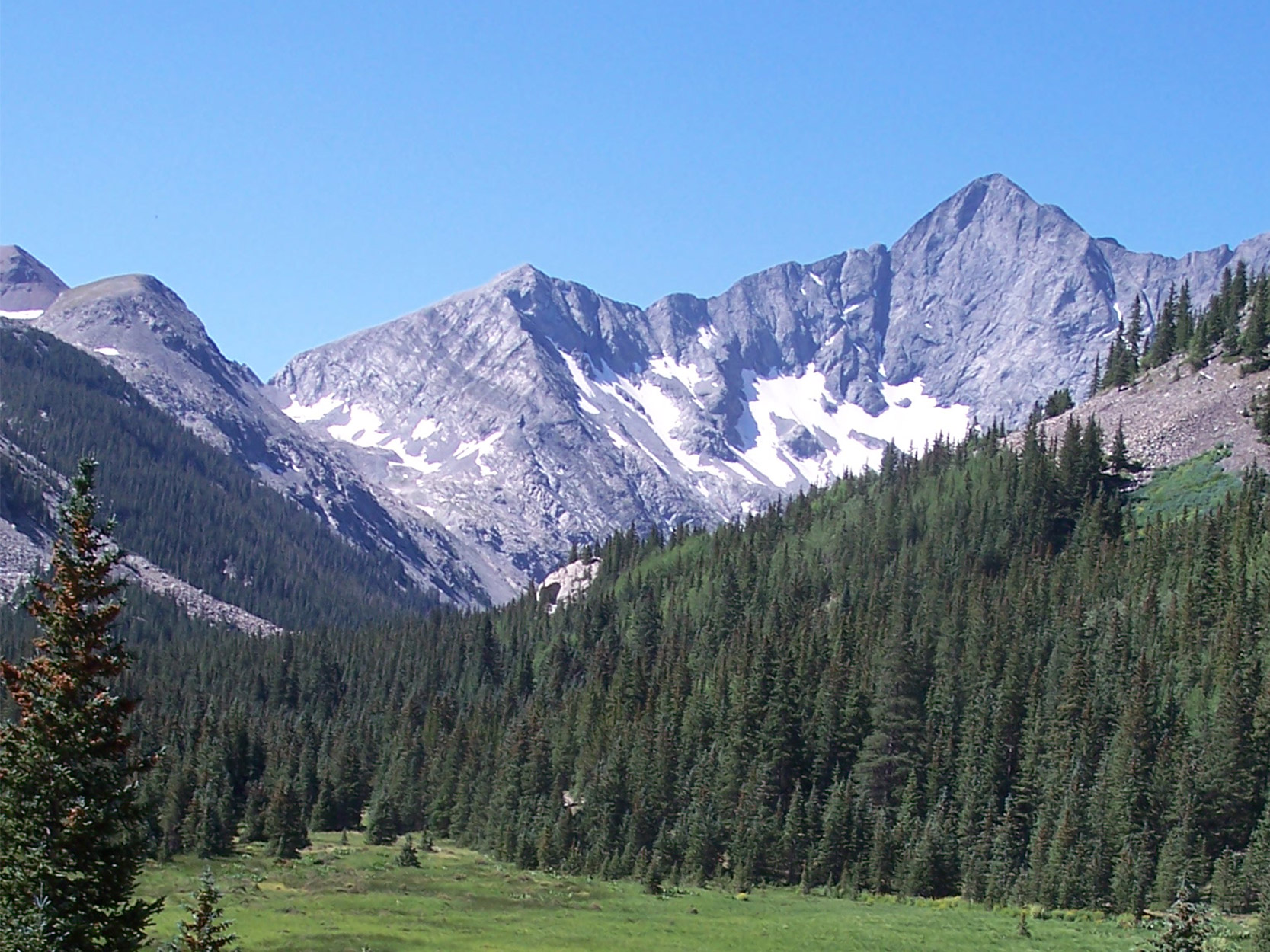
The San Carlos Ranger District manages the southern half of the San Isabel National Forest. The District is 50 miles wide and 110 miles long with about 400,000 acres of National Forest in Fremont, Custer, Huerfano, Pueblo and Las Animas counties. Mountain ranges include the Wet Mountains, the Sangre de Cristos and the Spanish Peaks.
It is home to the one of the first Forest Service Campgrounds designed by Arthur Carhart, the first landscape architect of the Forest Service. Prior to Carhart being hired in 1919, the agency focused primarily on timber uses of the forest. Carhart envisioned what we now know as sustainable recreation. His recreation plan for the San Isabel National Forest was the first for the agency. He went on to work with conservationist Aldo Leopold in creating the wilderness concept. The picnic shelters and fire hearths at Davenport Campground were reconstructed in 2006 using Carhart's original designs.
There are 11 campgrounds with 210 fee campsites plus two group sites which are reservation only. These campgrounds are operated by a concessionaire (contractor hired by the United States Forest Service), as well as a picnic area at Lake Isabel Recreational Area and four small sites in the Cuchara Creek Recreational Area.
At a Glance
| Operational Hours: | Open Monday-Friday, 8 a.m. to 4:30 p.m. Closed federal holidays. |
|---|---|
| Reservations: | Visit recreation.gov or call 1-877-444-6777 for campground reservations. Campground reservations cannot be made from this office. |
| Permit Info: | Special use permits are required for groups of 75 or more persons and all commercial activities including outfitting and guiding. |
| Usage: | Medium-Heavy |
| Busiest Season: | May-September |
| Closest Towns: | Cañon City, CO |
| Water: | Water fountain in the lobby of the district office. |
| Restroom: | Accessible restrooms available at the district office. |
| Passes: | America the Beautiful Federal Recreational Lands Passes |
| Operated By: | U.S. Forest Service |
| Information Center: | 3028 East Main Street Cañon City, CO 81212 Phone: 719-269-8500 |
Activities
Mountain Biking
Areas for Mountain Biking at San Carlos Ranger District
- Coal Creek Trail #1394
- Dodgeton Trail #1302
- Indian Trail #1300
- Left Hand Fork Trail #1325
- Mingus Ranch Cabin
- North Fork Trail #1309
- Pole Creek Trail #1398
- Rainbow Trail #1336 (San Carlos Ranger District)
- Shortcut Trail #1300 A
- Snowslide Trail #1318
- Stultz Trail #1334
- Tanner Peak Trail #1333
- Wachob Trail #1319
- Wildcat Trail #1312
- Zapata Trail #853
Campground Camping
Campground Camping on the San Carlos Ranger District.
Areas for Campground Camping at San Carlos Ranger District
- Alvarado Campground
- Bear Lake Campground
- Blue Lake Campground
- Cordova Pass Picnic Area and Campground
- Davenport Campground
- La Vista Campground
- Lake Creek Campground
- Ophir Creek Campground
- Purgatoire Campground
- Southside Campground
- St. Charles Campground
Group Camping
Developed campgrounds for group camping.
Areas for Group Camping at San Carlos Ranger District
Dispersed Camping
Some of the dispersed camping campsite located on the San Carlos Ranger District
Areas for Dispersed Camping at San Carlos Ranger District
Cabin Rentals
GENERAL INFORMATION:
- Reservations are required.
- Each cabin has a combination lock.
- Availability of cabins varies, refer to the cabin specific descriptions.
- Generally check-in is 2:00pm, while check-out is 12:00pm.
- There is no trash service at any of the sites; renters are responsible for disposing of their own trash.
- Lake Isabel has indoor plumbing; all other sites have vault toilets.
- RENTERS NEED TO TAKE DRINKING WATER TO ALL CABINS.
- Each of the cabins will have a combination lock. Renters will receive the combination in a confirmation letter mailed to them prior to their arrival.
- On weekends each cabin has a 2-night minimum stay requirement.
Areas for Cabin Rentals at San Carlos Ranger District
Lake and Pond Fishing
Lakes in the San Carlos Ranger District
Areas for Lake and Pond Fishing at San Carlos Ranger District
Day Hiking
Areas for Day Hiking at San Carlos Ranger District
- Alvarado Trailhead
- Apishapa Trail #1324
- Baker Trail #1301
- Bartlett Trail #1310
- Cisneros Trail #1314
- Coal Creek Trail #1394
- Comanche Trail #1345
- Cottonwood Trail #1344
- Crossover Trail #1352
- Dikes Trail #1389
- Dodgeton Trail #1302
- Dry Creek Trail #1343
- East Bear Trailhead #1333
- Farley Flower Overlook Observation Site
- Goodwin Trail #1346
- Greenhorn Trail #1316
- Horn Creek Trail #1342
- Horn Peak Trail #1362
- Horse Ranch Trail #1397
- Indian Trail #1300
- Lake Isabel Cabin
- Lake of the Clouds Trail #1349
- Levy-Krier Trail #1392
- Lewis Creek Trail #1329
- Lion Canyon Trail #1329
- Macey Trail #1341
- Marble Mountain Trail #1338
- Millset Trail #1317
- Mingus Ranch Cabin
- Newlin Creek Trail #1335
- North Brush Trail #1356
- North Colony Trail #1340
- North Fork Trail #1309
- North Taylor Trail #1348
- Pole Creek Trail #1398
- Rainbow Trail #1336 (San Carlos Ranger District)
- Rudolph Mountain Trail #1327
- San Carlos Trail #1320
- Santana Trail #1313
- Schafer Trail #1391
- Second Mace Trail #1322
- Shortcut Trail #1300 A
- Silver Lake Trail #1354
- Snowslide Trail #1318
- South Apache Trail #1311
- South Brush Trail #1355
- South Colony Basin
- South Colony Trail #1339
- South Creek Trail #1321
- Spring Creek Trailhead
- Squirrel Creek Trail #1384
- St. Charles Trail #1326
- Stultz Trail #1334
- Swift Creek Trail #1351
- Tanner Peak Trail #1333
- Texas Creek Trail #1350
- Turkey Creek Trail #1315
- Venable Trail #1347
- Vista Point Trail #1392a
- Wachob Trail #1319
- Wahatoya Trail #1304
- West Peak Trail #1390
- Wildcat Trail #1312
- Zapata Trail #853
Backpacking
Areas for Backpacking at San Carlos Ranger District
- Alvarado Trailhead
- Apishapa Trail #1324
- Baker Trail #1301
- Bartlett Trail #1310
- Cisneros Trail #1314
- Coal Creek Trail #1394
- Comanche Trail #1345
- Cottonwood Trail #1344
- Crossover Trail #1352
- Dikes Trail #1389
- Dodgeton Trail #1302
- Dome Rock Trail #1387
- Dry Creek Trail #1343
- Goodwin Trail #1346
- Greenhorn Trail #1316
- Horn Creek Trail #1342
- Horn Peak Trail #1362
- Horse Ranch Trail #1397
- Indian Trail #1300
- Lake of the Clouds Trail #1349
- Left Hand Fork Trail #1325
- Levy-Krier Trail #1392
- Lion Canyon Trail #1329
- Macey Trail #1341
- Marble Mountain Trail #1338
- Millset Trail #1317
- Mingus Ranch Cabin
- Newlin Creek Trail #1335
- North Brush Trail #1356
- North Colony Trail #1340
- North Fork Trail #1309
- North Taylor Trail #1348
- Pole Creek Trail #1398
- Rainbow Trail #1336 (San Carlos Ranger District)
- Rudolph Mountain Trail #1327
- Santana Trail #1313
- Schafer Trail #1391
- Second Mace Trail #1322
- Shortcut Trail #1300 A
- Silver Lake Trail #1354
- Snowslide Trail #1318
- South Apache Trail #1311
- South Brush Trail #1355
- South Colony Basin
- South Colony Trail #1339
- South Creek Trail #1321
- Squirrel Creek Trail #1384
- St. Charles Trail #1326
- Stultz Trail #1334
- Swift Creek Trail #1351
- Tanner Peak Trail #1333
- Texas Creek Trail #1350
- Turkey Creek Trail #1315
- Venable Trail #1347
- Vista Point Trail #1392a
- Wachob Trail #1319
- Wahatoya Trail #1304
- West Peak Trail #1390
- Wildcat Trail #1312
- Zapata Trail #853
Horse Camping
Areas for Horse Camping at San Carlos Ranger District
Horse Riding
Areas for Horse Riding at San Carlos Ranger District
- Alvarado Trailhead
- Apishapa Trail #1324
- Bartlett Trail #1310
- Cisneros Trail #1314
- Coal Creek Trail #1394
- Comanche Trail #1345
- Cottonwood Trail #1344
- Crossover Trail #1352
- Dikes Trail #1389
- Dodgeton Trail #1302
- Dome Rock Trail #1387
- Dry Creek Trail #1343
- East Bear Trailhead #1333
- Goodwin Trail #1346
- Greenhorn Trail #1316
- Horn Creek Trail #1342
- Horse Ranch Trail #1397
- Indian Trail #1300
- Lake of the Clouds Trail #1349
- Left Hand Fork Trail #1325
- Levy-Krier Trail #1392
- Lewis Creek Trail #1329
- Lion Canyon Trail #1329
- Macey Trail #1341
- Marble Mountain Trail #1338
- Millset Trail #1317
- Mingus Ranch Cabin
- North Brush Trail #1356
- North Colony Trail #1340
- North Fork Trail #1309
- North Taylor Trail #1348
- Pole Creek Trail #1398
- Rainbow Trail #1336 (San Carlos Ranger District)
- Rudolph Mountain Trail #1327
- Santana Trail #1313
- Schafer Trail #1391
- Second Mace Trail #1322
- Shortcut Trail #1300 A
- Silver Lake Trail #1354
- Snowslide Trail #1318
- South Apache Trail #1311
- South Brush Trail #1355
- South Colony Trail #1339
- St. Charles Trail #1326
- Stultz Trail #1334
- Swift Creek Trail #1351
- Tanner Peak Trail #1333
- Texas Creek Trail #1350
- Venable Trail #1347
- Vista Point Trail #1392a
- Wachob Trail #1319
- Wahatoya Trail #1304
- West Peak Trail #1390
- Wildcat Trail #1312
- Zapata Trail #853
Big Game Hunting
Access from Purgatory Campground via North Fork Trail.
Viewing Plants
Areas for Viewing Plants at San Carlos Ranger District
OHV Trail Riding
San Carlos Wet Mountain Off Highway Vehicle Map (East)
San Carlos Wet Mountain Off Highway Vehicle Map (West)
San Carlos Wet Mountain Off Highway Vehicle Map (North)
Areas for OHV Trail Riding at San Carlos Ranger District
- Baker Trail #1301
- Cisneros Trail #1314
- Dodgeton Trail #1302
- Dome Rock Trail #1387
- East Bear Trailhead #1333
- Horse Ranch Trail #1397
- Indian Trail #1300
- Left Hand Fork Trail #1325
- Lewis Creek Trail #1329
- Lion Canyon Trail #1329
- Pole Creek Trail #1398
- Rainbow Trail #1336 (San Carlos Ranger District)
- San Carlos Trail #1320
- Second Mace Trail #1322
- Shortcut Trail #1300 A
- Snowslide Trail #1318
- South Creek Trail #1321
- Spring Creek Trailhead
- Squirrel Creek Trail #1384
- St. Charles Trail #1326
- Stultz Trail #1334
- Tanner Peak Trail #1333
- Wachob Trail #1319
Interpretive Areas
Areas for Interpretive Areas at San Carlos Ranger District
Picnicking
Picnicking in a developed day use area.
Areas for Picnicking at San Carlos Ranger District
Scenic Driving
Scenic driving tours of the San Carlos Ranger District.
The Highway of Legends travels through an area rich in cultural history, crossing Cucharas pass, with an option to also travel over Cordova Pass. This route provides opportunities to see unique geological formations known as dikes.
Areas for Scenic Driving at San Carlos Ranger District
Related Information
Highlights
- 'Queen of the 14ers'

She is the agency’s Colorado Fourteeners Program manager; others simply refer to her as ‘Queen of the 14ers’.
Location