
Official websites use .gov
A .gov
website belongs to an official government organization in the
United States.
Secure .gov websites use HTTPS
A lock
(
) or https:// means you've safely
connected to the .gov website. Share sensitive information only
on official, secure websites.


Gray Butte Trail (#852)
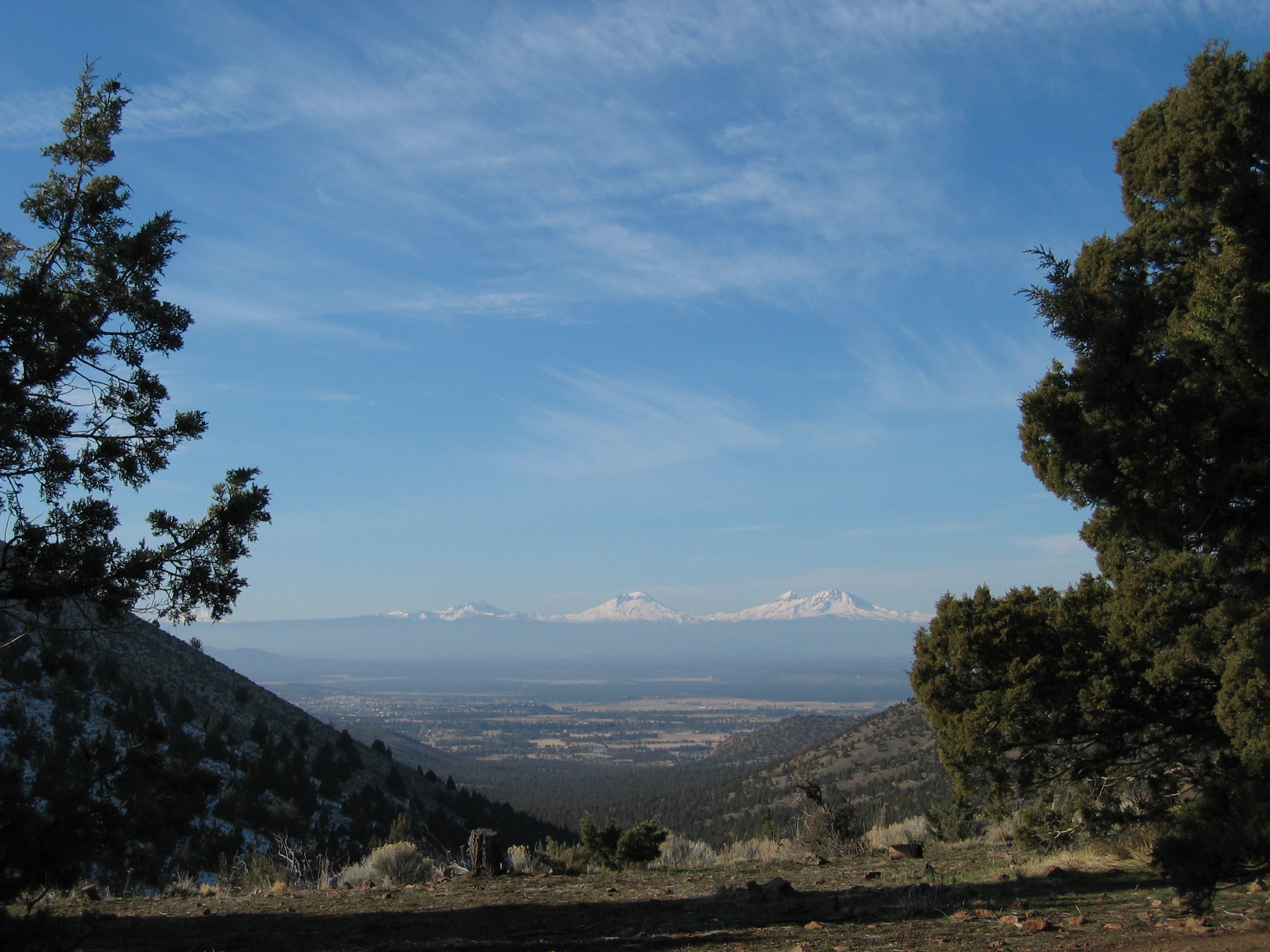
This well-known trail provides excellent views of the Crooked River National Grassland and the Cascades, and also ties into trails that reach BLM land and Smith Rock State Park. This trail is primarily accessed at Gray Butte Trailhead, though it can also be accessed from the Cole Loop Trail (#854).
Click on Gray Butte Trail Map for more information.
The trail begins in juniper forest and slowly climbs up the side of Gray Butte, dotted with sagebrush, and wildflowers in the spring. The trail is popular with hikers, horseback riders and mountain bikers. The ascent can be steep in places with some portions of loose rock. The trail is best avoided after a heavy rain because the soils are comprised of clay and sand that form an especially gooey "gumbo" when wet.
At a Glance
| Fees: | No Fee |
|---|---|
| Closest Towns: | Prineville, Oregon and Madras, Oregon |
| Operated By: | Forest Service |
| Information Center: |
Crooked River National Grassland 274 SW 4th Street Madras, OR 97741 (541) 416-6640 |
Activities
Mountain Biking
Recreation areas with activity Mountain Biking:This trail offers some varying terrain which can be challenging and fun depending on your skill level. Try not to ride too fast or you may miss some of the beautiful views of the Crooked River National Grassland that this trail offers. Please also use caution because this IS one of our most popular trails and it sees horseback and hiking visitors as well.
Day Hiking
Recreation areas with activity Day Hiking:This trail offers moderate terrain and awesome views of the Crooked River National Grassland and beyond. On a really clear day you can even see to Mt. Hood. It is short enough for a day trip and can be hiked as an out-and-back or as a loop if you tie in with BLM and Smith Rock State Park portions of the trail. This is our most popular trail and is used by mountain bikers and horseback riders too, so please be mindful and considerate of other users.
Horse Riding
Recreation areas with activity Horse Riding:This trail can be an addition to the Cole Loop Trail (#854) and offers some great views. It is our most popular trail and attracts hikers and mountain bikers as well, so please use caution when riding.