
Official websites use .gov
A .gov
website belongs to an official government organization in the
United States.
Secure .gov websites use HTTPS
A lock
(
) or https:// means you've safely
connected to the .gov website. Share sensitive information only
on official, secure websites.


Mayfield Spring
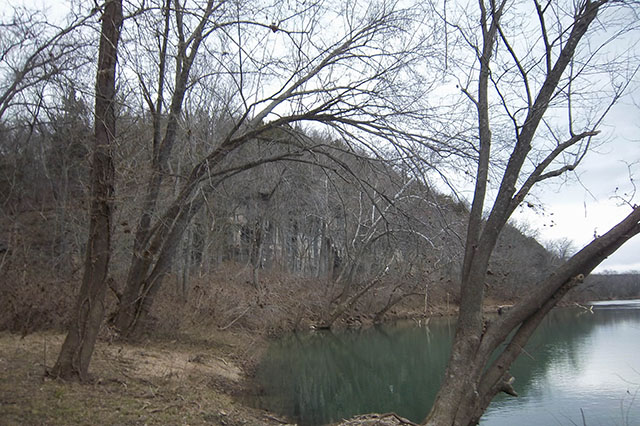
Mayfield Spring is a very small canoe launch area from a gravel bar, providing boat/canoe access for the Gasconade River. You can drive up close to the river to put in a kayak or canoe. There is one small place to park on the opposite side of the road.
At a Glance
| Operational Hours: | Day use from 6 am to 10 pm |
|---|---|
| Reservations: | First come, first served |
| Fees: | No fees |
| Permit Info: | Fishing permits are available from Missouri Department of Conservation |
| Open Season: | January - December |
| Restrictions: |
|
| Closest Towns: | Lebanon or Roby, MO |
| Water: | None |
| Restroom: | None |
| Operated By: | USDA Forest Service |
| Information Center: | Houston/Rolla/Cedar Creek Ranger District Email | Phone and Address |
General Information
Directions:From Competition, MO,
- head north on Hwy Z.
- Turn East on Berry Road to FS Road 5136.
Activities
River and Stream Fishing
This area has a gravel boat ramp, and is suitable for launching a motorboat or non-motorized watercraft. No drinking water, toilet facilities, or garbage service at this location.
| Fish Species | Bluegill, channel catfish, largemouth bass |
| Fishing Mode | Canoe, kayak, wading |
| Fishing Platform | None |
| Fishing Method | Rod & Reel, Flyfishing |
Boating - Non-Motorized
This area has a gravel boat ramp, and is suitable for launching non-motorized watercraft. No drinking water, toilet facilities, or garbage service at this location.
| Type of Craft | canoe, kayak |
| Size Restrictions | None |
| Class of Rapids | None |
Quick Links
Highlights
Location


