
Official websites use .gov
A .gov
website belongs to an official government organization in the
United States.
Secure .gov websites use HTTPS
A lock
(
) or https:// means you've safely
connected to the .gov website. Share sensitive information only
on official, secure websites.


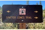
Spatter Cones Nature Trail
The self-guided interpretive trail traverses through the origin of the Hat Creek Lava Flow. Erupting in fountains and gushing from vents, the lava built small spatter cones along a 2-mile fissure. The vents also fed flows that reached many miles down Hat Creek Valley. A mosaic of plants has gained a foothold here, while pine forest frows in deeper soils at the flow's edges.
The loop trail, approximately 1.7 miles long, wanders through spatter cones with views of the Hat Creek Valley and Lassen Peak.
Some portions of the trail are steep. Due to hot, dry conditions, it is best to take this hike in the early morning or later afternoon and carry water. This landscape looks tough but it needs your protection and respect. Stay on maintained trails. Some rock formations are unstable and fragile. Plants and animals work hard to survive
For more information about the geology of the Hat Creek Valley, explore the Old Station Visitor Information Center, Subway Cave and Hat Creek Rim Overlook. These sites are all located within 4 miles of Spatter Cones Trail
At a Glance
| Operational Hours: | Dawn to dusk. |
|---|---|
| Area Amenities: | Interpretive Site, Accessible, Picnic tables, Toilets, Drinking water, Parking |
| Usage: | Medium |
| Best Season: | spring/summer/fall |
| Busiest Season: | weekends and holidays |
| Water: | yes |
| Restroom: | vault |
| Operated By: | USDA Forest Service |
| Information Center: | Old Station Visitor Information Center 13435 Brians Way Old Station CA 96071 530-335-7517. The Visitor Center is open April - December, Thursday - Monday, 8:30 am - 4:00 pm. Hat Creek Ranger District. 43225 E. Hwy. 299 | PO Box 220, Fall River Mills, CA 96028. 530-336-5521. |
General Information
Accessibility:Accessible restrooms and interpretive kiosk. Trail paved for a short distance.
Directions:
Hwy 89/44, approximately 1.5 miles south of Hwy 89/44 junction in Old Station.
Parking:
Large parking area with turn around, adequate for buses and RV's.
Activities
Day Hiking
| Status: | Open |
|---|---|
| Best Season: | spring/summer/fall |
| Difficulty Level: | Easy to Intermediate |
Backpacking
Access the Pacific Crest National Scenic Trail from the Spatter Cones Nature Trail. Enjoy a short stroll or pack out for the night.
Visitor Programs
Contact the Hat Creek Ranger District Office to schedule a tour for your group.