
Official websites use .gov
A .gov
website belongs to an official government organization in the
United States.
Secure .gov websites use HTTPS
A lock
(
) or https:// means you've safely
connected to the .gov website. Share sensitive information only
on official, secure websites.


McGee Pass Trail
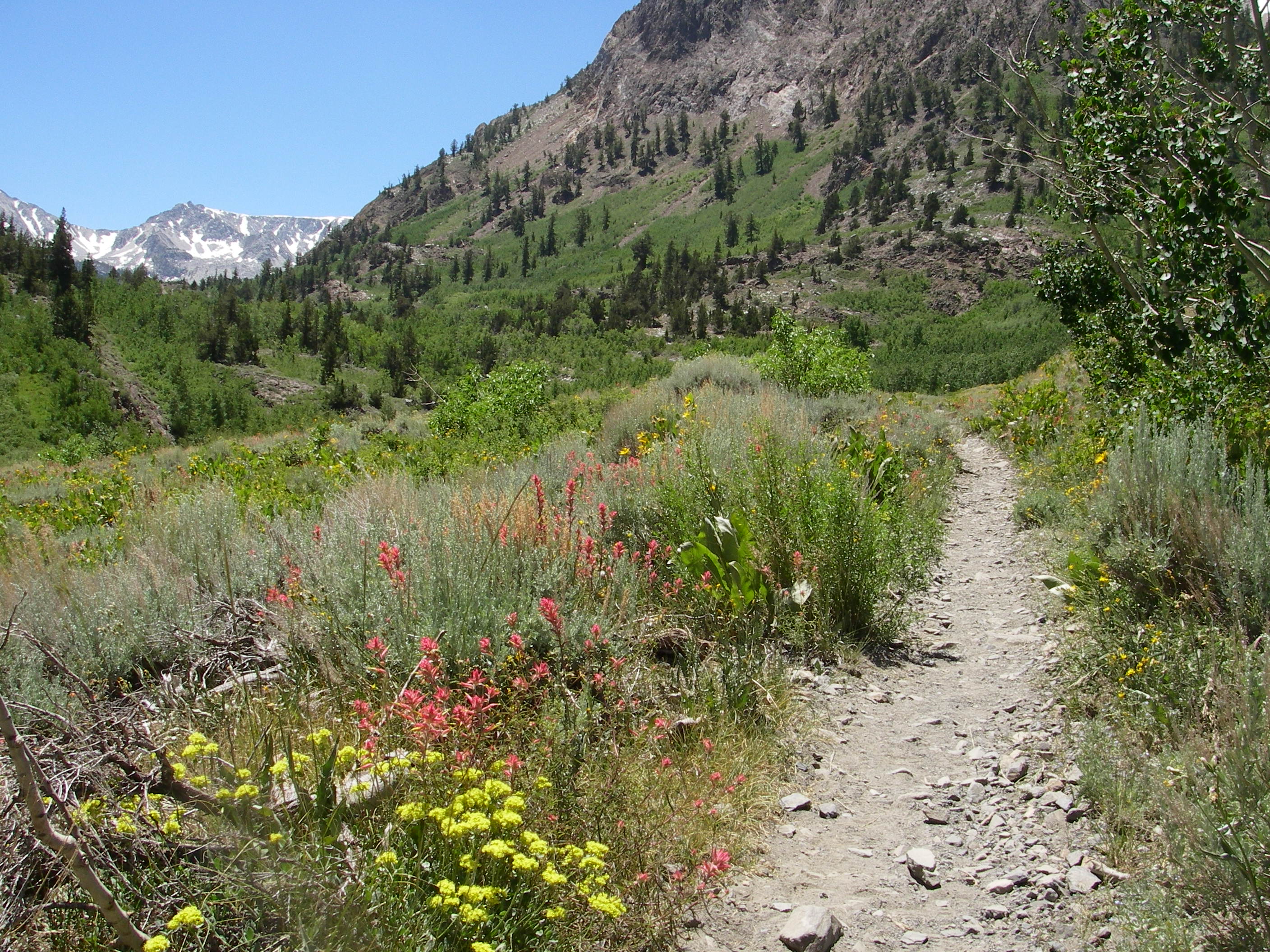
Abundant wildflowers mixed with sage fill the lower part of McGee Canyon on the way to Horsetail Falls. Water crossings may be high during spring snow melt. Expect to get your feet wet and use caution with high spring runoff . As the canyon turns west and climbs into aspen and lodgepole pine, side trails lead to Steelhead Lake and Baldwin Canyon. Farther up the canyon are Big McGee and Little McGee Lakes. Crossing over McGee Pass leads to Horse Heaven and Tully Hole on the John Muir Trail.
Common Destinations: Big and Little McGee Lakes, McGee Pass, Upper Fish Creek, John Muir Trail
Download area map for trail location, note there are several diffrent McGee Creeks in the Sierra.
To purchase more detailed maps or guidebooks of the area, visit sierraforever.org
At a Glance
| Rentals & Guides: | McGee Creek Pack Station is located near this trailhead offering day rides and mule pack trips (760) 878-2207 |
|---|---|
| Permit Info: |
|
| Busiest Season: | July-August |
| Restrictions: |
|
| Closest Towns: |
|
| Water: | Water from creeks, lakes and springs should be treated before drinking. |
| Restroom: | Vault toilet at trailhead. Please Leave No Trace. Bury human waste away from water sources. |
| Operated By: | Forest Service |
| Information Center: | White Mountain Visitor Center (760) 873-2500 Wilderness Permit Information (760) 873-2483 |
General Information
Directions:Leave Hwy 395 at the north end of Lake Crowley. Turn onto McGee Creek Road and drive until the road ends. The last mile is dirt. Paved parking, pit toilet and picnic tables near the aspen shaded creek.
Activities
Lake and Pond Fishing
Fishing in Big Mcgee, Little McGee and Steelhead Lakes have Rainbow and Brook Trout.
River and Stream Fishing
Try your luck for Rainbow and Brook Trout in McGee Creek.
Day Hiking
Backpacking
General Info:
Safety InformationBear lockers are not available at this trailhead. All hikers must safely store all food and scented items left in the vehicles. It is recommended to secure your food in the trunk of your vehicle and cover your ice chests.
Seasonal Information
Depending upon the weather, this trail is normally clear of snow by early June.
Horse Riding


Related Links
Location
