
Official websites use .gov
A .gov
website belongs to an official government organization in the
United States.
Secure .gov websites use HTTPS
A lock
(
) or https:// means you've safely
connected to the .gov website. Share sensitive information only
on official, secure websites.


Pioneer Mothers' Memorial Forest
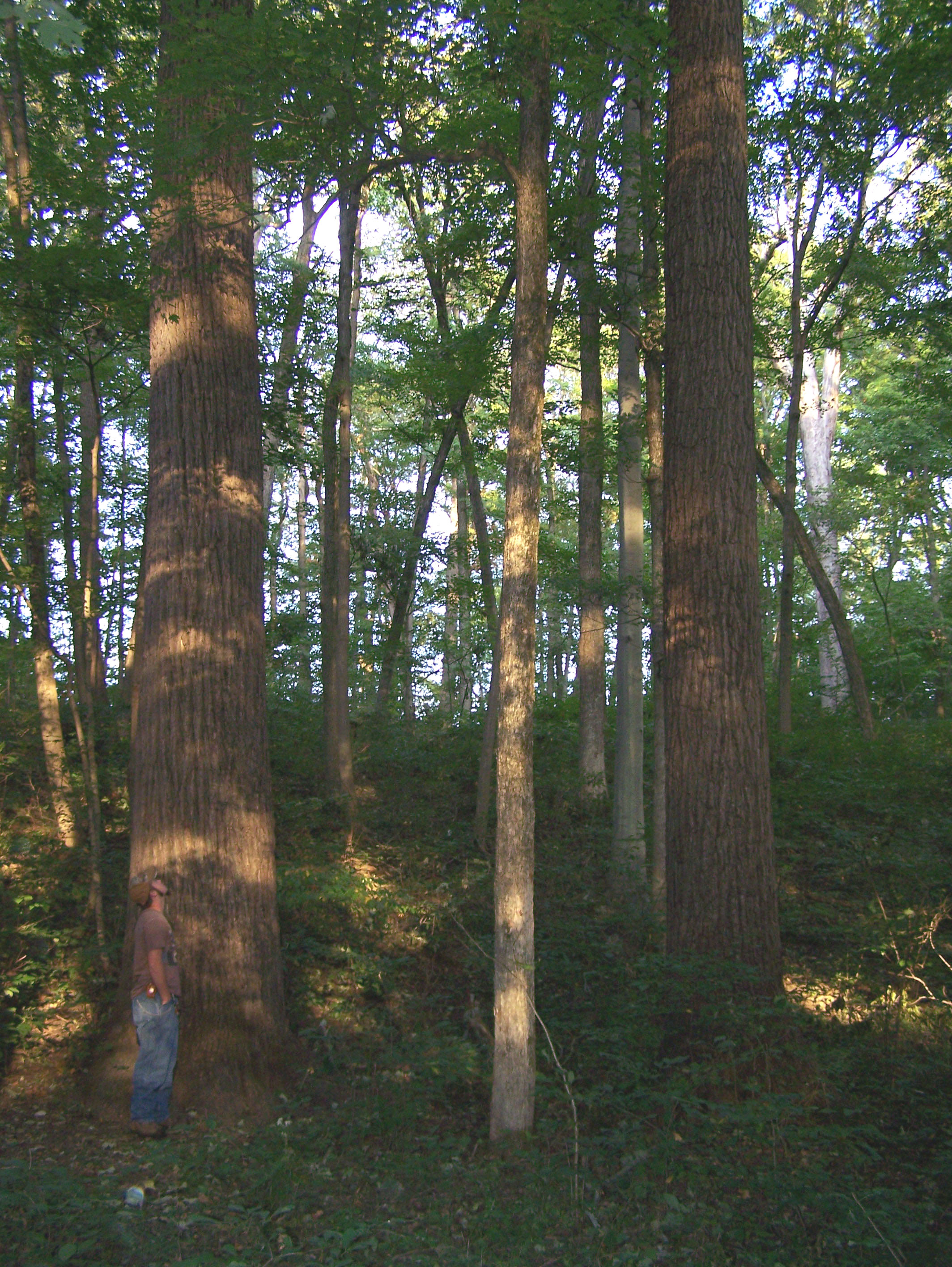
This 88-acre old growth oak-hickory forest has been virtually undisturbed since before it was purchased by Joseph Cox in 1816. After being protected by the Cox family for 124 years, when a descendent died in 1940, the land was sold to a lumber company. It was prevented from being cut due to a community fundraising effort. The US Forest Service put up half the funds and the land was purchased back from the company with the agreement no trees would ever be cut. It became part of the Hoosier National Forest and in 1944 the tract was designated a Research Natural Area by the Forest Service. Along with a 165- acre buffer, the area is managed to protect its unique qualities and is a National Natural Landmark. Along the trail there is a rock wall commemorating the Indiana Pioneer Mothers', who were instrumental in securing this tract. In the bottomland area was a prehistoric Native American village site. Extensive excavations have been done to study this Oliver Phase Mississippian village which dates to A.D. 1380. Archaeological sites are protected by federal and state law. Do not disturb or remove artifacts and notify the Forest Service if any are found.
At a Glance
| Current Conditions: | Trail open but expect to see tornado damage (August, 2023) |
|---|---|
| Open Season: | Year-round |
| Usage: | Light |
| Restrictions: | Since this area is a Research Natural Area no hunting, camping, target- shooting, or plant collecting is allowed. Horses and bikes are also prohibited in this area. |
| Closest Towns: | Paoli, IN |
| Water: | none |
| Restroom: | none |
| Information Center: | Hoosier National Forest - Tell City Ranger District Office |
General Information
Directions:From Paoli: Go south on Ind. 37 to the parking lot on the left.
US 150 entrance: From Paoli, go south on U.S. 150 about 1 mile to the parking lot on the right (across from S. Triangle Road).
General Notes:
There is a 1.3 mile trail between SR 37 and a rock wall commemorating the Pioneer Mothers' Forest at the bottom of the hill where a day use picnic area once stood. In the bottomland area was also a prehistoric Native American village site. Extensive excavations have been done to study this prehistoric village which is thought to date to A.D. 1380.
Additional Resources
Activities
Day Hiking
A one mile trail winds through this 88-acre tract south of Paoli which is the last old growth forest of it's size in Indiana. The one mile is one way so you can hike back up the trail or meander cross country through the big trees. The site has been left virtually undisturbed since before it was purchased by Joseph Cox in 1816. After being protected by the Cox family for 124 years, when a descendent died in 1940, the land was put up for sale. It was saved from being cut by a timber company due to a community effort and the US Forest Service purchasing the land back from the company. Later in 1944 the tract was designated a Research Natural Area by the Forest Service. Along with a 165-acre buffer, the area is managed to protect its unique qualities. There is a 1.3 mile trail between SR 37 and a rock wall commemorating the Pioneer Mothers' Forest at the bottom of the hill where a day use picnic area once stood. In the bottomland area was also a prehistoric Native American village site. Extensive excavations have been done to study this prehistoric village which is thought to date to between 1000 and 1500 AD.
| Fire Information | none |
Viewing Scenery
This 88-acre tract south of Paoli is the last old growth forest of it's size in Indiana. A one mile trail snakes down through the Forest to the bottom of the hill, then you can hike back up the trail or meander cross country through the big trees. The site has been left virtually undisturbed since before it was purchased by Joseph Cox in 1816. After being protected by the Cox family for 124 years, when a descendent died in 1940, the land was put up for sale. It was saved from being cut by a timber company due to a community effort and the US Forest Service purchasing the land back from the company. Later in 1944 the tract was designated a Research Natural Area by the Forest Service. Along with a 165-acre buffer, the area is managed to protect its unique qualities. There is a 1.3 mile trail between SR 37 and a rock wall commemorating the Pioneer Mothers' Forest at the bottom of the hill where a day use picnic area once stood.
| Special Feature | Rock wall, large trees, |
Interpretive Areas
This 88 acre tract south of Paoli is the last old growth forest of it's size in Indiana. The site has been left virtually undisturbed since before it was purchased by Joseph Cox in 1816. After being protected by the Cox family for 124 years, when a descendent died in 1940, the land was put up for sale. It was saved from being cut by a timber company due to a community effort and the US Forest Service purchasing the land back from the company. Later in 1944 the tract was designated a Research Natural Area by the Forest Service. Along with a 165-acre buffer, the area is managed to protect its unique qualities. There is a 1.3 mile trail between SR 27 and a rock wall commemorating the Pioneer Mothers' Forest at the bottom of the hill where a day use picnic area once stood. In the bottomland area was also a prehistoric Native American village site. Extensive excavations have been done to study this prehistoric village which is thought to date to between 1000 and 1500 AD. An interpretive sign at the parking area explains the history of the site.