
Official websites use .gov
A .gov
website belongs to an official government organization in the
United States.
Secure .gov websites use HTTPS
A lock
(
) or https:// means you've safely
connected to the .gov website. Share sensitive information only
on official, secure websites.


Lumberman's Monument Visitor Center
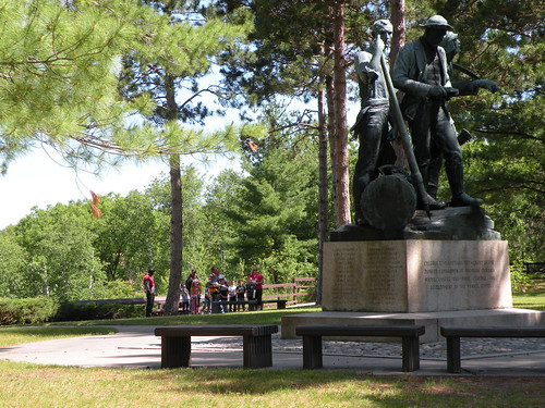
Lumberman’s Monument Visitor Center interprets the area’s colorful lumbering past. The 14-foot Lumberman’s Monument stands on a high bank with the Au Sable River providing a scenic backdrop.
Learn about the industry that helped develop northern Michigan and the men who cut the timber that helped build a nation. Climb through a log jam, use a peavey, cut a wooden cookie with a cross-cut saw, and learn about the life of a lumberjack through video and displays. Hike the stairway down to the wanigan, a loggers floating kitchen, or take the short trail to the dune observation deck. Enjoy a Kid’s Day program or take a guided nature hike.
Brochure with map:
- River Road National Scenic Byway (pdf) - this brochure shows River Road, the Au Sable River and Lumberman's Monument
- Highbanks River Trail Map (coming soon)
- Eagle Run Trail Map (coming soon)
The brochure is set to print on 11 x 17 paper, landscape (wide) orientation. To print on 8 1/2 x 11 paper set the print area to "shrink to printable area", this will make the text on the page smaller. The trail maps are set to printon 8.5x11 paper.
Flickr Photo Albums:
At a Glance
| Current Conditions: | Huron Shores Ranger Station Open for the season - check out our Facebook page for upcoming events. Be sure to prepare and plan in the event your favorite camping spot is occupied. |
|---|---|
| Operational Hours: | Visitor Center is open daily during open season, including weekends, from 9:00 am to 4:00 p.m. Grounds are open year-round. |
| Area Amenities: | Parking |
| Fees: | No Fee |
| Permit Info: | Au Sable River Primitive Camping -
|
| Open Season: | May 3 - October 24 |
| Usage: | Heavy |
| Restrictions: | As a visitor to the National Forest, you are asked to follow certain rules designed to protect the Forest, natural resources and to provide for public safety of visitors. These rules are available to you on-line or at any office of the Huron-Manistee National Forests. Please take time to read and understand them. General Topic orders apply across the Forests. Applicable Orders -
|
| Closest Towns: | Tawas, Oscoda, Hale, Glennie |
| Water: | Drinking Water |
| Restroom: | Flush |
| Operated By: | Visitor Center - (989) 362-8961/Huron Shores Ranger Station - (989) 739-0728 |
| Information Center: |
General Information
General Notes:Location - River Road National Scenic Byway, Au Sable River
Nearby Recreation Areas -
- Highbanks Nature Trail
- Monument Campground
County - Iosco
Seasonal and Other Information -
- This site is not gated during the off season.
-
This site is not maintained in winter:
- Access road and/or parking lot are not plowed.
- Water and/or toilet facilities are not available.
Directions:
Lumbermans Monument
5401 Monument Road
Oscoda, MI 48750
From Tawas -
- From M-55 turn right onto Wilber Rd. go 1.25 miles north to Monument Rd.
- Continue on Monument Rd. for 11 miles to River Rd.
From Oscoda -
- Travel 15 miles west along River Rd.
Accessibility:
Visitor Center and Grounds
- Paved parking
- Paved sidewalks
- Accessible restrooms
- Outdoor displays - along sidewalks
- Stairs to river and one display
Forest Discovery Trail
- Hard-packed, over 36 inches wide
Monument Campground
- Paved drive
- Paved parking pads
- Accessible restrooms
Activities
Campground Camping
Recreation areas with activity Campground Camping:

Monument Campground, established in 1909, was one of the first campgrounds built on the Huron National Forest. Monument Campground is a fully accessible camping area within a red pine plantation. This campground is located on River Road National Scenic Byway and is adjacent to Lumberman's Monument Visitor Center.
Group Camping
Recreation areas with activity Group Camping:Viewing Scenery
Recreation areas with activity Viewing Scenery:

There are several observation areas at the Visitor Center that provide views of the Au Sable River.
Amenity -
- Observation Area
| Special Feature | Au Sable River |
Visitor Programs
Recreation areas with activity Visitor Programs: Each year the Lumberman's Monument Visitor Center hosts programs during the summer months for visitors. To view a list of available programs go here: http://www.fs.usda.gov/news/hmnf/news-events.
Interpretive Areas
Recreation areas with activity Interpretive Areas:

Try one of the many activities available, including climbing a log jam or hiking the stairs down to the wanigan; a loggers floating kitchen. Visitors can also walk the Forest Discovery Trail to an observation deck.
Amenities -
- Interpretive Kiosk
- Native Plant Garden
- Interpretive Programs
- Day Hiking
- Observation Area
- Interpretive Exhibits
Visitor Centers
Recreation areas with activity Visitor Centers:
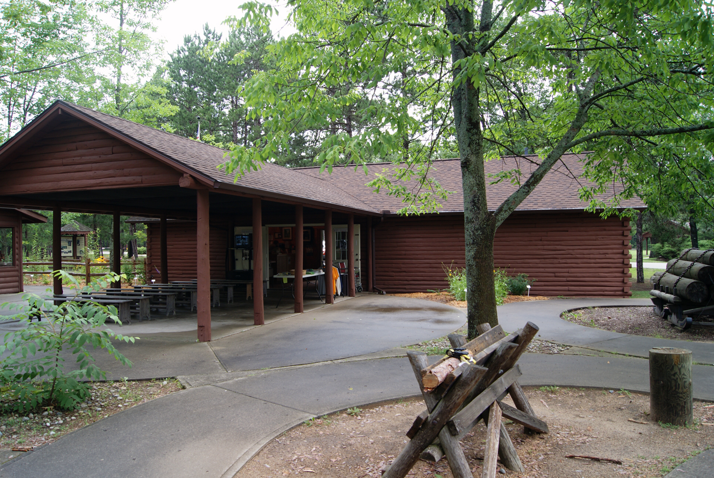 The visitor center is multiple displays spread across the grounds. One building houses several displays and a second building houses a gift store and information center.
Picnicking
Recreation areas with activity Picnicking:
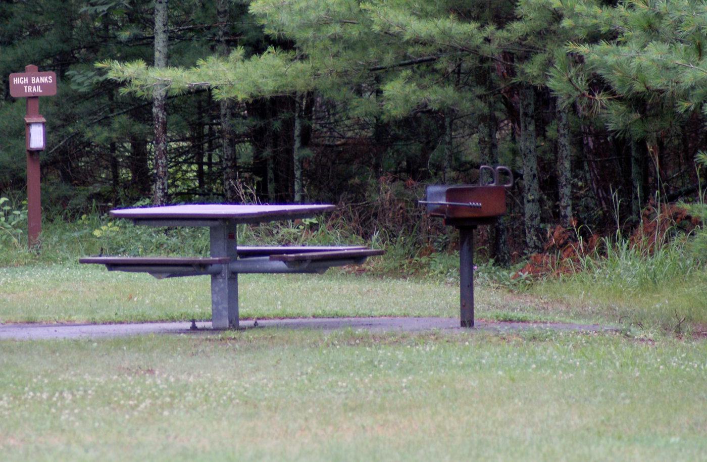
In addition to a picnic pavilion there are several picnic tables scattered around the grounds. Or throw down a blanket on the lawn.
Amenities -
- Picnic Shelter
- Observation Area
- Drinking Water
- Drinking Fountains
- Barrier Free
| No. of Sites | 10 |
| Reservation Info | No reservation needed. All sites are first come, first served. |
| Sleeping Shelter | No |
Group Picnicking
Recreation areas with activity Group Picnicking:

In addition to a picnic pavilion there are several picnic tables scattered around the grounds. Or throw down a blanket on the lawn.
Amenities -
- Drinking Fountains
- Barrier Free
- Picnic Shelters
- Drinking Water
| No. of Sites | 10 |
| Reservation Info | No reservation needed. All sites are first come, first served. |
| Group Shelter | No |
| Group Cooking Facilities | No |
| Hookups - Electric | No |
Amenities
| Parking: | 82 vehicle capacity |
|---|
Related Information
Location


