
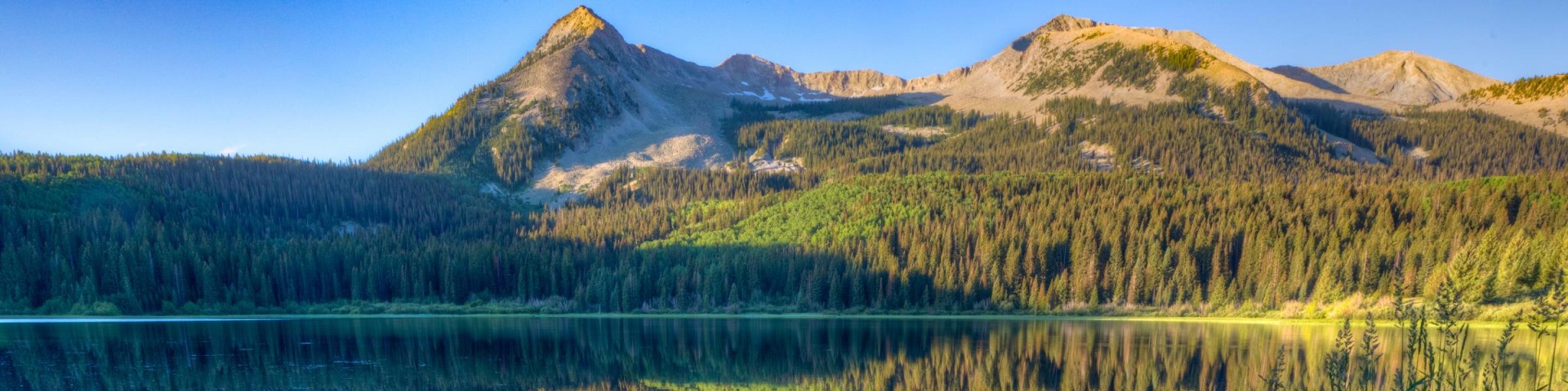
Recreation
Grand Mesa, Uncompahgre and Gunnison National Forests offer scenery and an abundance of opportunities for outdoor recreation. Over 3,500 miles of trails and routes provide access to areas of rugged beauty and solitude. Many were carved by indigenous peoples, early explorers, and miners, and offer an experience that connects users to the land and to the past. The mountains, plateau, and mesa that make up the forest will always provide a scenic backdrop and thus a component of the quality of life in the area.
We invite you to visit our forest and enjoy the beauty, history and challenges it has to offer. Recreation, motor vehicle and quad maps are available. View a Ranger District location map.

41 Trail #145
The 41 Trail #145 begins on FSR #505 and is a connection trail ending on FSR #533. This trail begins a gradual descend for the first mile, becoming steeper as it descends into the Potter Creek…
47 Trail #403
The 47 Trail #403 begins at Forest Service Road #402, Divide Road, and ends at Forest Service Road #600. It switchbacks down into a drainage, turning south and following a bench most of its length.…
Agate Creek #484
The Agate Creek Trail #484 begins at the Agate Trailhead on Highway 50 and ends at its intersection with the Crest Trail #531. The trail heads eastward, winding through the Agate Creek drainage and…
Agate Spur #484.2A
Forest Trail #484.2A (Agate Spur Trail) is 0.6 miles long. It begins at U.S. Highway 50 (T. 48 N. R. 5 E. Section 6) and ends at Forest Trail #484 (T48N R5E Section 6). Forest Trail #484.2A is open…
Ajax Peak
Ajax Peak is a nontechnical peak climb close to Telluride, CO that offers 360-degree views from its 12,785-foot summit. It is a fairly arduous hike, gaining over 2400 feet in elevation when started…
Alder Creek #510
The Alder Creek Trail #510 provides access into the Mount Sneffels Wilderness, where Wilderness Regulations apply. This trail receives only light maintenance so visitors should be prepared to…
Alder Creek #577
Alder Creek Trail (#577) is 3.1 miles long. It begins at Forest Road #538.2A and ends at Forest Road #882. Portions of this trail ( #577) are open for the following uses: hiking, mountain biking,…
Alexander Lake Boat Launch- Grand Valley RD
Lightly gravelled boat launch suitable for backing a trailer on.
Almont Campground - Gunnison RD
Site Open
Almont Campground is located adjacent to Colorado State Highway 135. This campground is in walking distance of the Almont Gorge, where the East River and Taylor River join to form the Gunnison River.…
Alpine #225
The Alpine Trail #225 begins at Forest Service Road #858, Owl Creek Pass/Cimarron Road and ends at Forest Service road #868, the Alpine Plateau Access Road on the Gunnison Ranger District. This trail…