Official websites use .gov
A .gov
website belongs to an official government organization in the
United States.
Secure .gov websites use HTTPS
A lock
(
) or https:// means you've safely
connected to the .gov website. Share sensitive information only
on official, secure websites.


Big Tree Trail
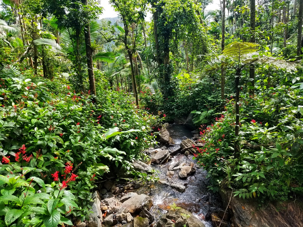
The Big Tree Trail is a self-guided interpretive trail that is asphalt paved throughout and several rain/picnic shelters are located along the way. It is called the Big Tree Trail due to the large Tabonuco trees found along the trail.
The trail ends at Cascada La Mina (La Mina Falls), an exquisite waterfall that drops over 35 feet through a jumble of huge rocks into a lovely pool where hikers can choose to swim in the cool refreshing water or merely rest and enjoy the view. Water temperature is 60-65 degrees. This trail connects to the La Mina Trail (which exits at Palo Colorado).
Location: PR 191, km 10.4. Parking is available in the adjacent paved parking lot, and at designated areas along the road.
Distance: 0.9 miles (1.4 km)
Elevation: 1804 to 1640 feet
Difficulty: Moderate; steep in some places
Amenities: Parking
Special Safety Messages: Congested Area – consider coming earlier in the day. Be aware of the weather and flash flooding. Pack it in, Pack it Out: please take your trash with you so it doesn’t end up in the river.
__________________________________________________
La vereda de Arboles Grandes es una vereda interpretativa auto guiada que está asfaltada, hay varios refugios para lluvia a lo largo del camino. Se llama vereda de árboles grandes debido a los grandes árboles de Tabonuco que se encuentran a lo largo de la vereda.
La vereda termina en la Cascada La Mina, una exquisita cascada que cae a más de 35 pies a través de enormes rocas en una hermosa poza donde los excursionistas pueden elegir nadar en las refrescantes aguas o simplemente descansar y disfrutar de la vista. La temperatura del agua es de 60-65 grados. Esta vereda se conecta con la vereda La Mina (que sale en Palo Colorado).
Ubicación: PR 191, km 10.4. Estacionamiento está disponible en el área pavimentada adyacente y en las áreas designadas a lo largo de la carretera.
Distancia: 0.9 millas (1.4 km)
Elevación: 1804 a 1640 pies.
Dificultad: Moderada; empinada en algunos lugares
Servicios: estacionamiento
Nota de Seguridad: área congestionada; considere llegar temprano en el día. Tenga en cuenta el clima y las inundaciones repentinas. No hay zafacones; todo lo que trajo al bosque debe regresar con usted. Po favor llévese su basura para que no termine en el río. El área de la Cascada La Mina NO es un área de pasadías, NO llevar productos de consumo.
At a Glance
| Current Conditions: | Closed for repairs. / Cerrado debido a reparaciones. |
|---|
General Information
Directions:The Trail originates at PR 191, km 10.4 in the EYNF El Yunque Recreational Area. Parking is available in the adjacent paved parking lot, and at designated areas along the road.
Activities
Day Hiking
Along the trail, you will be serenaded by the pleasant buzzing whistle of our tiny black and yellow native warbler with the silly-sounding name; “Bananaquit”. After crossing one of the many clear mountain streams, you may encounter a lovely Puerto Rican Emerald Hummingbird (“Zumbadorcito” in Spanish) sipping nectar from a bright red Hibiscus flower, or even be inspected by a family of Mongoose hurriedly crossing your path. But never approach or interact with a mongoose, as they can carry rabies.
| Elevation desc | 1804 to 1640 feet |
| Difficulty Level: | Moderate |
|---|
Viewing Wildlife
Viewing Plants
Viewing Scenery
Interpretive Areas
Swimming
The trail ends at Cascada La Mina (La Mina Falls), an exquisite waterfall that drops over 35 feet through a jumble of huge rocks into a lovely pool where hikers can choose to swim in the cool refreshing water or merely rest and enjoy the view.
Related Information
Location