
Official websites use .gov
A .gov
website belongs to an official government organization in the
United States.
Secure .gov websites use HTTPS
A lock
(
) or https:// means you've safely
connected to the .gov website. Share sensitive information only
on official, secure websites.


Posey Spur Trail - #34028
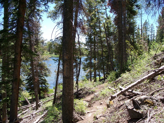
This trail provides access to the Great Western Trail from the Posey Lake Campground. The trail is 1.2 miles in length and is rated easy to moderate.
At a Glance
| Usage: | Light-Medium |
|---|---|
| Restrictions: | Open to: Hikers, bikers Closed to: Horse riders and motorized vehicles, including E-bikes |
| Closest Towns: | Escalante, UT |
| Water: | Water is available at the trailhead between Memorial Day and Labor Day. |
| Restroom: | Vault toilets are available at the trailhead. |
| Operated By: | Forest Service |
| Information Center: | Escalante Interagency Visitor Center (435) 826-5499 |
General Information
Directions: Driving Directions: From Escalante, turn north on the Hells Backbone Road. At 0.7 miles the road will fork, stay right. After 3.5 miles the road will turn to dirt and is now called Forest Road 153 (FR153). At 13.6 miles the road will fork, turn left on FR154 and follow the signs to Posey Lake Campground. The trail starts at the boat ramp in the campground.Activities
Mountain Biking
E-bikes are not permitted
Bike responsibly: Be Bear Aware and follow Leave No Trace Principles
| Difficulty Level: | Moderate |
|---|
Day Hiking
Hike responsibly: Be Bear Aware and follow Leave No Trace Principles
| Difficulty Level: | Easy to Intermediate |
|---|
Backpacking
Hike and camp responsibly: Be Bear Aware and follow Leave No Trace Principles
| Difficulty Level: | Easy to Intermediate |
|---|
Location


