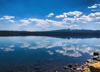
Paulina Falls Day Use Area


Located in a thicket of majestic conifer species, Paulina Creek Falls is located just west of Paulina Lake outside of the Newberry Caldera. This double falls drops 80 feet over volcanic cliffs onto a jumble of rocks below.

There is an accessible trail to picnic sites and a stunning overlook of the falls.

Trailhead provides access to Paulina Falls Trail.

Recreation Fee Site: Parking at this site requires payment/recreation pass. Passes are NOT available at this site, but can be purchased from Forest Service offices or vendors. Please check here for more information about recreation passes and where they can be purchased.

At a Glance

Fees: Recreation Fee Site: $5/vehicle/day or valid recreation pass. On-site passes not available.
Usage: Medium
Water: No
Restroom: Vault Toilet
Passes: Recreation Fee Site: Parking at this site requires payment/recreation pass. Please check here for more information about recreation passes and where they can be purchased. Acceptable passes include:

General Information

Directions:

From Bend, OR: Travel 23.5 miles south on Highway 97, then 12.3 miles east on Paulina Lake Road/County Road 21.


Recreation Map

Map showing recreational areas. Map Information

Activities

Day Hiking

This short and scenic hike (about 0.4 miles) is a great way to enter the Newberry Crater. Ideally, a car or bus driver will let people off at Paulina Creek Falls then drives to the Paulina Lake Lodge.  People then hike up Paulina Creek to Paulina Lake.  At Paulina Creek Falls you are outside of the Newberry Crater.  At the outlet of Paulina Lake, you are standing on the lowest point of the rim surrounding Newberry Crater.  Things to notice: 1) Two waterfalls, not one. 2) Big, angular boulders lying at the bottom of the falls.  Where did they come from? 3) Undercut region behind the lower half of the falls.  This area erodes and takes away support for the rocks above it. 4) Dam at the outlet of Paulina Lake. It raises the lake level about 4 feet. (The first dam was built in 1899. Water held by the dam is used for irrigation on the Kelldano Ranch in the La Pine Basin.)

Viewing Scenery

Picnicking

Related Information

Recreation Areas

Recreation Activities

Location

 
  Latitude : 
43.71039

  Longitude : 
-121.28317

  Elevation : 
6250