
Official websites use .gov
A .gov
website belongs to an official government organization in the
United States.
Secure .gov websites use HTTPS
A lock
(
) or https:// means you've safely
connected to the .gov website. Share sensitive information only
on official, secure websites.


Rough Trail #221
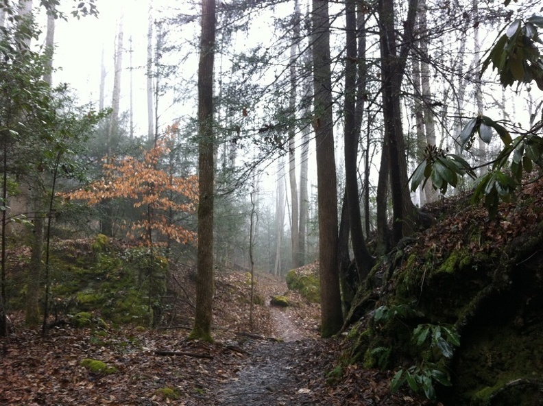 Rough Trail #221 extends through the Red River Gorge between KY 77 and KY 715, traversing the Gorge from west to east. This trail is located in the Red River Gorge on the Cumberland District of the Daniel Boone National Forest.
This challenging trail climbs from streamside to ridge-top and back down again several times. Use care when crossing streams after heavy rains. The trail At the east end the Swift Camp Creek Trail #219 continues into Clifty Wilderness for almost another 7 miles making for a long trail outing of nearly 15 miles one way.
Rough Trail begins on the western end at Martins Fork Trailhead. From the trailhead hike back toward Nada Tunnel and cross the road at a footbridge. The first section climbs up Martins Fork and abuts Grays Arch Trail #205.
From the intersection with Grays Arch Trail, it continues on toward Grays Arch itself through its second section, first continuing out a broad, flat ridge before dropping down a newly cut section of trail and then some steep stairs. At the bottom of the stairs go a few yards to the right for a view of Grays Arch before turning around and continuing east on Rough Trail. The trail continues down into the deep valley and immediately begins climbing up to Rush Ridge. The second section ends when the trail levels out on top.
The third section immediately drops steeply over a rock step from the crest of the ridge and then passes under an overhanging section of cliff and then into a narrow slot canyon for a short distance before coming out on a steep slope that drops down to Rush Branch. Again, Rough Trail begins climbing steeply as soon as it hits bottom. The third section ends with the third climb along the trail as Rough Trail intersects the Sheltowee Trace on Pinch-Em-Tight Ridge.
Once on top of the ridge, Rough Trail runs with the Sheltowee Trace straight out the ridge for about a mile before beginning another descent. In the valley, the trail crosses the creek in severl times before splitting. The Sheltowee heads north and Rough continues east, crossing the creek several more times. Then there is a steep climb out of Chimney Top Creek to Chimney Top Road.
At the beginning of the fifth section is another respite before the descent into Parch Corn Creek. There is one more big climb before the end at KY 715.
Rough Trail #221 Guide and Map (pdf)
Trailheads: Martins Fork Parking Area on KY 77 and Rough Trail/Swift Camp Creek Trail parking area on KY 715.
At a Glance
| Area Amenities: | Toilets |
|---|---|
| Passes: | No fee for trail use. All vehicles on KY 15 or in the Red River Gorge and Indian Creek area north of KY 15 must display a recreation permit for backcountry camping between the hours of 10 p.m. and 6 a.m. $5/day; $7/3 days; $50/annual pass. Recreation Passes and Permits |
| Information Center: | Gladie Office Contact Information |
General Information
Parking:Parking is available at the trailhead on KY 77 and Rough Trail/Swift Camp Creek trail parking area on KY 715.
Directions:
East end of Rough Trail
From Slade, travel east on KY 15 for 7 miles and turn left onto KY 715. Continue 4.1 miles to the Rough Trail/Swift Camp Creek Trail parking area on the left.
From Pine Ridge, take exit 40 off the Mountain Parkway and head west on KY 15. Turn right onto KY 715; continue 4.1 miles to the Swift Camp Creek/Rough Trail parking area on the left. Rough Trail begins from the parking area.
West end of Rough Trail
From Slade, travel west on KY 11/15. After about 1.5 miles, turn right onto KY 77. Follow 77 through Nada Tunnel. The Martin’s Fork parking area is on the left.
Activities
Day Hiking
Amenities
| Toilets: | Vault toilet at Martins Fork parking area meets accessibility standards for persons with disabilities. |
|---|
Quick Links

Related Information
Featured Events
- The Boone Forest Rally
Date(s): Jul 26, 2024 - Jul 27, 2024
Location