
Official websites use .gov
A .gov
website belongs to an official government organization in the
United States.
Secure .gov websites use HTTPS
A lock
(
) or https:// means you've safely
connected to the .gov website. Share sensitive information only
on official, secure websites.


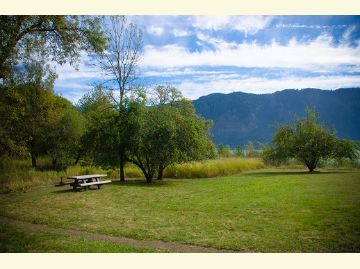
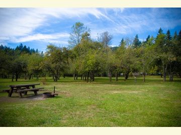
St. Cloud Day Use Area & Trail (#4410)
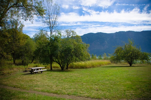
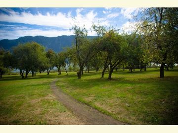
Acquired by the Forest Service in 1990, this historic site offers a great family stroll through a historic apple orchard along St. Cloud Interpretive Trail #4410. An accessible interpretive loop of three-foot wide gravel provides signs explaining the site's history and views of the Oregon side of the Gorge. Picnic tables at the viewpoint help complete the experience for day trippers.
Once the St. Cloud Ranch homestead, the area is possibly the largest remaining natural wetland in the Gorge, providing habitat for an extensive variety of wildlife. The site is culturally significant to Native Americans as well. Historically, members of the Watlala Tribe utilized many of the plant and animal species that were or are present at the St. Cloud site.
Please be aware of the nearby railroad tracks.


At a Glance
| Fees: | $5/vehicle/day |
|---|---|
| Usage: | Light |
| Restrictions: | No motor vehicles on trail. |
| Closest Towns: | Washougal, WA; Stevenson, WA |
| Water: | No |
| Restroom: | Vault Toilet (1). ADA accessible. |
| Passes: | Recreation Passes may be used as a form of fee payment |
| Operated By: | Forest Service |
General Information
Directions:From Bingen, WA: Travel west on Washington State Route 14 approximately 35 miles to milepost (MP) 29.9. Turn left (south) and cross the railroad tracks to site's parking area.
From Vancouver, WA: Travel east on Washington State Route 14 approximately 30 miles to milepost (MP) 29.9. Turn right (south) and cross the railroad tracks to site's parking area.
Accessibility:
See video
Activities
Day Hiking
Short loop through an old apple orchard. Interpretive signs explain the historical importance of the area.
Viewing Wildlife
The wetlands and riparian areas support a variety of bird species. Also the site of a 14 year bird banding project.
Viewing Scenery
Access to the beach with views of Multnomah Falls and the Columbia River Gorge.
Interpretive Areas
Descriptive history and nature signs
Picnicking
Four accessible tables on site.
| No. of Sites | 4 |
| Reservation Info | None |
| No. of Accessible Sites | 4 |
| No. of Accessible sites | 2 |