
Official websites use .gov
A .gov
website belongs to an official government organization in the
United States.
Secure .gov websites use HTTPS
A lock
(
) or https:// means you've safely
connected to the .gov website. Share sensitive information only
on official, secure websites.


Doc Long Picnic Site
Doc Long Picnic Site is named for Dr. William Henry Long. He was one of three forest pathologists in the USA who conducted pioneering research of tree diseases.
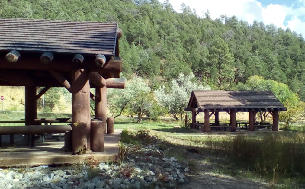
"Doc" Long, worked in New Mexico from 1910 through the 1930's. He lived in a cabin on the site where the “furthest set” rustic log pavilion is now. Pavilions ‘A’ and ‘B’ were added later.
The original pavilion and picnic ground were constructed in 1935 by the Civilian Conservation Corps, also known as the CCC. Their base camp was located a short distance down NM 536 and is now owned by the Boy Scouts of America.
Pavilions ‘A’ and ‘B’, which are replicas of the 1930s Civilian Conservation Corps design, are accessible and can accommodate up to 30 people. They are equipped with multiple picnic tables and grills. The site also features a playing field area near the group shelters and interpretive displays toward the interior of the site.
The Civilian Conservation Corps has a rich history and lasting presence throughout the Sandia Mountains. In their honor, we ask that you take extra care to “Leave No Trace” when you visit.
- No Camping Allowed
- Additional dispersed picnic areas, which do not require a reservation, are available on a first-come, first-served basis. Each area can accommodate a small family group and have no covering. Tables and grills are provided.
At a Glance
| Reservations: |
|
|---|---|
| Area Amenities: | Accessible, Picnic tables, Toilets, Parking |
| Fees: | Goup Use: $75 per day for groups of up to 50 people
Non-group Use:
|
| Open Season: | Seasonally |
| Usage: | Medium-Heavy |
| Busiest Season: | Spring through Fall |
| Restrictions: | DOGS MUST BE LEASHED. |
| Water: | No |
| Restroom: | Vault Toilet (2) |
| Passes: |
|
| Operated By: | Forest Service |
| Information Center: |
|
General Information
Directions:From Albuquerque drive east on I-40 to Exit 175, proceed north toward Cedar Crest, on State Highway 14 approximately 6 miles to Scenic Byway 536. Go just over a mile west on Scenic Byway 536 to the picnic area and look for signage on your left. Group sites are in the two covered areas adjacent to the road.
Please, Do Not Park in front of any gates. Gates must be accessible at all times.
(MVUM) Official Motor Vehicle Use Map - North
Living With Large Predators in New Mexico
About the Civilian Conservation Corps
Obtain firewood near your destination and burn it on-site: Don't Move Firewood
Activities
Day Hiking
Picnicking
Group Picnicking

Location