
Official websites use .gov
A .gov
website belongs to an official government organization in the
United States.
Secure .gov websites use HTTPS
A lock
(
) or https:// means you've safely
connected to the .gov website. Share sensitive information only
on official, secure websites.


Beaver Creek (#911)
Length: Mitchell Lake Trailhead (TH) to Mount Audubon Trail - 1.7 miles; Coney Flats TH - 5.1 miles; to Buchanan Pass Trail - 6.9 miles. DISTANCES ARE ONE-WAY.
Elevation: 10,460 feet at Mitchell Lake TH; 11,250 feet at Beaver Creek Trail intersection with Mount Audubon Trail; 9,800 feet at Coney Flats TH
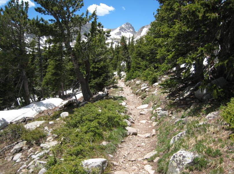
Trail Description: Beaver Creek Trail enters into the Indian Peaks Wilderness shortly after leaving the Beaver Creek Trailhead. After a few switchbacks, the trail circles the ridge and intersects with the Mount Audubon Trail.
Beaver Creek Trail continues northward for 3.4 miles, descending the northeastern flank of the mountain on a nice graded trail, finally dropping into Coney Flats. From Coney Flats the Beaver Creek Trail turns west into the Indian Peaks Wilderness. The Coney Lake Trail intersects 0.25 miles west of Coney Flats, and Beaver Creek Trail ends at Buchanan Pass Trail, 1.8 miles west of Coney Flats.
Click here for a trail summary.
View a trail map here.
At a Glance
| Fees: | Brainard Lake Recreation Area fees apply during the summer operating season (typically mid/late-June through mid-October). |
|---|---|
| Permit Info: | This trail lies within the Indian Peaks Wilderness Area:
|
| Usage: | Heavy |
| Best Season: | Hiking conditions are best from July through September. |
| Restrictions: | Indian Peak Wilderness restrictions apply:
|
| Closest Towns: | Ward, Colorado |
| Water: | Occasional streams; treat water for drinking |
| Restroom: | Vault toilet at trailhead |
| Operated By: | U.S. Forest Service |
General Information
Accessibility:The Coney Flats and Brainard Lake Roads are open seasonally. During these months, a vehicle fee applies for trailheads located within the Brainard Lake Recreation Area.
Directions:
From Colorado Highway 72 at Ward, turn west onto the Brainard Lake Road. Travel 2.5 miles to the entrance portal, and continue another three miles to the Mitchell Lake TH parking area. The Beaver Creek Trailhead is on the north side of this lot.