
Official websites use .gov
A .gov
website belongs to an official government organization in the
United States.
Secure .gov websites use HTTPS
A lock
(
) or https:// means you've safely
connected to the .gov website. Share sensitive information only
on official, secure websites.


Mount Blue Sky Recreation Area & Scenic Byway
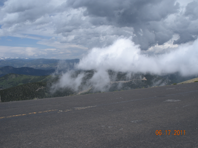
The Scenic Byway to Mount Blue Sky climbs over 7,000 feet in its 28-mile length, reaching an altitude of 14,130' feet. Idaho Springs serves as the starting point to the byway, which is the highest paved road in North America! This drive offers visitors scenic views of the Continental Divide, mountain goat and bighorn sheep herds, marmots, birds and apline wildflowers, and the Rocky Mountain Bristlecone Pine trees. The Mount Blue Sky Recreation Area offers easy access to Colorado’s inspiring high mountain environment. Take a short walk to the top of your first 14er! Overlook spectacular views of distant mountain peaks, alpine lakes and glacier valleys! Walk amongst the oldest living organisms on earth! A drive to the top of Mount Blue Sky will take your breath away, in more ways than one!
The Scenic Byway to Mount Blue Sky is jointly managed with the Colorado Department of Transportation.
Improvements to a section of Mount Blue Sky Scenic Byway (Colo. Highway 5) will impact visitors in 2024 and 2025. Construction will begin in late July or early August 2024 with a temporary lane closure in the project area near Summit Lake. Visitors may experience traffic delays. Starting Sept. 3, 2024, through all of 2025, Mount Blue Sky Highway will be closed to motorized and non-motorized travel (foot, bike, etc.). A public closure area will span from the CDOT gate on Colo. Highway 5 through the project area, above Summit Lake. Access to the Mount Blue Sky summit will only be available from various hiking trails. The area will reopen, as conditions allow, on Memorial Day weekend 2026.
Mount Blue Sky History - Learn about the history of the mountain and the road.
In 2019, Clear Creek County supported petitions by the Cheyenne and Arapaho Tribes of Oklahoma and the Wilderness Society to change the name of Mount Evans, which was named after John Evans, the territorial governor of Colorado who authorized the Sand Creek Massacre. After two nation-to-nation consultations, the Board on Geographic Names voted in September 2023 to change the name to Mount Blue Sky. The new name holds significance to the Arapaho who were known as the Blue Sky People and to the Cheyenne who have an annual renewal of life ceremony called Blue Sky. Following the name change of the mountain, the Colorado Department of Transportation changed the name of the state highway to the Mount Blue Sky Scenic and Historic Byway. As of this printing, legislation to change the name of the Mount Evans Wilderness area has been introduced.
Watch this helpful video by Colorado Parks and Wildlife for important information to know before visiting Mount Blue Sky.
At a Glance
| Operational Hours: | The Mount Blue Sky Recreation Area is tentatively scheduled to open May 31, 2024, weather dependent. Reservations for Mount Blue Sky can be made starting at 8 a.m. May 21, 2024, and reservations can be made up to 30 days before your visit. Reservations are required if planning to park and visit one of the three developed sites (Mount Goliath Natural Area, Summit Lake Park, or the Mount Blue Sky Summit) between 8 a.m. and 6 p.m. |
|---|---|
| Reservations: | Reservations are required for vehicle entry. Go to recreation.gov to create an account and purchase your ticket. https://www.recreation.gov/timed-entry/10087438 |
| Fees: | Please see recreation.gov for all fees and additional information. |
| Usage: | Heavy |
| Restrictions: |
|
| Closest Towns: | Idaho Springs, CO; Bergen Park, CO |
| Water: | No |
| Restroom: | Vault Toilets |
| Operated By: | Highways operated by CDOT - Colorado Department of Transporation |
General Information
Directions:From I-70: Take exit 240 in Idaho Springs. Follow Highway 103 south until it meets Echo Lake. Take Highway 5 to the top of Mount Blue Sky.
From Bergen Park: Take Highway 103 west and travel to Echo Lake. Take Highway 5 to the top of Mount Blue Sky.
Activities
Road Cycling
Recreation areas with activity Road Cycling:| Difficulty Level: | Easy to Difficult |
|---|
Day Hiking
Recreation areas with activity Day Hiking:- Mount Blue Sky Summit / Interpretive Site
- Mt. Goliath Natural Area/Dos Chappell Nature Ctr.
- M. Walter Pesman (#50)
- Summit Lake Park
Viewing Wildlife
Recreation areas with activity Viewing Wildlife:Viewing Scenery
Recreation areas with activity Viewing Scenery:Interpretive Areas
Recreation areas with activity Interpretive Areas:Scenic Driving
Recreation areas with activity Scenic Driving:| Pavement Type for Parking | Paved |
| Size Restrictions | Vehicles over 30' long are not recommeded on Highway 5 (Mount Evans road) due to the steep, narrow, winding road. |
| Corrals | Vehicles over 30' long are not recommeded on Highway 5 (Mount Evans road) due to the steep, narrow, winding road. |