USDA Forest Service / Pacific Northwest Region / Fire & Aviation
Aviation Hazards
Data and Map Products
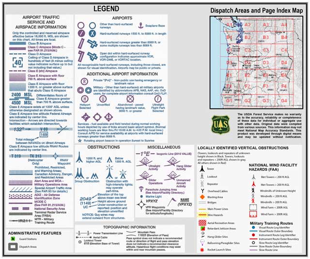
Geo-referenced PDFs showing aviation hazards in Oregon and Washington are available below. Maps show national hazards and may show additional locally sourced hazards where available.
Contact Information
Desraye Assali, NWCC GIS Coordinator, (desraye.assali@usda.gov)
All documents are Adobe PDF files.
Published/Updated: 03 June 2022.
- Mount Rainier NP
- Blue Mountain UMF North
- Blue Mountain UMF South
- Blue Mountain WWF
- Burns
- Central Oregon
- Central Washington
- Columbia Cascades
- Colville
- CWICC Central
- CWICC North
- CWICC South
- Eugene
- John Day
- Lakeview
- Mapbook
- Northeast Washington
- Puget Sound
- Rogue Valley
- Roseburg
- Vale
- Warm Springs
- Yakima