
Roan Mountain Day Use Area
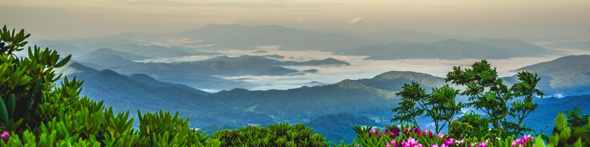
Famous for its spectacular natural gardens of Catawba rhododendrons, Roan Mountain shelters a rich diversity of life, from spruce-fir forests to vast grassy balds.
Roan Mountain is actually not one mountain, but a high ridge about 5 miles long. It ranges from a height of 6,286 feet at Roan High Knob to a low of 5,500 feet at Carver’s Gap. No one knows the origin of the mountain’s name. Some claim the name refers to the roan or reddish color of the mountain when rhododendrons bloom in June,
or the mountain ash berries appear in September. Others say the name comes from Daniel Boone’s roan horse, because he and his horse were frequent visitors.


Active Alerts
General Information
The first human visitors to Roan Mountain were American Indians, who lived at the base of the mountain and traveled across its gaps. The first people to study the mountain were botanists, such as Andre’ Michaux, John Fraser, and Asa Gray. They described rare plant communities and discovered scores of “new” plants, including Fraser fir, Catawba rhododendron and Grays lily.
Around 1870, General John T. Wilder bought 7,000 acres along the top and sides of Roan Mountain. It was Wilder who built the road to Carver’s Gap. He also constructed a 20-room log inn near the summit of Roan High Knob in 1877, then replaced it with the luxurious Cloudland Hotel. For about 20 years, guests enjoyed the “pure air, the delightful temperature, the clear cold spring water and the perfume-laden woodlands.” Today little evidence remains of the once grand hotel.
Memorial Day -Sept 30th
During normal season, this recreation area is closed between the hours of 10:00PM and 6:00AM.
NO OVERNIGHT PARKING
Possessing alcoholic beverages, camping, building campfires and overnight parking are prohibited.
$3.00 per passenger vehicle. Cost for larger vehicles and buses $1.00 per person. Payable with cash at feed tube at the entrance as well as online pay portal through this link at www.recreation.gov

Address: 632 Manor Road Mars Hill, NC 28754
Phone: (828) 689-9694
Hours: (Mon-Fri) 7:30 AM-4 PM (Closed on federal holidays)
Office Email: appalachianrd@usda.gov
Getting There
Latitude / Longitude
Latitude: 36.10334043
Longitude: -82.13363438
Elevation
6,285 feet
Directions
From Burnsville take 197 N to Red Hill, turn left towards Johnson City, TN (Hwy. 226N). Go 3 miles to Fork Mountain Rd. #1338; turn right and go to the end of the road. Turn left onto 261 N and follow 261 N to Carver's Gap. Follow the signs from there to the Gardens.
Facility and Amenity Information
Restrooms
Restrooms are not available at this site.
Water
Potable water is not available at this site.