
Dog Mountain Trail (#147)
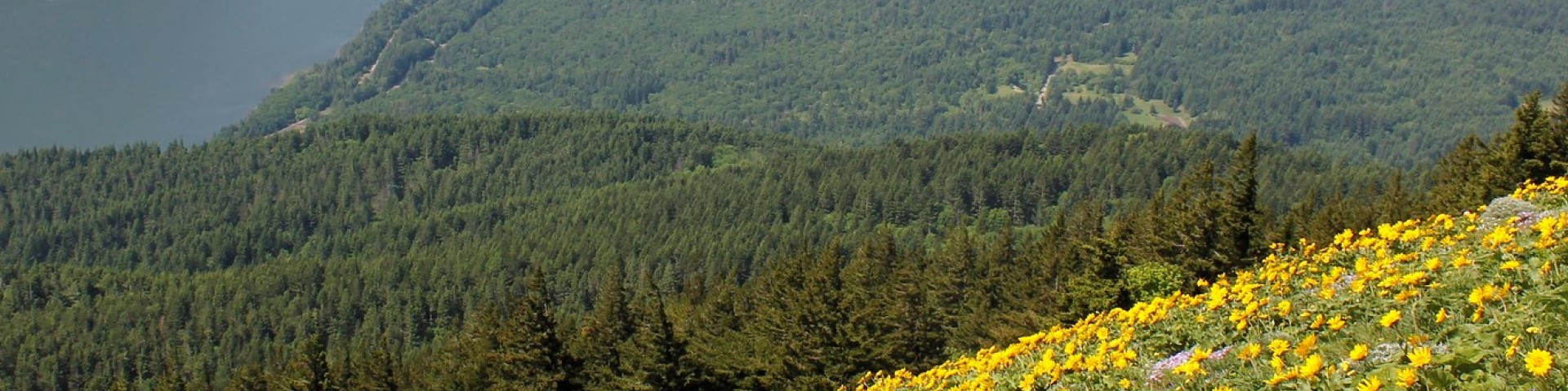
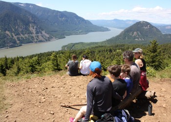
Springtime wildflower blooms and stunning views make Dog Mountain one of the most popular hiking areas in the Columbia River Gorge National Scenic Area. Visitors will enjoy panoramic views of the Columbia River Gorge and Mount Hood towering to the south. The popular Dog Mountain - Augspurger Loop is a strenuous 6.8-mile hike that climbs 2,828 feet. Approximate hiking time is four to six hours. The area provides opportunities for several shorter hikes as well. Visitors may experience crowded conditions along the trail on weekends during the wildflower season. During wildflower season permits are required on weekends April - June.
The trail climbs steeply for the first half mile before reaching a split in Dog Mountain Trail. Those who head west will pass through old growth trees along the original, steeper trail. About a mile into the east leg, hikers will encounter a lower meadow nicknamed "Puppy Dog" which overlooks the Columbia River as it meanders past Wind Mountain. Directly across the river, Starvation Creek Falls is visible to the left, as is the summit of Mount Defiance. This is a good picnic spot or turnaround point for a shorter hike.
Those who continue to the upper meadow will find the rest of the hike very open. On a clear day, the Columbia River can be seen winding through the Gorge in both directions, with Mt. Hood towering to the south and Mount St. Helens looming on the northwest horizon. On rainy days, hikers can sometimes find themselves above the clouds.
Hikers can continue past the upper meadow to create a loop via Dog-Augspurger Tie Trail to Augspurger Trail #4407 which shares the same trailhead.


Specific Trail Information
Trail Type
General Information
During the winter, the peak is snow-covered and even the most intrepid hikers should come prepared with mountaineering gear such as traction devices, poles, and a good GPS.
Note: Because of its steep grades of 10-25%, this trail may not be suited to young children or unfit adults.
Year-round
Day use fee at Dog Mountain Trailhead: $5 per vehicle per day, or valid recreation pass
Seasonal permits are required. Each hiker must carry a permit or digital proof of permit each year on Saturdays and Sundays during peak spring wildflower season.
- Motor vehicles are prohibited.
- Fires not allowed within 200 feet of trail.
Getting There
Directions
From Stevenson, WA: Travel east on Washington State Route 14 for 10 miles. Trailhead parking is available at milepost 53.7 by the Dog Mountain Trailhead sign.
From Portland, OR: Travel west on Interstate 84 to Cascade Locks exit #44. Follow the off ramp under the interstate and take the first right to the Bridge of the Gods across the Columbia River. At the stop sign, turn right (east) on Washington State Route 14 and travel 12 miles. At milepost 53.7 there is a large sign for the Dog Mountain Trailhead. Park in the pullout on the left.
Additional Information
Operated By
Forest Service