

Four Forest Restoration Initiative
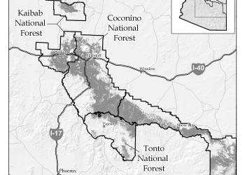
Four national forests—the Kaibab, Coconino, Apache-Sitgreaves and Tonto—are engaged in a collaborative initiative to restore fire-adapted ecosystems in the Southwest. Through collaboration with a diverse group of stakeholders, the four forests plan and carry out landscape-scale restoration of ponderosa pine forests in Northern Arizona.
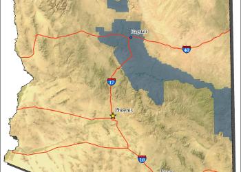
The 4FRI landscape was identified as having a high risk for wildfire by the Forest Service in 2010. The landscape covers 2.4 million administrative acres across the four forests. In collaboration with local industry and partners, 4FRI has implemented hazardous fuel reduction; improved forest health; diversified wildlife and plant species; and created and/or sustained ecosystems for the long term across four Arizona forests.
4FRI Public Dashboard

An interactive online map that display 4FRI activities since 2010, including prescribed fire, commercial timber, non-commercial timber, and hazardous fuels.
About 4FRI
View maps, accomplishments, strategic plans, and more.
Industry
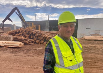
4FRI aims to get the job done while expanding the timber industry and community relationships.
Partners
Partners increase 4FRI’s restoration capacity to create the desired pace and scale.
4FRI Accomplishments

From 2010 to 2024, 4FRI has treated 1,275,240 hazardous fuel acres. Within this success are:
- 212,624 acres of commercial thinning completed of 319,486 acres awarded
- 351,728 acres of non-commercial thinning
- 654,639 acres of broadcast burning
- 120,998 acres of pile burning
The following before and after photos are an example of restoration work from the Pine Canyon project on the Tonto National Forest. Click the photos to enlarge.


Treating the Landscape
Monthly Operation Reports

The 4FRI team publishes an operations report each month that highlight the progress for mechanical thinning and prescribed fire activities across the entire 2.4 million acres.
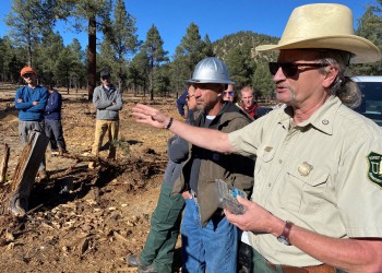
Implementation
In order to accomplish on-the-ground objectives, 4FRI implements commercial and non-commercial thinning treatments, pile burning, and broadcast burning.
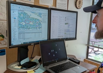
Monitoring & Adaptive Management

The intent of monitoring is to link land management actions and outcomes with learning. Monitoring is a valuable tool that can help the 4FRI adapt its management practices based on the effects of previous activities.
Planning
Within the 4FRI footprint, close to 2 million acres have been analyzed through the National Environmental Policy Act. Two large 4FRI-specific NEPA analyses are complete.
Contact Us
The 4FRI team is located at the Coconino National Forest Supervisor's Office. You can also contact an individual forest if you have questions about a particular restoration effort.

