


Larson Ridge Trailhead
Larson Ridge Trailhead is located approximately 1/3 mile north of Arizona State Highway 260 on Forest Road 237. The trailhead provides parking and a vault toilet.
General Information
The Larson Ridge Trailhead provides access to the Willow Springs Bike Loop Trail and The General Crook National Historic Trail. These trails are non-motorized trails - Bicycle, horse, foot traffic Only.
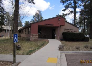
Address: P.O. Box 968 2748 East AZ 260, Overgaard, AZ 85933
Phone: (928) 535-7300
Hours: M-F: 8:00 a.m. - 4:30 p.m. (Closed on federal holidays)
Getting There
Latitude / Longitude
Latitude: 34.33035278
Longitude: -110.8343306
Directions
From Forest Lakes, Arizona, travel west on Arizona State Highway 260 for approximately 1.7 miles to Forest Road 237. Turn north onto Forest Road 237 and travel approximately 1/3 mile to the trailhead.
Travel Considerations
area becomes inaccessible during winter due to snow
Parking
Parking lot is adjacent to the vault toilet
Facility and Amenity Information
Restrooms
Vault Toilet (1)Water
Potable water is not available at this site.
Picnic Tables
Picnic tables are not available at this site.


