
Allen Ridge Trail #17
Description: This 3.7-mile secondary single-track trail begins at a popular swimming/fishing hole with a suspension foot bridge crossing the St. Joe River and used to access Middle Sister Lookout. The trail now dead ends at Forest Road 752 after about 3.7 miles from the river at Allen Point where good views can be found. The first 2 miles (a nice hike) of the trail are an old Wyssen logging road built in the 1960s which gently switchbacks up through a cool, dank north-facing cedar slope (highly recommended stretch of this trail). Watch for unique flora including species of moss, lichen, orchids, and ferns. The last 1.5 miles of this trail are as steep as anything in this forest, whew! No water is along the trail and there can be abundant huckleberries.
Directions:
• Approximate driving time from Avery to the Trail 17 Allen Ridge Trailhead is 15 minutes.
• From Avery drive upriver on Forest Highway 50 for 9.5 miles to the Trail 17 Allen Ridge Trailhead.
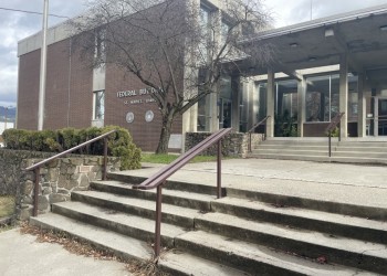
St. Joe Ranger District
222 S. 7th, Suite #1 St. Maries, ID 83861
7:30 a.m. to 12:00 and 12:30 p.m. to 4:00 p.m. weekdays (Closed on federal holidays)
(208) 245-2531
Specific Trail Information
Trail Number
Trail Type
General Information
Address: 222 S. 7th, Suite #1 St. Maries, ID 83861
Phone: (208) 245-2531
Hours: 7:30 a.m. to 12:00 and 12:30 p.m. to 4:00 p.m. weekdays (Closed on federal holidays)