

Visitor Maps and Guides
Interactive Trails Map

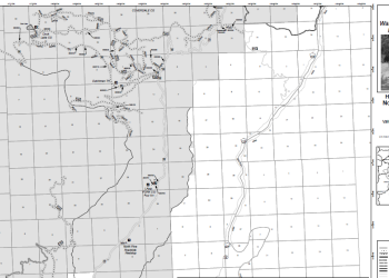
This web map is designed to show the wilderness trails in Wallowa Mountains. Trail maintenance status is the main feature, with authoritative data on fire closures (point, line, poly) in regard to the current season.
Motor Vehicle Use Maps - Hells Canyon National Rec. Area
These Motor Vehicle Use Maps show the roads and trails, where forest visitors can take highway legal vehicles (such as passenger cars, pickup trucks, SUVs, motorcycles) and off highway vehicles (such as ATVs, UTVS – or side by sides, off road motorcycles, etc.) within Hells Canyon National Recreation Area.
Consult this description of all Pacific Northwest Region Forest Service maps to determine which map or maps will help you plan and complete a safe and enjoyable visit to a national forest.
Forest Service Topographic Maps are at a scale of 1:24,000 (2.64 inches to the mile) and offer the most detailed view of the terrain. These maps are based on USGS Quad maps, but also feature recreation features, such as such as roads, trails, and campgrounds. They were developed in the 1990s, so some of the information may be outdated.
Topographic Quadrangle or “Quad” Maps are at a scale of 1:24,000 (2.64 inches to the mile) and offer the most detailed view of the terrain. These maps feature elevation contours and are considered essential to carry for those venturing into the backcountry via an established trail system or cross-country on foot.
National Forest and Pacific Northwest Interagency Recreation (Visitor) Maps are at a scale of 1:126,720 (one half inch to the mile) and are useful for general trip planning and navigating the main state, county, and primary Forest Service roads. Most feature shaded relief, denote land ownership, and highlight developed recreation sites including campgrounds, boat launches, and day use areas.
Ranger District Maps are at a scale of 1:63,360 (one inch to the mile) and are useful for detailed trip planning and navigating a District’s secondary, unpaved, one-lane, and backcountry roads. In addition to developed recreation sites, these maps show hiking trails and roads closed to vehicle use. Most District maps include elevation contours and some include vegetation cover. These maps are popular with hunters, hikers, and those interested in dispersed recreation and cross-country foot travel.
Wilderness Maps are generally at a scale of 1:63,360 (one inch to the mile) and are useful for those planning and completing trips into designated Wilderness. These maps include elevation contours and vegetation cover, and highlight Wilderness boundaries, trailheads, and trails.
Motor Vehicle Use Maps. These maps display National Forest System routes (roads and trails) that are open to motor vehicles. They are generally at scales of between 1:42,000 and 1:75,000 (about 1.5 and 0.85 inches to the mile) and display only National Forest System routes (roads and trails) that are open to motor vehicles.
Clarkston, Washington HCNRA Office
2535 Riverside Drive
P.O. Box 699
Clarkston, Washington 99403
(509) 758-0616
Riggins, Idaho HCNRA Office
1339 Highway 95 South
P.O. Box 832
Riggins, Idaho 83549
(208) 628-3916
*La Grande Ranger District Office
3502 Highway 30
La Grande, OR 97850
(541) 963-7186
*Wallowa Mountains Office
201 East 2nd.
P.O. Box 905
Joseph, Oregon 97846
(541) 426-5546
Whitman Ranger District
1150 Dewey Ave Suite A
Baker City, Oregon 97814
(541) 523-6391
*Pine Ranger District Office (Vending Machine is operational June through October)
38470 Pine Town Lane
Halfway, Oregon 97834
(541) 742-7511 (May-mid December)
*Offices indicated have a vending machine for after hours purchases.
Hard copy maps are available for sale at local Forest Service Offices.
- Snake River Boaters Guide: $14.00
- Grande Ronde River Guide: $14.00
- Lower Salmon River Guide: $10.00
- Middle Fork River Map: $14.00
- Hells Canyon NRA Map: $14.00
- Clearwater NF Map: $14.00
- Nez Perce Flight Map: $14.00
- Umatilla NF Map: $14.00
- Wallowa-Whitman NF Map: $14.00
- Tucannon Wilderness Map: $14.00
- Payette NF Map: $14.00
- Pomeroy Ranger District Map: $14.00
- Baker Ranger District Map: $6.00
- Wallowa Valley Ranger District Map: $6.00
- Eagle Cap Ranger District Map: $6.00
- Unity Ranger District Map: $6.00
- Wenaha-Tucannon Wilderness Map: $10.00
- Pine Ranger District Map: $6.00
- La Grande Ranger District Map: $6.00
- Walla Walla Ranger District Map: $14.00
- Southern Blue Mountains Map: $14.00
- Wallowa/Grande Ronde Boaters Guide: $14.00
The Avenza free mobile app makes it easy to download forest maps onto your mobile device. View a list of available maps in the Pacific Northwest by area below or visit the Forest Service, Pacific Northwest Region Avenza library to search for all available maps in the region.
Avenza maps are georeferenced so that you can find your location on the downloaded map, even without WiFi or network connectivity. The GPS on your mobile device can use your location to pinpoint you on the map with a blue dot, and the dot follows you as you go. Learn more about georeferenced maps.
Safety Reminder: Never count on your cell phone map as the only navigation device out in the forest, especially in the backcountry.
WALLOWA-WHITMAN NATIONAL FOREST
- Wallowa-Whitman National Forest Visitor Map North
- Wallowa-Whitman National Forest Visitor Map South
- Wallowa Valley Ranger District Map
- Pine Ranger District Map
- East La Grande Ranger District Map
- West La Grande Ranger District Map
- Baker Ranger District Map
- Hells Canyon National Recreation Area Map South
- Hells Canyon National Recreation Area Map North
- Wallowa-Grande Ronde Boaters Guide
- Eagle Cap Ranger District Map
- Unity Ranger District Map
- Malheur River Country Recreation Map North
- Monument Rock Wilderness Map
UMATILLA NATIONAL FOREST
- Walla Walla Ranger District Map South
- Walla Walla Ranger District Map North
- Pomeroy Ranger District Map South
- Pomeroy Ranger District Map North
- North Fork John Day Ranger District Map South
- North Fork John Day Ranger District Map North
- Heppner Ranger District Map
- John Day River Recreation Map
- Umatilla National Forest Visitor Map South
- Umatilla National Forest Visitor Map North
- Wallowa-Grande Ronde Rivers Boater's Guide
- Umatilla National Forest - Motor Vehicle Use Map - Heppner RD - 2018
- Umatilla National Forest - Motor Vehicle Use Map - Walla Walla RD - 2018
- Umatilla National Forest - Motor Vehicle Use Map - North Fork John Day RD - 2018
- Umatilla National Forest - Motor Vehicle Use Map - Pomeroy RD - 2018
MALHEUR NATIONAL FOREST
- Owyhee Canyon Country Recreation Map North
- Malheur River Country Recreation Map South
- Malheur River Country Recreation Map North
- Steens High Desert Country Recreation Map South
- Steens High Desert Country Recreation Map North
- Southern Blue Mountains Recreation Map South
- Southern Blue Mountains Recreation Map North
- Monument Rock Wilderness Map
- Strawberry Mountain Wilderness Map
These free downloadable geo-enabled quadrangle maps are created by the Forest Service.
The US Geological Survey Map Store carries many Forest Service maps, as well as other agency publications. Check out their inventory!
Digital data (GIS) is available at the USDA Forest Service Geodata Clearinghouse.
This guide includes map segment and river mile feature descriptions.
Additional Map Resources
Forest Service Map Finder - Locate and purchase a Forest or Grassland Visitor Map using this national interface.
Discover Your Northwest: A nonprofit partner carrying a wide selection of maps, books, guides, and other interpretive products that highlight the Northwest’s natural and cultural history and support educational programs and services on public lands.
National Interactive Visitor Map
View the online National Interactive Visitor Map to explore recreation sites on National Forest System lands across the country.