
Official websites use .gov
A .gov
website belongs to an official government organization in the
United States.
Secure .gov websites use HTTPS
A lock
(
) or https:// means you've safely
connected to the .gov website. Share sensitive information only
on official, secure websites.


Recreation Passes & Permits
Before you plan a recreational activity on the Payette Forest, please be sure to check whether you will need a permit, river pass or interagency pass.
The McCall Ranger District is a good source for information on permits and passes. They can be reached at 208-634-0400.
Fees that are charged are making a difference. The National Forests in the Intermountain Region are using the recreation fee revenues to improve and enhance recreation opportunities.
Under the Recreation Fee Demonstration Program 100% of the revenue generated is retained by the National Forest to help fund the operation, maintenance and enhancement of recreation facilities, visitor services, and the protection and rehabilitation of natural resources. Find out more about recreation passes...
Also visit the Boise National Forest Web site for information about the Payette River Pass.
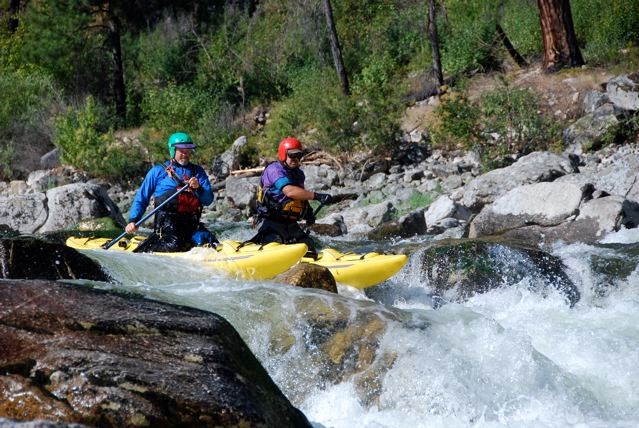
Information for the South Fork and Big Creek Float Permits
The Lower South Fork Salmon River (from the confluence of the East Fork South Fork Salmon River to Main Salmon River) requires a free but mandatory permit to float year round.
This information pertains to a free, but mandatory permit to float Big Creek and South Fork Salmon River (SFSR). Both of these rivers require a permit to float and both rivers are located on the Payette National Forest.
The updated 2003 Frank Church River of No Return Management Plan recognized the need to give boaters floating Big Creek and SFSR a way to exit their floats. A Special Order (Order #04-12-362) was enacted on March 31, 2006 requiring floaters of Big Creek and SFSR to be in possession of a permit. These permits allow boaters to exit from Big Creek onto the Middle Fork of the Salmon River (MFSR), and exit the South Fork Salmon River onto the Main Salmon River, the same day they enter. This order will be in effect during any open boating period.
Each group entering the South Fork Salmon River (SFSR) and Big Creek river corridors are required to carry a permit notating their group size and trip duration, as well as, a float tag indicating which river they will be exiting upon. For Big Creek this is a Middle Fork Salmon River (MFSR) tag, for the South Fork Salmon River (SFSR) this is a Main Salmon tag. Maximum group size is limited to 20 people at one time. Camping restrictions apply - see below.
Information on the lottery permits for the MFSR and the Main Salmon River can be found here.
So how do I get my permit?
Please allow 7-10 days for your permit application request to be processed.
To begin the application process for a Big Creek or South Fork Salmon River permit, choose one of the following methods:
- Electronically: Complete the permit application (see links below), save it to your computer, and email the form to rebecca.gillette@usda.gov.
- By mail: Complete the permit application (see links below), print it, and mail the hard copy to:
McCall Ranger District, ATTN: River Permit Application, 102 W. Lake St., McCall, ID 83638
- In person: Stop by the McCall Ranger District office at 102 W. Lake St., McCall, Idaho.
- Over the phone: Call the McCall Ranger District office at (208) 634-0400.
Once we receive your application, we will issue your official permit, as well as float tags that must be physically attached to your boats (we provide the zip ties). The float tags allow you to exit Big Creek onto the Middle Fork and Main Salmon rivers to the takeout at Cache Bar, or to exit the South Fork Salmon onto the Main Salmon to the takeout at either Carey Creek or Vinegar Creek.
After we issue the permit and float tags, we can either mail the permit packet to you, or we can leave it in a drop box outside the McCall Ranger District office for you to pick up at your convenience.
The permit packet also contains information about natural and cultural resource protection, boater etiquette, and boater responsibilities. Please ensure that ALL members of your boating party have reviewed this information BEFORE getting on the water.
If you have any questions, please call the McCall Ranger District office at (208) 634-0400. Office hours are Monday through Friday, 8:00 AM – 4:30 PM.
Click here for Big Creek permit application.
Click here for South Fork Salmon River permit application.
Camping
The permit for the SFSR allows use of the Main Salmon River however you may NOT camp on the Main Salmon between the confluence of the South Fork and the Main to Vinegar Creek. Camping is allowed beyond Vinegar Creek if you do not choose to exit at Vinegar Creek or Carey Creek.
For Big Creek, the permit allows use of the Middle Fork of the Salmon River from the confluence of Big Creek to the take-out at Cache Bar on the Main Salmon but does NOT allow camping on this section of river.
River Float Boat Closure Periods
Be aware there are closure periods on some sections of both of the above rivers for the periods listed below for the protection of threatened fish (Special Order 04-12-318). Float boating restrictions are in effect from April 1 - May 31, and August 1 - September 30 of each year. Permits will not be issued for Big Creek during the closure periods. The entire Special Order, along with a map that displays the sections of river that are closed, can be found here.
The following sections of river are closed during these periods:
Big Creek, from the Big Creek/Smith Trailhead at the Frank Church River of No Return Wilderness Area boundary located within Township 21 North, Range 9 East, Section 13, downstream in an easterly direction approximately 32 miles to the confluence with the Middle Fork of the Salmon River located within Township 20 North, Range 14 East, Section 10, Boise Meridian, Valley County, Idaho, and within the administrative boundaries of the Frank Church of No Return Wilderness, Krassel Ranger District, Payette National Forest.
Lake Creek, from its headwaters within Township 24 North, Range 4 East, Section 36, downstream in a southeasterly direction approximately 10 miles to the confluence with the Secesh River, located within Township 22 North, Range 5 East, Section 7, Boise Meridian, Idaho County, Idaho, and within the administrative boundaries of the McCall Ranger District, Payette National Forest.
Secesh River (a tributary to the SFSR), from its confluence with Lake Creek within Township 22 North, Range 5 East, Section 7, downstream in southwesterly direction approximately 8 miles to Chinook Campground located with Township 22 North, Range 5 East, section 26, Boise Meridian, Idaho County, Idaho, and within the administrative boundaries of the McCall Ranger District, Payette National Forest.
South Fork Salmon River, from its confluence with Goat Creek near the boundary between the Payette and Boise National Forests located within Township 16 North, Range 6 East, Section 1, downstream in a northerly direction approximately 22 miles to the confluence with the East Fork of South Fork Salmon River located with Township 19 North, Range 6 East, Section 3, Boise Meridian, Valley County, Idaho, within the administrative boundaries of the Krassel Ranger District, Payette National Forest.
Requirements and Guidelines
Idaho requires that all watercraft display an Idaho Invasive Species Fund Sticker. The only exception to this requirement are inflatable, non-motorized watercraft less than 10 ft. in length. Sticker vendors throughout the state can be located here.
The permit holder assumes primary responsibility for their group when they sign the permit. They must accompany the group throughout the duration of the trip. They should make each group member aware of relevant rules and river etiquette.
All groups should carry and use the following equipment:
· A portable toilet system with sufficient carrying capacity for all group members for the duration of the trip.
· A metal fire pan and receptacle for the associated ash.
· A large water bucket or container for fire suppression.
· A mesh strainer sufficient for removing food particulate from grey water.
Do your part by leaving each river corridor cleaner than you found it. Carry out all human and pet waste, food waste, and trash.
Check for any current fire restrictions prior to your trip. Please do not build new or expand existing fire rings. Avoid burning any garbage that contains toxic materials.
Camp only in pre-established camp sites with enough durable surfaces to accommodate the group size. Do not expand existing sites.
Never introduce any soap, even biodegradable soap, directly into any body of water.
Black bears inhabit each river corridor. All food, garbage, and any scented items should be stored in bear-resistant containers or suspended at least 12 ft. high and 10 ft. away from the nearest tree. The “counter-balance” is the most effective bear hang technique.
Cultural Site Etiquette for River Users - Artifacts that you see are protected by law; please leave them where you find them. The Antiquities Act and the Archaeological Resource Protection Act prohibit the collection of any historic and Native American artifacts or disturbance, vandalism, and looting of archaeological and historic sites. Please leave all archeological artifacts and natural features intact. Do not touch the pictographs; natural body oils will break down the paints. . With usage on the rise, adhering to minimum impact practices helps to ensure the quality and longevity of these amazing waterways and helps to ensure guaranteed permit availability for everyone for years to come. Thank you for doing your part!