
Official websites use .gov
A .gov
website belongs to an official government organization in the
United States.
Secure .gov websites use HTTPS
A lock
(
) or https:// means you've safely
connected to the .gov website. Share sensitive information only
on official, secure websites.


About the Forest
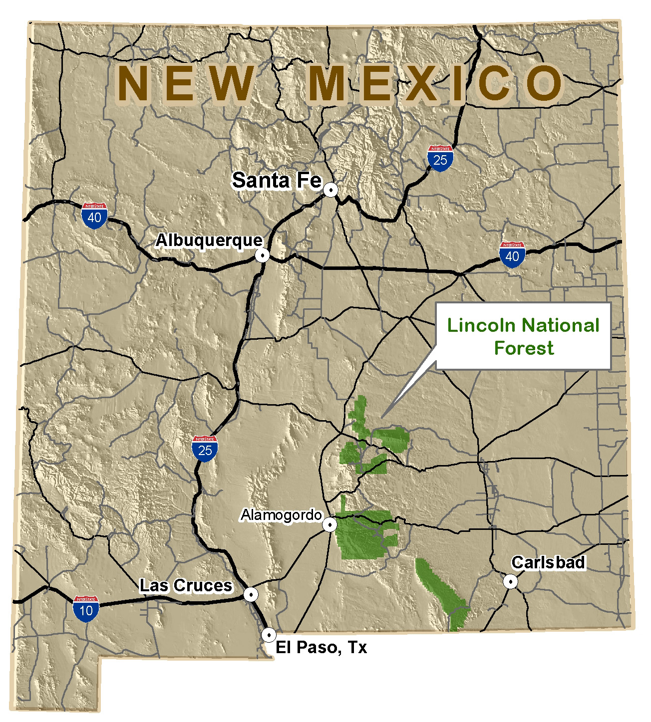
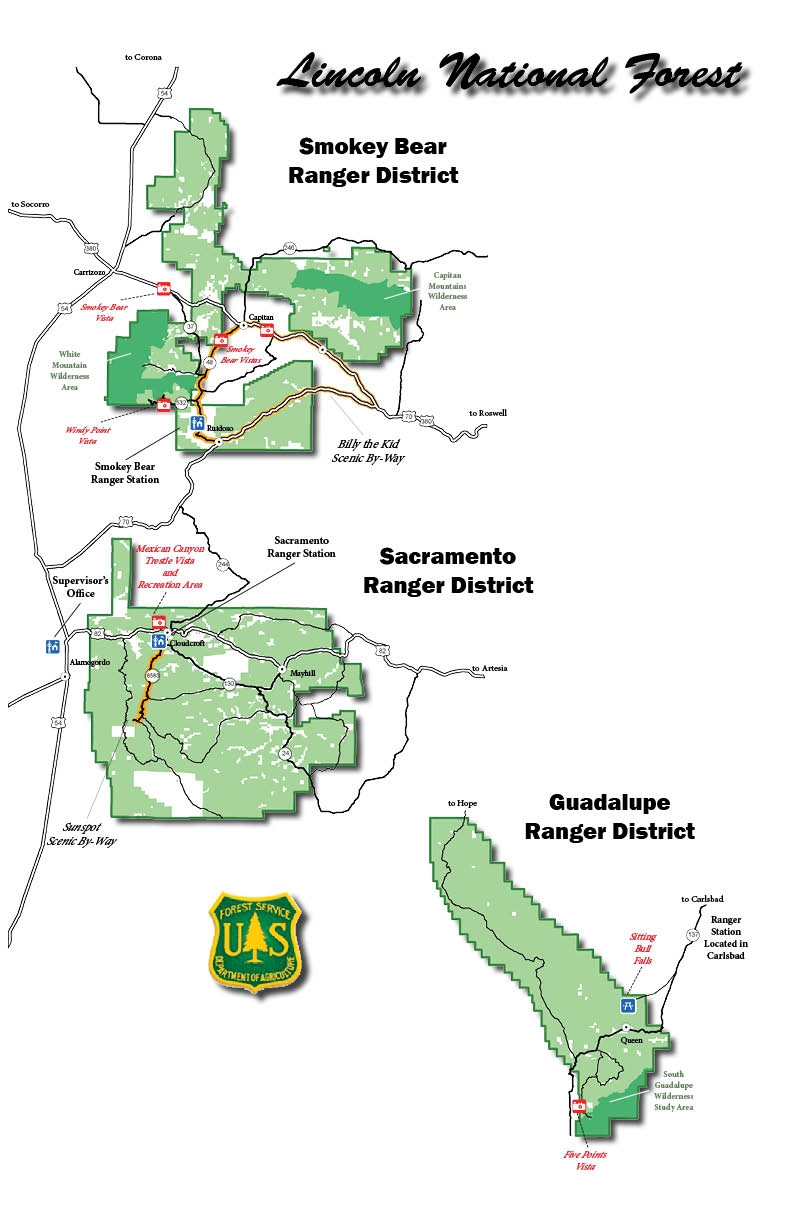
The Lincoln consists of three ranger districts: Sacramento, Smokey Bear and Guadalupe. There are three major mountain ranges: Sacramento, Guadalupe and Capitan that cover 1,103,441 acres in parts of four counties in southeastern New Mexico. Elevations range from 4,000 to 11,500 feet and pass through five different life zones from Chihuahuan desert to sub-alpine forest. Vegetation types are very diverse across the Forest and range from rare cacti in the lower elevations to Englemann spruce in the higher.
Temperatures vary with elevation. At higher elevations, 7,000 feet and up, summer nights are a chilly 40º and days can warm to the low 80's. Winter temperatures can drop to -15º at night and rise to 40º-50º during the day. At lower elevations, 6000-7000 feet, winter temperatures rarely fall below 0 and usually run from the teens to 50s. Summer temperatures range from 50º to 85º. At the lowest elevations, 4,000 to 6,000 feet, temperatures are generally 10 degrees higher throughout the year.
Spring is the windy season and these high winds dry the forest to the point of extreme fire danger. Fire season usually starts in March or April and continues through mid-July. If the fire danger becomes too high, open fires may be prohibited, requiring the use of contained fuel stoves for cooking. The rainy season begins in July and continues through September. The first snows fall in late October or early November.
Due to the rapidly changing environment, forest users are constantly faced with safety factors with which they should be familiar. Avoid trouble through awareness and preparedness.
Alerts & Warnings
- NEVER Bring or Use Fireworks on Federal Lands. It is Illegal.
- Smokey Bear Ranger District Area Closure #03-08-01-24-004
- South Fork and Salt fires Information
- # 03-08-24-0001: Emergency Stage 2 Fire Restrictions
- Order # 03-08-02-24-002: Toboggan Trail (T5003) Closure
- Order Number: #03-08-02-24-001: Forest Service Road 162 B (La Luz Canyon Road)
- 14-Day Stay Limit 03-08-00-23-002