
Official websites use .gov
A .gov
website belongs to an official government organization in the
United States.
Secure .gov websites use HTTPS
A lock
(
) or https:// means you've safely
connected to the .gov website. Share sensitive information only
on official, secure websites.


Maps & Publications
Additional Maps Available
These maps have large file sizes and will take some time to download. For a faster download, click your right mouse button and select "Save target as..." from the pop-up menu, then save the file to your computer. It will copy itself to your computer and you may look at it or print it more quickly.
Vicinity Maps
Fishlake National Forest (PDF 1,017kb)
Fillmore Ranger District (PDF 780kb)
Fremont River Ranger District (PDF 894kb)
Beaver Ranger District (PDF 1,026kb))
Richfield Ranger District (PDF 935kb)
Other Maps
Gooseberry ATV Map (PDF 7,288 KB)
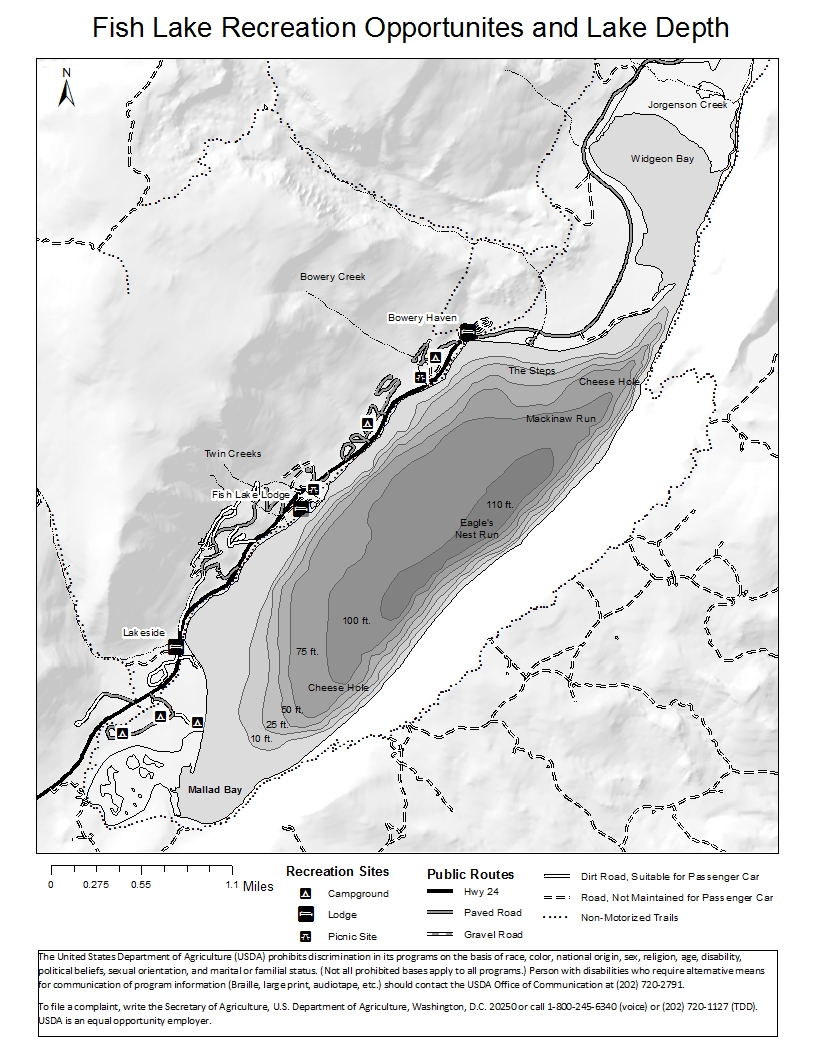
Bathymetric (Contour) Map of Fish Lake (PDF, 512Kb)
Features
Maps
The Fishlake National Forest completed a route designation process in 2007. Motorized, off-highway vehicle travel is restricted to designated routes and two small play areas only. Recently the Forest completed an administrative review and has updated the official Motor Vehicle Use Map (MVUM) as well as the associated Travel Maps, which are available to the public.
Publications and Brochures
The Fishlake National Forest produces a variety of publications in order to provide information to the public. These publications may include brochures, maps and reports. Many of these are available online to view or download. Others may be available only by request as noted, by contacting the Fishlake National Forest.