
Official websites use .gov
A .gov
website belongs to an official government organization in the
United States.
Secure .gov websites use HTTPS
A lock
(
) or https:// means you've safely
connected to the .gov website. Share sensitive information only
on official, secure websites.


About the Forest
The Daniel Boone National Forest is among 155 national forests, 20 national grasslands, and other public land utilizations. These lands total 193 million acres across 44 states, Puerto Rico, and the Virgin Islands. The National Forest system is managed by the Forest Service, an agency of the U.S. Department of Agriculture.
The Forest is managed for multiple uses, including recreation, timber, wildlife, fish, water, minerals and wilderness. The diverse landscape of the Forest provides a home for thousands of plant and animal species, including species that are federally listed as threatened or endangered.
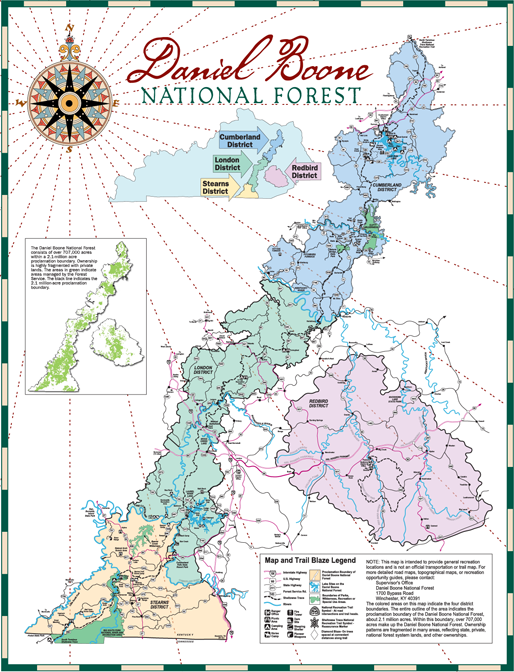
Above is a vicinity map of the Daniel Boone National Forest. The Cumberland, London, Stearns and Redbird Ranger Districts are highlighted. Visit our maps page to view, print, or order maps.