
Official websites use .gov
A .gov
website belongs to an official government organization in the
United States.
Secure .gov websites use HTTPS
A lock
(
) or https:// means you've safely
connected to the .gov website. Share sensitive information only
on official, secure websites.


Maps & Publications
Online Maps and Data
-
Eagle Creek Closure

Take a look at the current closure order and associated map after the 2017 Eagle Creek Fire.
-
National Interactive Visitor Map

Displays all national forest and grasslands recreation sites - zoomed into Columbia River Gorge National Scenic Area.
-
Free, Downloadable Maps

Maps overlay Forest Service assets on USGS topo maps by quadrangle. Maps are geo-referenced PDFs.
-
Maps for Mobile Devices

Search for forest maps on Avenza & download using the PDF-maps app.
-
Motor Vehicle Use Map

Map shows national forest system roads & trails open to motorized travel.
-
GIS Data

Digital data is available on our Geospatial Data web page.
Where can I buy paper maps?
- National Forest Store: Nationwide selection of forest, ranger district, Wilderness & specialty maps.
- Discover Your Northwest: A wide selection of maps, books, and guides highlighting the Northwest’s natural and cultural history. Proceeds support educational programs and services.
- US Geological Survey: The national source to find, order, or download topographic maps, including quadrangles or “quads”.
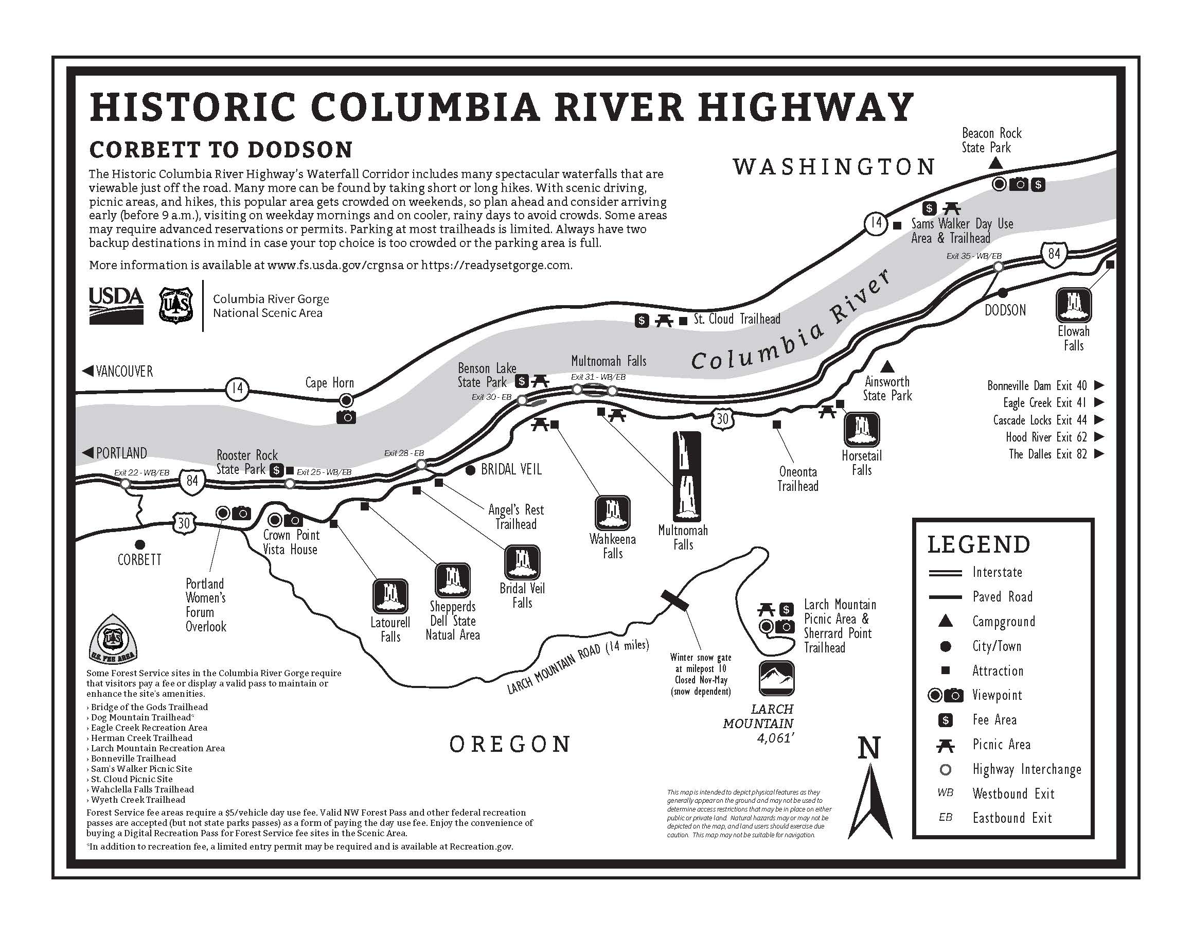
Columbia River Gorge National Scenic Area Trail Maps
- Mt. Hood Scenic Loop (.pdf)
- Hiking Loops near Multnomah Falls (pdf)
Alerts & Warnings
- Wyeth campground potable water
- Lower Cape Horn Trail Seasonal Closure
- Concept Development for Mosier to The Dalles Trail Underway
- Effective Jan 1, 2024-October 20, 2024: Eagle Creek Fire Closure
- Drones prohibited in wilderness and select recreation sites
- Klickitat Mile One Overnight Use & Large Boat Launch Prohibition
- Guard against car theft
- Check road and weather conditions