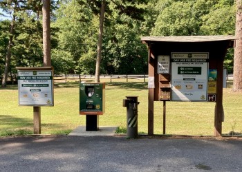
Motor Vehicle Use Maps (MVUMs)

Off-Highway Vehicle (OHV) Routes

There are hundred of miles of designated off-highway vehicle (OHV) routes in the Ouachita National Forest. For a list of those routes by district, as well as designated trail systems, please check this link.

Motor Vehicle Use Maps (MVUM)

The Forest Service is responsible for protection of the environment and provision of balanced use of the lands under Forest Service management.  The Travel Management Rule implements  Executive Order (E.O.) 11644 (February 8, 1972), ‘‘Use of Off-Road Vehicles on the Public Lands,’’ as amended by  E.O. 11989 (May 24, 1977).  These Executive orders direct Federal agencies to ensure that the use of off-road vehicles on public lands will be directed and controlled so as to protect the land resources, to promote the safety of all public land users, and to minimize conflicts among the various uses of those lands.

The Travel Management Rule directed each national forest and grassland to prepare Motor Vehicle Use Maps (MVUMs) that reflect travel management decisions on each managed unit.  For the Ouachita National Forest, there are five District Units and five MVUMs, one for each of the five Districts on the Forest.  Maps for the Ouachita National Forest are available and are updated around May of each year.  To view or print an electronic copy of a map, select a District from the table below.  

The black and white maps show National Forest System (NFS) roads and trails (routes) that are open to travel by the public on motorized vehicles, including Off-Highway Vehicles (OHVs).  Tables that list routes provide further detail about allowable uses, such as game retrieval, special designations (trails are open to OHV less than 64” in width) and seasonal openings of routes.  These tables are an integral part of the MVUMs; and the MVUMs are not complete if the data in the tables are not utilized in conjunction with the mapped data.  These designations apply only to National Forest System roads and trails on National Forest System lands.  NFS routes not shown on the MVUMs are not open to the public for motor vehicle travel.

MVUMs are the legal document indicating which routes are open to the public for motorized use.  Route number signs correspond to the numbers of the roads and trails on the MVUMs; however, signs are sometimes removed accidentally.  If you notice that a sign is missing, please report this to the appropriate District.

In addition to roads managed within the NFS system, many roads within the Forest are under state, county, or private jurisdiction.  Such roads are not shown with designations on the MVUMs although they may appear as a light gray line for reference only.  Please consult local laws regarding uses of non-NFS routes.  Users should not rely on MVUMs for recreation orientation and should consult a Forest Visitor Map or a topographic map for additional detail.

Designation of a road or trail for motor vehicle use on a MVUM should not be interpreted as encouraging or inviting use, nor does it imply that the road, trail, or area is passable, actively maintained, or safe for travel.  Maintenance of designated roads and trails will depend on available resources and some routes may receive little maintenance.

The MVUM's are geo-referenced maps that can be used in several smart phone apps, including Avenza. The beauty of using Avenza or similar apps is that you can access these maps and locate yourself even when you’re offline (no WiFi or Cell connection) because they’re saved to the device’s memory and the maps are geo-referenced.

To print a section of the online MVUM Map --you will need Adobe Acrobat.  Use the “Print Current View” function to print the view on your screen.  The MVUM will not be complete unless you also print the legend box and the tables that accompany each map.

MVUMs by District:

Oklahoma 

Map
Front
Tables

Avenza Link

Poteau/Cold Springs 

Map
Front
Tables

Avenza Link

Jessieville/Winona/Fourche 

Map
Front
Tables

Avenza Link

Caddo/Womble 

Map
Front
Tables

Avenza Link

Mena/Oden 

Map
Front
Tables

Avenza Link


Frequently Asked Questions

How can I get a copy of the MVUM?

What information is on a Motor Vehicle Use Map (MVUM)?

What type of vehicles does the MVUM regulate?

What is an Off-Highway Vehicle (OHV)?

What are my responsibilities as a driver/rider/operator?

What other prohibitions are in effect?

Am I allowed to go off-route to park my motor vehicle?

Are there road and trail route marker signs on the ground?

Who can use routes not shown on the MVUMs? 

Does the MVUM also show non-motorized trails?

Why are some routes only open during a specific season? 

Why is the corridor for big game retrieval set at ½ mile from certain roads?


How can I get a copy of the MVUM?

MVUMs are available on this website and you may print sections of it from your home computer.  Please remember to print the instructions for interpreting the map (the collar language) as well as the tables that describe seasonal and special designations, big game retrieval, and dispersed camping and short roads.


What information is on a Motor Vehicle Use Map (MVUM)?

  • The map displays all NFS roads and trails designated for public use of motor vehicles.
  • Information includes designation details, routes open seasonally by time of year, and any motorized access for the purpose of dispersed camping (camping in locations other than campgrounds).
  • The MVUM also shows roads where only highway-legal vehicles are allowed.


What type of vehicles does the MVUM regulate?

MVUMs regulate all wheeled, motorized vehicles that travel on the Ouachita National Forest including cars, trucks, four-wheel drives, motorcycles, and any type of all-terrain vehicle or off-road vehicle


FAQ

What is an Off-Highway Vehicle (OHV)?

For purposes of travel management, the Ouachita National Forest has defined an OHV as one of the following:

1.  An all-terrain vehicle that travels on three or more low-pressure tires; has handle bar steering; is less than or equal to 50 inches in width; and has a seat to be straddled by the operator;

2.  A vehicle with a seat or saddle and designed to travel with two wheels in contact with the ground; or

3.  A vehicle 64 inches or less in width, designed to travel on four or more low-pressure tires that has a bed for cargo.


What are my responsibilities as a driver/rider/operator?

Operating a motor vehicle on NFS roads and trails on Forest Service managed lands carries a greater responsibility than operating that vehicle in a city or other developed setting.  Not only must you know and follow all applicable traffic laws, you need to show concern for the environment, as well as other forest visitors.  The misuse of motor vehicles can lead to the temporary or permanent closure of any designated road or trail.  As a motor vehicle operator on a National Forest System route, you must comply with the MVUM, as well as all Federal, State, and local laws and regulations.  Read and understand the MVUM in its entirety.  It is important that you know and understand the MVUM so that you may meet your responsibility to comply with the rules.  If you have questions, please contact the Ouachita National Forest for clarification.

Much of the Forest is remote.  Medical assistance may not be readily available.  Cellular telephones do not work in many areas of theOuachita National Forest.  Check weather conditions in advance, and take adequate food, water, first-aid supplies, and other equipment appropriate for the conditions and expected weather.

Motor vehicle use, especially off-highway vehicle use, involves inherent risks that may cause property damage, serious injury, and possibly death to participants.  Drive cautiously and anticipate rough surfaces and features such as mud, vegetation, and water crossings common to remote driving conditions.  By your participation, you voluntarily assume full responsibility for these damages, risks, and dangers.  Take care at all times to protect yourself and those under your responsibility.   

Always remember to respect private land!  Protect your privilege.  Stay on the designated roads and trails.


FAQ


What other prohibitions are in effect?


You must comply with the designations on the MVUM, because possessing or operating a motor vehicle on NFS lands other than in accordance with these designations (36 CFR 261.13) is prohibited.  Violators are subject to a fine of up to $5,000, imprisonment for up to 6 months or both.  This prohibition applies regardless of the presence or absence of signs.

Designated roads and trails may also be subject to temporary, emergency closures.  As a visitor, you must comply with signs notifying you of such restrictions.  Closure orders may close a road, trail, or area on a temporary basis to protect the life, health, or safety of forest visitors or the natural or cultural resources in these areas.

Under the travel management rule, users are responsible for knowing what roads are open to which type of use.  For example, users may not ride an OHV within any campground.  The MVUM clarifies the restrictions for motorized uses only and serves as an enforcement tool for motorized vehicle use on the Forest.


Am I allowed to go off-route to park my motor vehicle?

Motor vehicles may be parked up to 24 feet from the edge of the road surface when it is safe to do so without causing damage to NFS resources or facilities, unless prohibited by state law, a traffic sign, or an order (36 CFR 261.54).


FAQ


Are there road and trail route marker signs on the ground?

Routes designated for motorized uses will be identified on the MVUM.  Route number signs correspond to the numbers of the roads and trails on the MVUMs; however, signs are sometimes removed accidentally.  If you notice that a sign is missing, please report this to the appropriate Ranger District.

The MVUM is a tool to help individuals stay on the correct route.  It is the responsibility of the operator to determine if they are on a route designated for motor vehicle use and on-the-ground signs help to illustrate the information on the MVUM.  However, the presence or absence of a sign does not override the legal information on the MVUM.


Who can use routes not shown on the MVUMs? 

Motor vehicle access may occur on routes not shown on the MVUM for limited administrative access by Forest Service personnel; for fire and law enforcement for emergency purposes and; by persons authorized by a written special use permit or contract from the Forest Service.


FAQ


Does the MVUM also show non-motorized trails?

MVUMs do not feature non-motorized facilities and attractions on the Ouachita National Forest.  On the MVUMs, the Ouachita National Recreation Trail is shown for reference purposes only.  The most reliable source for other recreation information is the web, a Forest Visitor Map or the Recreation Area Directory.


Why are some routes only open during a specific season? 

Seasonal use is allowed on some routes for various reasons such as to provide access to traditional hunting camps, reduce wildlife disturbance, protect users from unsafe or impassable conditions, and/or to reduce impacts to other resource values.


Why is the corridor for big game retrieval set at ½ mile from certain roads?

A ½-mile corridor along many of the roads that pass through the National Forest provides access for OHV to retrieve legally downed big game animals from much of the National Forest.  Only OHVs as defined above may be used to retrieve the legally downed big game animal, not larger vehicles.  The ½-mile big game retrieval corridor is not designated along some Forest roads due to resource concerns.

Big game retrieval is permitted within ½ mile of specific routes during the months of October, November, and December(during state-specified black bear and white-tailed deer seasons).  The ½ mile is calculated at a 90-degree angle to the road.  If streams are present, they should be crossed at designated crossings only.  Cross-country travel is not permitted except for limited big game retrieval.


HISTORY

MAPS

Please be patient.  Some maps may take from 30 seconds to several minutes to download.

Selected Alternative E Quad Maps

Alternative A

Alternative B

Alternative C

Alternative D

Alternative F

Alternative G

Alternative H

Travel Management Project Update (March 2009)

Proposed Action Notice & Comment Letter (February 21, 2008)

Motor Vehicle Volunteer Form