
Official websites use .gov
A .gov
website belongs to an official government organization in the
United States.
Secure .gov websites use HTTPS
A lock
(
) or https:// means you've safely
connected to the .gov website. Share sensitive information only
on official, secure websites.


IITF RMAP 01 English
22 May 2018


 Urban and rural land use in Puerto Rico. View the map in high resolution (9.3 MB PNG) [Opens in New Window] | Download the map in high resolution (9.3 MB PNG)
Title: Urban and rural land use in Puerto Rico
Type: Research Map (RMAP)
Year: 2008
DOI: https://doi.org/10.2737/IITF-RMAP-1 [Opens in New Window]
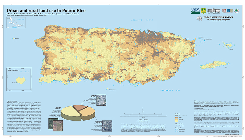
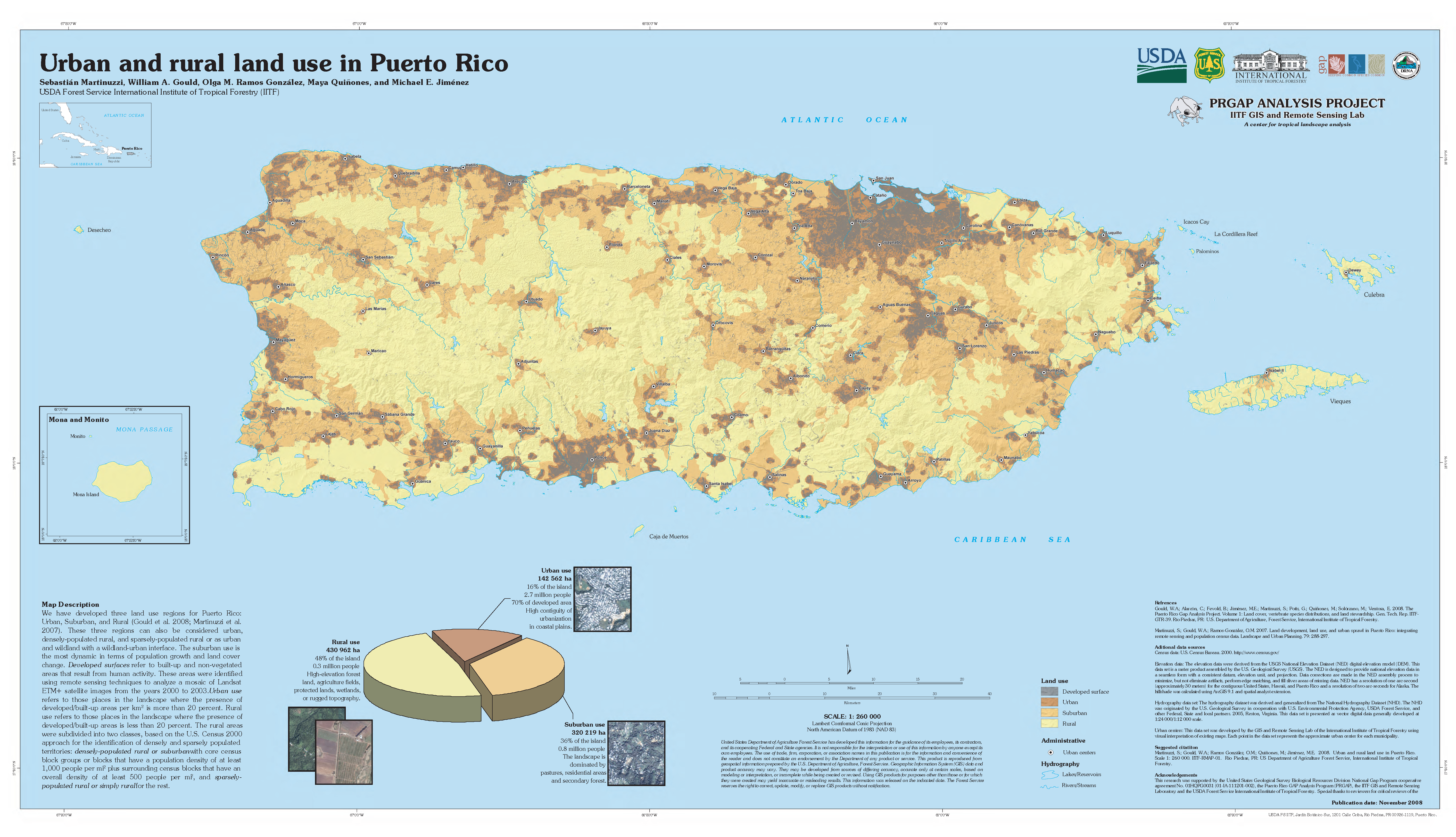
Description: We have developed three land use regions for Puerto Rico: Urban, Suburban, and Rural (Gould et al. 2008; Martinuzzi et al. 2007). These three regions can also be considered urban, densely-populated rural, and sparsely-populated rural or as urban and wildland with a wildland-urban interface. The suburban use is the most dynamic in terms of population growth and land cover change. Developed surfaces refer to built-up and non-vegetated areas that result from human activity. These areas were identified using remote sensing techniques to analyze a mosaic of Landsat ETM+ satellite images from the years 2000 to 2003.Urban use refers to those places in the landscape where the presence of developed/built-up areas per km2 is more than 20 percent. Rural use refers to those places in the landscape where the presence of developed/built-up areas is less than 20 percent. The rural areas were subdivided into two classes, based on the U.S. Census 2000 approach for the identification of densely and sparsely populated territories: densely-populated rural or suburbanwith core census block groups or blocks that have a population density of at least 1,000 people per mi2 plus surrounding census blocks that have an overall density of at least 500 people per mi2, and sparsely-populated rural or simply rural for the rest.
Suggested Citation: Martinuzzi, Sebastian; Gould, William A.; Ramos Gonzalez, Olga M.; Quinones, Maya; Jimenez, Michael E. 2008. Urban and rural land use in Puerto Rico. Scale 1: 260 000. Res. Map IITF-RMAP-01. Rio Piedras, PR: U.S. Department of Agriculture Forest Service, International Institute of Tropical Forestry.
Page last modified: 08/14/2018