

Plan Your Next Visit
The Deschutes National Forest encompasses nearly 1.6 million acres, offering year-around recreation opportunities.
Recreation

The Deschutes National Forest offers year-round recreation opportunities. Start planning your next adventure today!
Recreation Passes

Some recreation sites require a day use fee. Find out where fees are charged and which passes may be used to cover these fees.
Condition Reports

Know Before You Go - check road statuses, dock installation, trail conditions & closures and OHV trail statuses.
Visitor Maps & Guides

We offer a variety of maps! You can digitally download some for free while others can be purchased through online vendors.
Newberry National Volcanic Monument

Plan your visit to the Newberry National Volcanic Monument, which includes Lava Lands Visitor Center, Lava River Cave, Lava Butte and the Newberry Caldera.
Spotlights
Lava River Cave Timed Reservations

Reserve your Lava River Cave Timed Reservation Ticket to secure your timeslot for parking at Lava River Cave ahead of arrival. Lava River Cave Timed Reservation Tickets improves visitors’ safety and experience by providing timeslots available for reservation in advance, including same-day arrivals (subject to availability).
Central Cascades Wilderness Permits

The Mount Jefferson, Mount Washington and Three Sisters Wilderness areas are home to iconic mountain peaks, high alpine meadows and lakes, and old growth forests. In an effort to preserve the natural beauty and wilderness experience for you and future visitors and to better manage recreation-related impacts, these areas are managed with use limits, or quotas, to ensure the protection of these landscapes now and into the future.
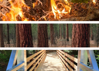
Central Oregon Fire Information

Visit Central Oregon Fire Info for information on prescribed fire, wildfire and smoke on the Deschutes & Ochoco National Forests, the Prineville BLM and the Oregon Department of Forestry. Text "COFIRE” to 888-777 to receive prescribed burning text alerts.
Accessible Adventure in Deschutes National Forest

This video features Accessible Adventures at the Lava Lands Visitor Center on the Deschutes National Forest in Oregon including the visitor center, the Trail of Molten Lava, and the Lava Butte Crater and Lookout on the Newberry National Volcanic Monument.
Discover Your Forest

Our non-profit partner Discover Your Forest enhances visitors' experiences while supporting the next generation of public land stewards.
Northwest Forest Plan & Amendment
The Northwest Forest Plan covers 24.5 million acres of federally managed lands in California, Oregon, and Washington. It was established in 1994 to address threats to threatened and endangered species while also contributing to social and economic sustainability in the region. Over 30 years later, the Northwest Forest Plan needs to be updated to accommodate changed ecological and social conditions.


