Wild and Scenic Snake River- Trip Planning

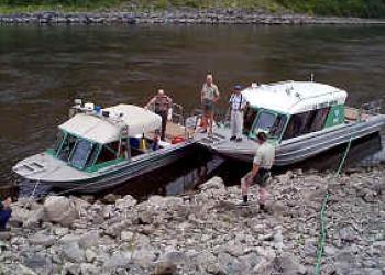
A small raft tied to the shore and and jetboat on the Wild and Scenic Snake River

Private Powerboat Reservations

Before You Go...

Before you go on your much anticipated river trip to the Snake River, it is good to plan out what you'll need to bring, where to spend the night, and prepare for conditions that may arise.

Handling the Snake

Rafting and powerboating the rapids of Hells Canyon is not recommended for the inexperienced or poorly equipped. For floaters, portaging or lining through or around many of the rapids is difficult if not impossible. For powerboaters, open bows or overloaded boats are dangerous in rapids. It is strongly recommended that prior to running these rapids you stop and scout the water for the best and safest route. If you are at all uncertain about your white water skills, go with an experienced professional outfitter/guide service that is licensed on this river.

Rapids will change considerably with different flows; some will become more turbulent and others will disappear. Water flows may vary from 5,000 cubic feet per second (cfs) in summer to 70,000 cfs or more in spring runoff. Since the river is controlled by dams, flows can vary from day to day and even hour to hour. You can obtain current and projected flow information by webistes and phone numbers at the Snake River - River Flow webpage.

Boating Permits and Regulations

  • Permits are required year-round for all non-commercial floaters and powerboaters on the Snake River within the HCNRA. Take time to read the regulations printed on the back of the permit before embarking on your trip.
  • During the primary river season, reservations and trip permits issued by the Forest Service are required to launch trips at specific locations along the river. For information on powerboat or float permits and reservations, call the appropriate river information/reservation number listed in this web site.
  • A special use permit issued by the Forest Service is required for outfitting and guiding of all commercial float and powerboat trips within the boundaries of the HCNRA. Any of the HCNRA offices can provide you with a list of outfitters who are permitted to operate in Hells Canyon NRA. Rewards of up to $500 are offered for information leading to convictions for commercial outfitting or guiding without a permit.

Recommended Craft

Rafts (12 feet and over, rigged for whitewater), kayaks, drift boats, whitewater canoes and powerboats are used in Hells Canyon. Open canoes are not recommended due to difficult portages and heavy whitewater. Welded aluminum powerboats with jet pumps are preferred for powerboating in the river's shallow water. Propeller-driven boats are often used downstream of the Imnaha Rapids. Some types of non-traditional float and motorized craft are not allowed (i.e. personal watercraft, sailboards, etc.)

The Forest Service doesn't inspect boating equipment, except for specialized equipment required under Forest Service regulations to protect the river environment (i.e. fire pans, carry-out waste systems, fuel absorption filters, etc.) It is your responsibility as a boater to ensure that you have the proper safety equipment on board and that your craft is in good operating condition. Also, be sure to carry good, serviceable PFDs (Personal Floatation Devices), suitable for whitewater.

Remember: the type and size of craft should be geared to river conditions and personal skill level, and a PFD helps you only when it is worn properly!

Launching and Landing

The Hells Canyon Creek Recreation Site, 1/2 mile downstream from Hells Canyon Dam, has a concrete launch ramp. However, space is limited. Anyone planning to launch or land directly from a trailer should have a vehicle with good traction. The concrete ramp is steep. At flows below 6,000 cfs (cubic feet per second), this ramp is unsuitable for launching and landing boats that require the trailer to be in the water. This site, 19 miles north of Copperfield (Oxbow), OR, is accessible year-round via a paved Idaho Power Company road.

The launch site at Pittsburg Landing on the Idaho side of the river has a concrete apron and boat ramp. At river flows below 5,000 cfs, this ramp is unsuitable for launching or landing powerboats. Pittsburg Landing is accessed by the Deer Creek Road. It leaves Highway 95 just south of the town of Whitebird at mile marker 222. After crossing the Salmon River, turn left and stay on the main road, approximately 17 miles to Pittsburg Landing. This is a well maintained single lane gravel road with turnouts, that crosses the divide at an elevation of over 4300 feet between the Salmon and Snake Rivers. 'There are steep grades on both sides of this divide, so visitors pulling travel trailers or driving RV's should use extreme caution. Grades are up to 16% so be sure your brakes and transmission are in good condition before beginning the drive, and use low gears.

Dug Bar, on the Oregon side, has a concrete boat ramp. The Dug Bar Road, heading north from Imnaha, requires a high clearance, 4WD vehicle, and is very slippery when wet. This is a single lane, unsurfaced road with turnouts and should be driven with extreme caution.

The Heller Bar launch site is owned by the State of Washington and operated by the Bureau of Land Management. The site, located just downstream from the mouth of the Grande Ronde River, approximately 23 miles south of Asotin, WA, is accessible year-round. The first 11 miles south of Asotin are paved, the rest is gravel. 

International Scale of Rapids

Whitewater rapids are rated on a scale of one through six, indicating the difficulty of each rapid at medium water level. Remember that rapids can change radically as river flows fluctuate. Be sure you know how to read the water, and scout rapids from shore if necessary to find the best route.

  • Class I - Very Easy-small, regular waves and riffles; few or no obstacles; little maneuvering required.
  • Class II - Easy-small waves with some eddies, low ledges, and slow rock gardens; moderate difficulty, some maneuvering required.
  • Class III - Medium-numerous waves that are high and irregular; strong eddies; narrow, but clear passages that require expertise in maneuvering; scouting from the shore recommended.
  • Class IV - Difficult-long rapids with powerful, irregular waves, dangerous rocks, and boiling eddies; precise maneuvering and scouting from the shore imperative; take all possible safety precautions.
  • Class V - Very Difficult-long rapids with wild turbulence and extremely congested routes that require complex maneuvering; a danger to your life and boat and near the limits of navigation.
  • Class VI - The Limits of Navigation-rarely run; a definite hazard to your life.

High Flow and Low Flow of Major Rapids

The Snake is a big river with power many river users have never experienced. You must treat this river with respect; your life depends on it. The river doesn't care!

The table below gives a summary of the ratings applied to some of the important rapids in Hells Canyon at both low and high flows.


Rapid Low Flow High Flow
Wild Sheep IV V
Granite Creek IV V
Lower Bernard Creek IV III
Waterspout IV III
Rsuh Creek III IV
Imnahah III III
Wild Goose II III


Length of Trip

Floaters should allow two to three days for the trip from Hells Canyon Creek Recreation Site to Pittsburg Landing, and four to six days to Heller Bar, especially during low river flows.

Power boaters should be aware that there is no gasoline available at Hells Canyon Creek, Pittsburg Landing or anywhere upriver from Heller Bar, WA. Be sure you have enough fuel to complete the trip into and back out of Hells Canyon!

To help you plan your trip, the table below gives some important reference points on the river and their distances from Hells Canyon Creek Recreation Site (HCC), Pittsburg Landing (PL), and the Lewiston/Clarkston Valley (L/C, at Hellsgate State Park).


Location River Mile From HCC From PL From L/C Valley
Hells Canyon Creek 247.0 0 32.6 104
Wild Sheep Rapid 241.4 5.6 26.4 98.4
Granite Creek Rapid 239.2 7.8 24.6 96.2
Rush Creek Rapid 231.5 15.5 16.4 88.5
Kirkwood Ranch 22.5 26.5 5.6 77.5
Pittsburg Landing 214.9 32.1 0 71.9
Dug Bar 196.2 50.8 18.7 53.2
Imnaha River 191.7 55.3 23.2 48.7
Salmon River 188.3 58.7 26.6 45.3
Cache Creek 177.0 70.0 37.9 34.0
Heller Bar 168.3 78.7 46.5 25.3
L/C Valley 143.0 104.0 71.5 0


Seasons In The Canyon

The river can be traversed year round by powerboaters and floaters who are prepared for the weather, however, May through October are the most popular months. Summers are usually hot with temperatures often soaring above the 100-degree mark.

Both spring and fall can be cold and rainy. Water temperatures can also be cold during these months, so you should be equipped to avoid hypothermia.

River flows vary daily, but are most commonly high during the spring and early summer. Very high and very low flows can both pose special hazards for boaters. Read the water carefully!

Things to Be Aware Of

There are a few hazards besides steep canyon walls, falling rocks and big rapids that Hells Canyon is famous for. Many unpleasant encounters can be avoided simply by watching where you put your hands and feet and being aware of whatÕs going on around you! 

  • Western rattlesnakes, black widow and brown recluse spiders are common. Know how to identify these venomous animals and their bites. Be aware of proper first aid procedures and seek medical attention as quickly as possible if bitten. 
  • Check your clothes often for ticks. Repellents will discourage most other insect pests. 
  • Poison ivy is abundant along the Snake River and side drainages. Look out for low-growing (from a few inches to several feet tall), shiny-leafed shrubbery or stalks with three leaflets. White berries appear in late summer and persist through winter; the leaves turn red in early fall. Contact with any part of these plants can produce allergic reations during any season. 
  • Cougars are present in Hells Canyon and sightings in the river corridor have increased significantly in recent years. Cougar attacks on humans are rare, but should you have a close encounter with one: (1) stand your ground and face the cat, do not turn around and walk or run away, as this may stimulate the lionÕs instinct to chase and attack; (2) do not approach the animal, give it an escape path; (3) keep children close to you, take them in your arms; (4) make lots of noise and stand tall, making yourself appear bigger than the lion; and (5) fight back if you are attacked. 
  • Black bears occasionally cause problems in the river corridor. Check with Forest Service staff before you launch to find out whether there are campsites known to have bear problems and avoid these sites. Do not pitch tents in obvious game trails, donÕt eat in tents, take the usual precautions with food storage, and carry out all garbage.

Hunting and Fishing

Within Hell Canyon NRA, the Snake River forms the boundary between the states of Oregon and Idaho. Licenses are required to hunt and fish in each state, however, only one state's license is required to fish the river from a boat.

Read the fish and game laws. Be sure you understand them and follow them. Bag limits, seasons, and other requirements vary between the states and enforcement is strict.

Fish in the Snake River include cold water species such as steelhead, salmon and rainbow trout. However, the river also supports warm water species such as bass, crappie, and catfish. In addition, Hells Canyon is one of the last strongholds of the giant white sturgeon.

Bear, deer, and elk hunting is available on both sides of the canyon. Mountain goats can be hunted by special permit in Idaho. In the river breaks, chukar hunting is a popular fall activity.