History and Development

THE TONTO NATIONAL FOREST OVERVIEW

At over 2.9 million acres, the Tonto National Forest is the largest national forest in Arizona, and the ninth largest national forest among 154 USDA National Forests.

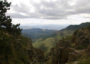
The Tonto features some of the most rugged and inherently beautiful land in the country. Sonoran Desert cacti and flat lands slowly give way to the highlands of the Mogollon Rim. This variety in vegetation and range in altitude -- from 1,300 to 7,900 feet -- offers outstanding recreational opportunities throughout the year, whether it's lake beaches or cool pine forest.

The Tonto is one of the most-visited “urban” forests in the United States with 3 million visitors annually. The forest’s boundaries are Phoenix to the south, the Mogollon Rim to the north and the San Carlos and Fort Apache Indian reservations to the east. 

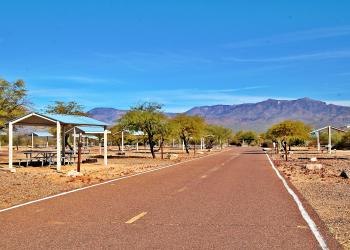
During winter months, national and international visitors flock to Arizona to share the multi-hued stone canyons and Sonoran Desert environments with Arizona residents. In the summer, visitors seek refuge from the heat at the Salt and Verde rivers and their chain of six man-made lakes. Visitors also head to the high country to camp amidst the cool shade of tall pines and fish the meandering trout streams under the Mogollon Rim.

One of the primary purposes for establishing the Tonto National Forest in 1905 was to protect its watersheds around reservoirs. The forest produces an average of 350,000 acre-feet of water each year. Six major reservoirs on the forest have the combined capacity to store more than 2 million acre-feet of water. Management efforts are directed at protecting both water quality and watershed and riparian area conditions.

Eight Wilderness Areas, encompassing more than 589,300 acres, are managed to protect the unique natural character of the land and to assure the public recreation areas where one is only a visitor. In addition, portions of the Verde River have been designated by Congress as Arizona’s first and only Wild and Scenic River Area.

Fish and wildlife are abundant on the Tonto; more than 400 vertebrate species are represented, including 21 listed among federal and state Threatened and Endangered Species. Maintaining quality habitat to support and improve wildlife diversity is a primary management consideration.

Approximately 26,000 head of cattle are permitted to graze on the forest. Because of its year-round availability, permitted use is extremely high and land allotments must be carefully managed to avoid over-utilization and declining productivity of the range. Currently, long-term drought conditions across the Southwest have limited our ability to sustain more than 20 percent of the permitted numbers on the forest.

The Tonto has a rich history of producing copper, gold, silver, lead, zinc, uranium, molybdenum, manganese, asbestos, mercury and many other metals and minerals. This history spans over 150 years and includes 38 mineral districts with recorded production.

Although the Tonto is not heavily timbered, about 4 million board feet total of saw logs, fuel wood and other forest wood products are selectively harvested each year.

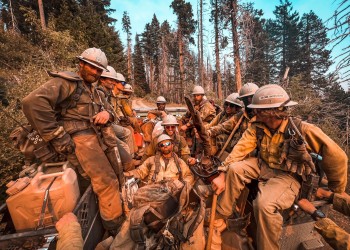
The critical fire season is relatively short, usually lasting from May to mid-July. During that period, natural and human-caused fires often threaten the timber, chaparral, grass and light shrub vegetative zones. The Tonto has averaged 330 wildfires a year over the last ten years.

With some of the state’s more prominent peaks located on the Tonto, the forest supports an important communication link for Arizona. Radio, television and telephone networks use the electronic sites on these mountains to facilitate state and national communications. Many of the high-capacity transmission lines that bring Phoenix its power also crisscross the Tonto.

Balancing conflicting resource needs and providing for comprehensive multi-use management, consistent with the conservation ethic, is a continuous objective in administering the resources of the Tonto National Forest.

THE TONTO NATIONAL FOREST HISTORY

The Tonto National Forest has a rich heritage reaching thousands of years into the past. Originally home to several prehistoric Indian groups who hunted and gathered wild plants in the Mazatzal Mountains and Sierra Ancha and along the Salt and Verde Rivers and their tributaries, it was colonized more than a thousand years ago by a related group of people known today as the Hohokam.

The Hohokam were accomplished farmers, craftsmen, traders and warriors who built large towns and villages and dug hundreds of miles of irrigation canals along the Salt and Gila rivers around Phoenix. Centuries of trade and conflict then gave rise to several distinctive new cultures, the best known of which is the Salado of Tonto Basin.

Eventually, by about 600 years ago, the effects of several hundred years of droughts, floods, and warfare took their toll on the Salado, the Hohokam, and their neighbors and most of these people left the Tonto area, never to return. Their descendants, however, can be found today among the Pima, Hopi, and Zuni tribes.

A twenty-year struggle with the U.S. Army ensued (approximately 1866-1886), resulting in the removal of both the Apache and Yavapai to reservations at San Carlos and Fort Apache. Today the White Mountain and San Carlos Apache reservations border the forest on the east with the Tonto Apache Reservation located inside the forest at Payson, and the Fort McDowell Yavapai Reservation situated along the southwest edge. The Apache in particular still use the forest for gathering wild plants and other traditional practices.

Once the army had removed the Indians from the area, the Tonto filled up rapidly with settlers. First came the miners and Mormon farmers, followed quickly by sheep and cattle ranchers. The Mormon colony was withdrawn after a few years and the sheep are all but gone today, but mining remains a major industry around Globe and Miami and cattle ranching continues as a traditional economy and lifestyle, with many of the ranches on the Tonto remaining in the same families who originally homesteaded the area in the 1870's.

THE FOREST INCEPTION AND EARLY DEVELOPMENT

The forest itself owes its existence to a singular historic event that took place shortly after the turn of the century -- the building of Roosevelt Dam to control the Salt River and ensure the water supply of what were then the heavily agricultural cities of Phoenix, Mesa, and Tempe in the Salt River Valley. Before its recent reconstruction (finished in the early 1990's), the Theodore Roosevelt Dam was the tallest masonry dam in the world.

The forest was created in 1905 to protect the watersheds of the Salt and Verde rivers. This continues to be a central focus of the Tonto National Forest while the reservoirs built along these rivers have created recreational opportunities for thousands of Arizonans.

The Tonto National Forest Heritage Program, headed by the forest archeologist and a small staff of specialists, is charged with preserving the many archeological and historic sites on the forest and protecting them from development, vandalism, and looting. Carrying out this enormous job requires close relationships between the forest and many other people and groups, including the State Historic Preservation Office (SHPO), the Arizona Site Stewards Volunteer Organization, and nine Indian tribes. In addition to protecting archeological sites, the forest also works with the tribes to ensure that traditional Native American economic and religious activities can continue to be practiced on what are now public lands.

A major goal of the forest's heritage program is public interpretation and education through publications, brochures, and exhibits at developed recreation sites. Interpretative trails and exhibits are currently available at two prehistoric sites: the Sears-Kay Ruin near Carefree, and the Shoofly Village site (handicapped-accessible) just north of Payson. Other site developments and exhibits at the Roosevelt Lake Visitor Center in Tonto Basin are being planned for the future.