Official websites use .gov
A .gov
website belongs to an official government organization in the
United States.
Secure .gov websites use HTTPS
A lock
(
) or https:// means you've safely
connected to the .gov website. Share sensitive information only
on official, secure websites.


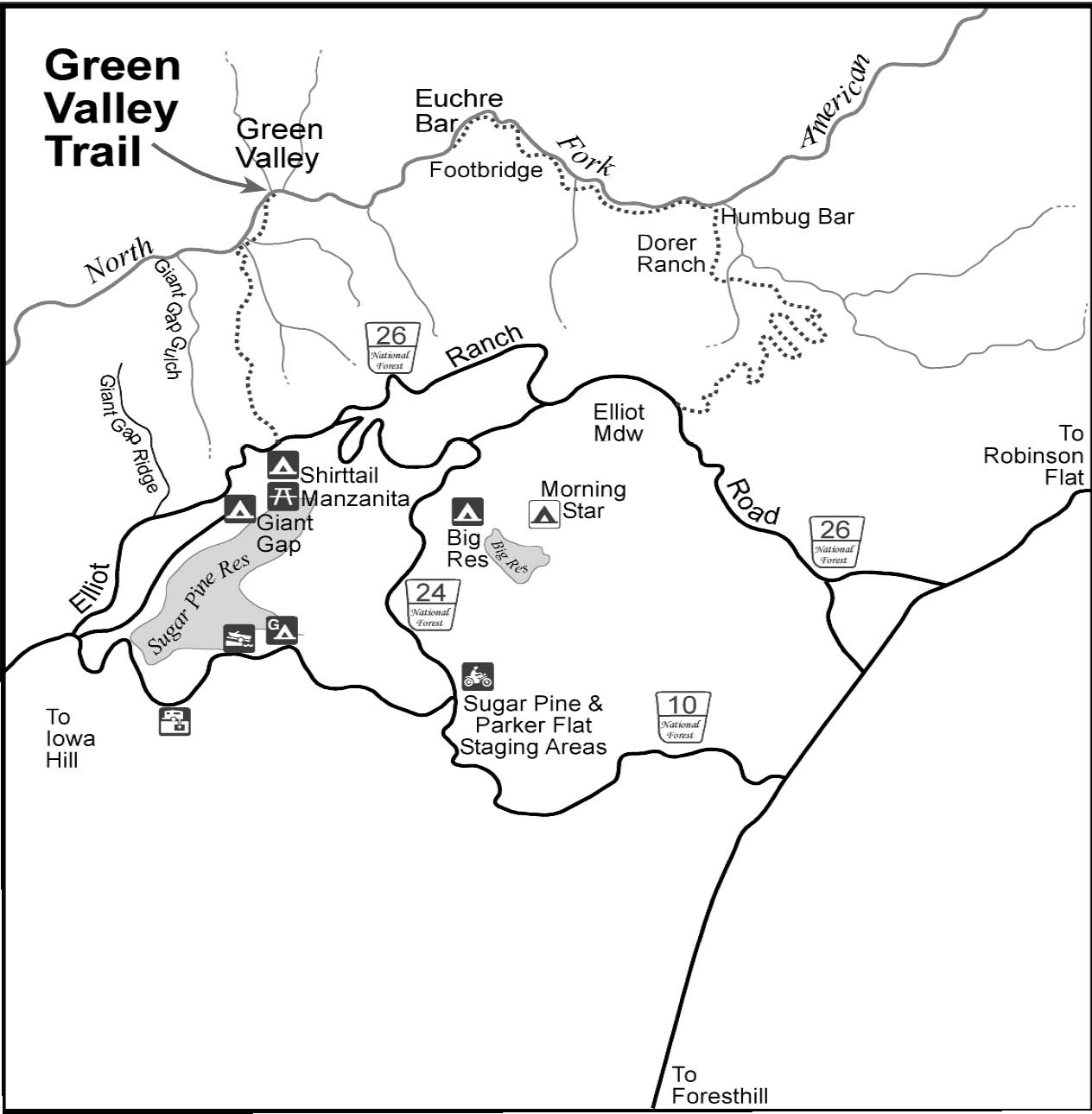
Green Valley Trail
Green Valley Trail
American River Ranger District
Tahoe National Forest
General Information
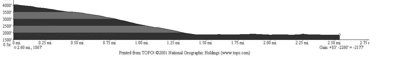
Mileage: ..................................... 2.62 miles each way
Elevation: ................................... 4,080 to 1,867 feet
Difficulty: .................................... Most Difficult
Use Level: ................................... Light
Topographic Map:......................Dutch Flat
Trailhead Access
From Interstate 80, take the Foresthill exit to Foresthill Road and proceed 15.5 miles to the Foresthill Ranger Station. Continue 10 more miles to Sugar Pine Road (Forest Road 10). Follow it for 5 miles until you cross Sugar Pine Dam. One mile beyond the dam, turn right on to Elliot Ranch Road, which is the dirt road just past the paved road to the campgrounds. Travel 3 miles to the signed trailhead and make a left. NOTE: The road is rocky and a high clearance vehicle is advised.In winter months the road is closed to motor vehicles for protection of resources in wet weather.
Trail Description
Access to the North Fork of the American River via the Green Valley trail is very steep, and rocky in places. There is a 2,200 foot change in elevation in the 2.6 mile hike; good physical condition is needed to hike this trail. It is possible to continue downriver for a short way, but the Forest Service established trail does not go far and there is private property in the area; please respect the property owner’s rights. Good fishing is available at times, and river access with limited camping is possible along the trail. Campfire permits are required for campfires, backpacking stoves, BBQs and lanterns.
For More Information
American River Ranger District
Foresthill Ranger Station
22830 Foresthill Road
Foresthill, CA 95631
(530) 367-2224
(530) 367-2226 TDD
Trail Map
Trail Profile