
Official websites use .gov
A .gov
website belongs to an official government organization in the
United States.
Secure .gov websites use HTTPS
A lock
(
) or https:// means you've safely
connected to the .gov website. Share sensitive information only
on official, secure websites.


Several BWCAW Entry Points are inaccessible due to road washouts and flooding on the Superior National Forest
Release Date:
Contact(s): Joy Vandrie, Public Affairs Officer, Tim Engrav, Public Information Officer
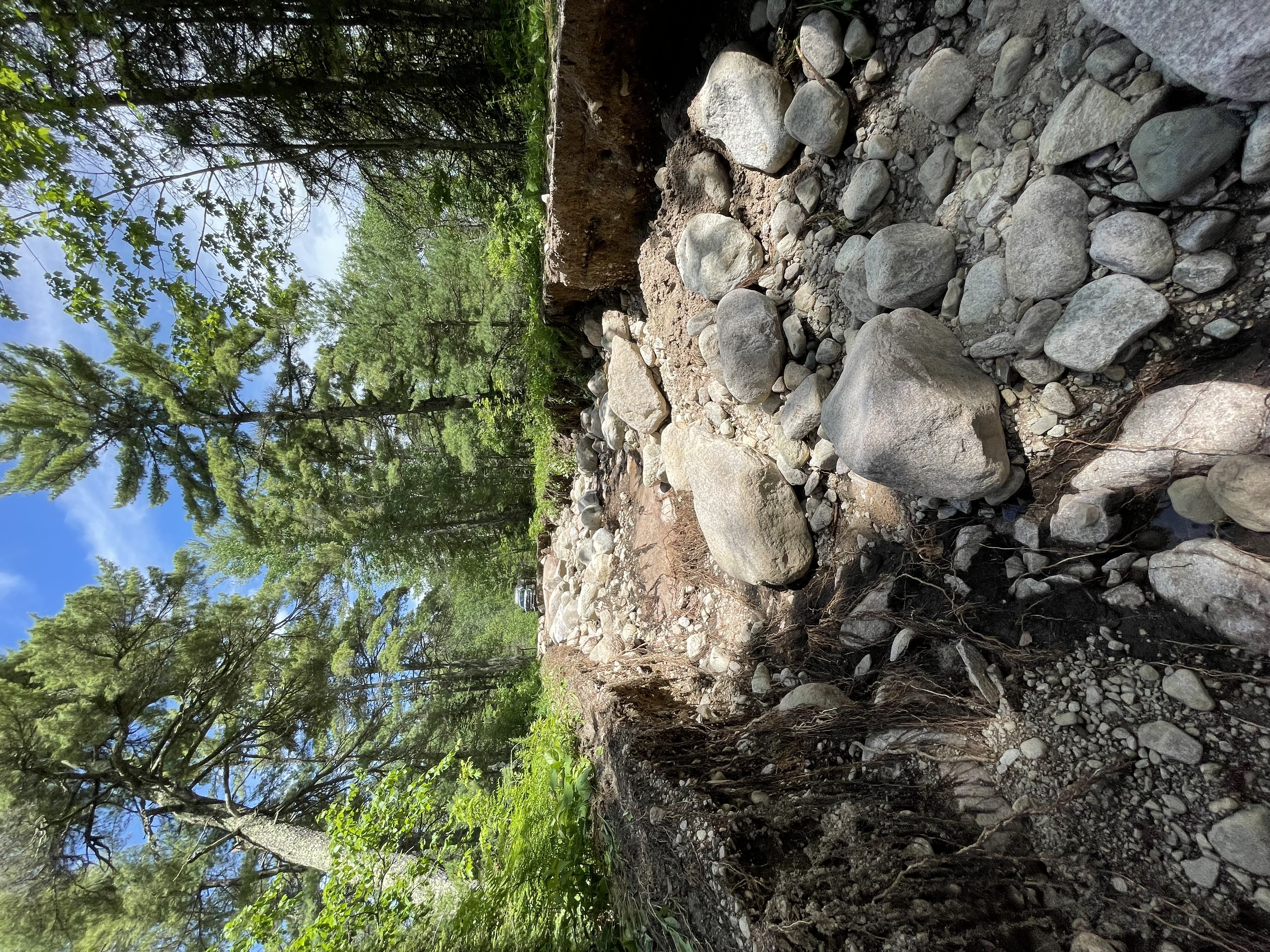 Like much of northeastern Minnesota the Superior National Forest experienced heavy rainfall from a series of severe thunderstorms that moved through the area on June 18, 2024. Rainfall amounts from 6 to 7 inches or more have caused washouts and flooding on numerous roads across the 3-million-acre forest. Some areas also experienced trees being blown down from isolated winds associated with the thunderstorms.
Due to washouts, flooded roads, and downed trees several Boundary Waters Canoe Area Wilderness (BWCAW) Entry Points are currently inaccessible. As a result, BWCAW permits cannot be issued for these entry points at this time. Individuals with BWCAW permits reserved through June 22, 2024, are being notified of cancellation. We will reassess conditions and access routes each day and determine if the length of BWCAW permit cancellations needs to be extended.
The BWCAW Entry Points currently inaccessible where permits have been cancelled and suspended include:
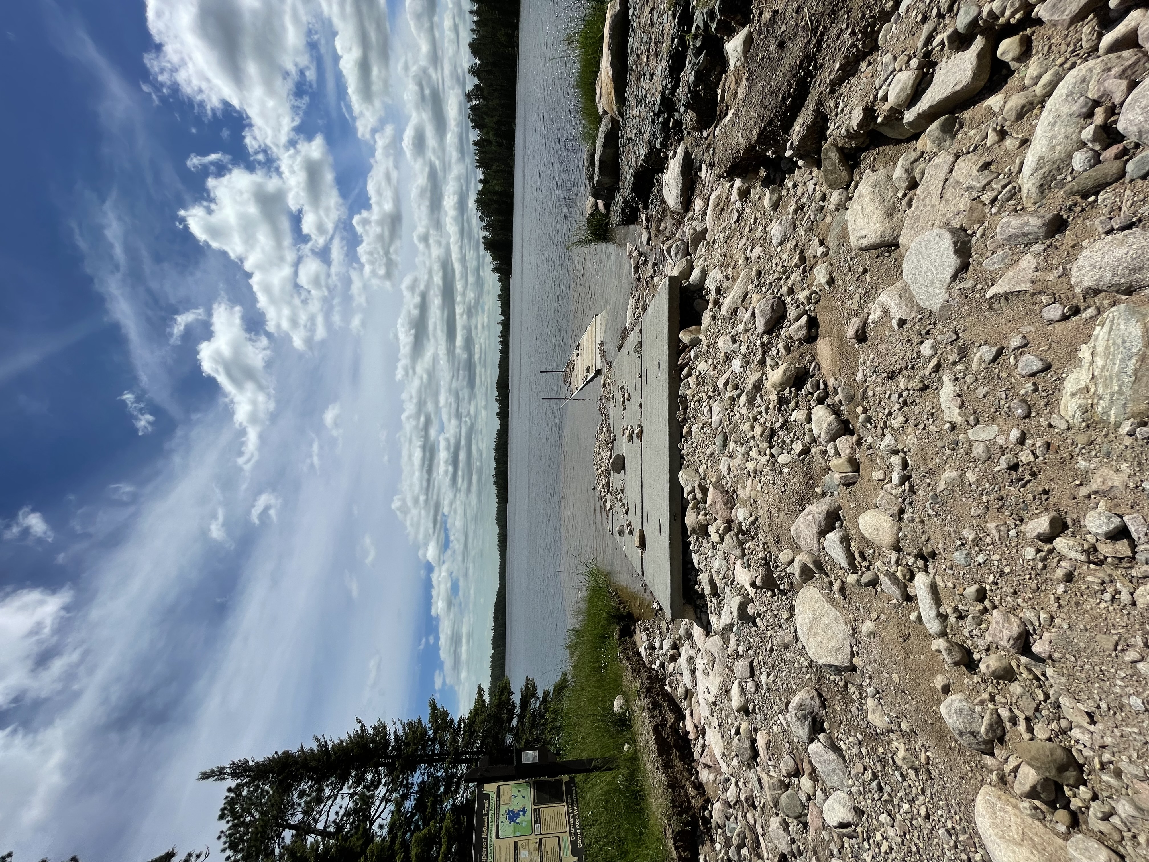
- Trout Lake Overnight Motor and Day Use Motor Entry Point #1 inaccessible due to washouts and the motorized portage not being able to operate on the road/trail. Overnight paddle permits are still being issued and the canoe portage is open.
- Slim Lake Entry Point #6 inaccessible due to washouts on the North Arm of Burntside Road.
- From Big Lake Entry Point #7 inaccessible due to washouts on the boat access road.
- Stuart River Entry Point #19 inaccessible due to the east Echo Trail closure and fallen trees.
- Angleworm Lake Entry Point #20 and Angleworm Trail Entry Point #21 inaccessible due to the east Echo Trail closure and fallen trees.
- Mudro Lake Entry Point #23 inaccessible due to a major washout on the Grassy Road.
- South Hegman Lake Entry Point #77 inaccessible due to the east Echo Trail closure and fallen trees.
Employees from all the ranger district offices continue to assess storm impacts to forest roads focusing on the health and safety of visitors and residents living in or near the forest. The priority of every response mission is the safety of the public and responders. Please note:
- In some locations vehicles may need to remain in locations where access is not safely possible on the road.
- A more comprehensive list of forest roads affected will be shared when it becomes available.
- The Forest Service is actively coordinating with our state and county partners in northeastern Minnesota.
 Wilderness Travel Advisory
BWCAW visitors should expect to encounter high and fast-moving water throughout the Wilderness after recent rain events. Portage landings may be flooded, difficult to discern, and located near swift moving water. Consider the skills and abilities of your entire group when planning travel routes. If conditions exceed your group’s abilities, turn around and exit the Wilderness. Remember to always wear your lifejacket.
PUBLIC:
The Superior National Forest encourages the public to check social media accounts as new information will be pushed out over the next few days.
MEDIA
The Superior National Forest is planning to issue updates, like this, along with photos from the field periodically. We ask that media crews call ahead to ensure the area they seek to cover is safe for passage.