
Official websites use .gov
A .gov
website belongs to an official government organization in the
United States.
Secure .gov websites use HTTPS
A lock
(
) or https:// means you've safely
connected to the .gov website. Share sensitive information only
on official, secure websites.


Featured Accessible Sites
| Special Places | Accessible Adventures Videos | Featured Accessible Sites |
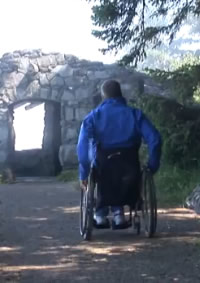
We've selected the sites below to showcase some of our premier accessible sites. There are many more sites that offer some degree of accessibility.
- The Accessible Adventures Videos for Cape Perpetua Scenic Area, Oregon Dunes National Recreation Area, and Hidden Gems of the Oregon Coast offer a great introduction to accessible destinations on the Central Oregon Coast.
- We’ve provided links to additional information about the sites shown in the videos, and we've also included more unique and wonderful forest places offering accessible options for exploring the Siuslaw National Forest.
-
Please check individual trail and campground descriptions in the Recreation section for more opportunities.
- What do we mean by accessibility in rustic forest settings?
List of Featured Sites by Travel Corridor
- Tillamook to Newport
-
Newport to Florence
- Sweet Creek Trail
- Holman Vista Trail & Viewpoint
-
Cape Perpetua Visitor Center
(featured in Where the Forest Meets the Sea video) -
Cape Perpetua Day Use & Whispering Spruce Trail
(featured in Where the Forest Meets the Sea video) -
Devil’s Churn Viewpoint & Restless Waters Trail
(featured in Where the Forest Meets the Sea video) -
Cooks Chasm Overlook & Captain Cook Trail
(featured in Where the Forest Meets the Sea video)
-
Florence to Coos Bay
- Taylor Dune Trail
- Umpqua Beach Viewing Platform - Trail and Viewpoint
-
South Jetty Crab Dock
(featured in Oregon Dunes NRA video) -
Lagoon Trail - first ¼ to ½ mile
(featured in Hidden Gems video) -
Oregon Dunes Day Use with Oregon Dunes Loop Trail
(featured in Hidden Gems video) -
Tahkenitch Landing at Tahkenitch Lake
(featured in Oregon Dunes NRA video) -
Horsfall Beach Viewing Platform
(featured in Oregon Dunes NRA video) -
Reedsport Visitor Center - Oregon Dunes Headquarters
(featured in Hidden Gems video)
Tillamook to Newport
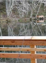
Hebo Lake Campground & Hebo Lake Loop Trail
Mount Hebo has a number of recreation attractions in a rustic natural forest setting which is special on the Siuslaw National Forest.
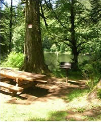 Hebo Lake Campground is a wonderfully restful setting with access to water’s edge and fishing.
The campground is set around a sheltered, peaceful lake – really a pond -- created by the Civilian Conservation Corps in the 1930’s.
Several lakeside campsites meet accessible standards. People sometimes move campground tables so space around tables may not meet the four foot standard.
 The picnic shelter at the site was originally built by the Hebo camp of the CCC’s in 1937, the stone floor is original. The floor is uneven.
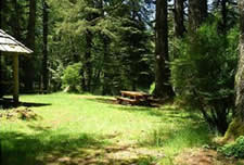
The lawn around it, part of the original design, is a bright picnic spot. The ground surface here is firm and fairly level, though some will need assistance.
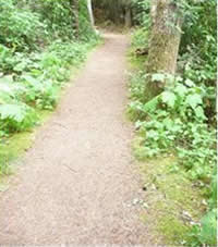
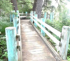
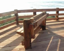
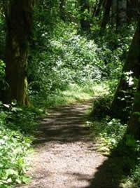 The Hebo Lake Loop Trail with fishing platforms follows the lake edge about two thirds of the way around it at a fairly flat grade. Be aware, however, that the trail surface is uneven and has places where it slopes towards the lake. The crushed rock surface has no fully compacted. There are likely to be some damp or soft parts of the trail where it is low, some areas of sloughing. There may be slight dip up or down from a platform to the trail surface. There is a bench near the beginning of the trail, to the west.
 The main fishing platforms are accessible immediately off the campground loop road.
The easiest to access vault restrooms are located at the east side of the campground, near the Pioneer Indian Trail, an historic trail, which does not meet access standards. Other restrooms at Hebo Lake do not currently meet standards due to uneven surface accessing them.
Hebo Lake Campground is located along Forest Road 14 off Highway 22, at the east edge of the town of Hebo.
Newport to Florence
Sweet Creek Trail - from Homestead Trailhead
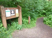
Sweet Creek Trail follows Sweet Creek, and provides access to a wonderful creekside forest setting, with waterfalls and lush vegetation. Sweet Creek feeds into the Siuslaw River near Mapleton. The creek is named after the Sweets, early homesteaders who came to the area by wagon train.
The Homestead Trailhead - the first of 4 trailheads for the trail - is in a little clearing where apple trees are reminders of the early settlers. A short segment (about 550 feet), beginning at Homestead Trailhead is accessible with a maximum 5% grade, up to the second bench where there is a view of the first, small, waterfall.
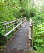
The remainder of the trail does not meet access standards. A portion of the trail clings to the creek bank with sections built on “catwalks” where trail users travel on grill and can view down to the creek. The trail does not meet access standards to the catwalks and there are stairs on the trail. The trail is steeper beginning at the first falls, with a 12% grade to the lower catwalk, approximately 400 feet.
The Homestead Trailhead for Sweet Creek Trail is located off Highway 126. Just east of the bridge into Mapleton, turn south onto Forest Road 5036 and travel about ten miles.
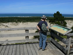
Holman Vista Trail & Viewpoint
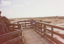 Catch beautiful, picturesque views of the low sand dunes and overlook a coastal creek from the Holman Vista viewing deck. Experience the muted colors and the constant change of the Oregon coast landscape. The land is uniquely wild in appearance and extends undeveloped north and east to Highway 101.
A short trail connects the parking lot to the view deck.
Holman Vista is part of the Sutton Recreation Area, seven miles north of Florence, along the Oregon Coast Highway 101.
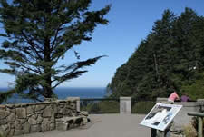
Cape Perpetua Visitor Center
 Cape Perpetua Visitor Center offers a variety of services: friendly visitor information at the front desk, day use passes, exhibits on natural and cultural resources, particularly related to the local resources and history of the Cape Perpetua Scenic Area, and a gift shop.
Short nature movies are available upon request in the little theater within the Visitor Center.
Most visitors are initially captivated by the stunning views of the ocean through the arched windows on the west side of the Visitor Center.
Guided walks and informal talks are available daily (except Wednesdays) in the summer at various locations, ask at the Visitor Center for details.
Off-season ranger talks are available as staffing permits.
Restrooms are available in a separate building, just before entering the Visitor Center.
Two marked accessible parking spots are available, above and to the right of the Visitor Center, with a short and fairly low or level grade down and across a crosswalk, leading to the Visitor Center.
- Description
- Accessible Adventures Videos: Where the Forest Meets the Sea
Cape Perpetua Day Use & Whispering Spruce Trail
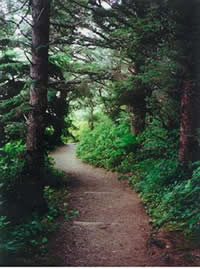 The Whispering Spruce Trail is a ¼ mile trail of compacted crushed rock leading towards a fabulous viewpoint. Whispering Spruce trail leads west from the Cape Perpetua Day Use area to the historic stone West Shelter, which offers a wide, picturesque view of the Pacific and rocky headlands to the south.
The floor of the shelter is uneven. The Whispering Spruce trail has an uneven surface, steep portions and obstacles, and places with outslope. It does not meet standards. “Accessible Adventures” recommends having assistance.
The other viewpoint, to the south, from this day use parking area does not meet access standards. The restroom at the parking area has entrance paving that is too narrow for turnaround, and not to standard.
This day use site and trail can be reached by driving east on the 55 road from Highway 101 about a mile, and then turning left at the first intersection. Take your time on this slow and curvy road.
- Cape Perpetua Day Use and Whispering Spruce Trail Descripton & Map
- Accessible Adventures Videos: Where the Forest Meets the Sea
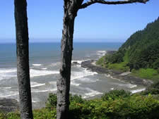
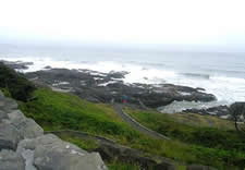
Devil’s Churn Viewpoint & Restless Waters Trail
 Devil’s Churn is a spectacular scenic attraction, a popular recreation site. The Devils Churn Day Use site provides an overlook into the interesting water and lava features of the Devil’s Churn. There are views of the Cape Perpetua headlands, the Pacific Ocean, and Devil’s Churn, with its lava formations.
The Devil’s Churn overlook platform, with its heavy stonework, is accessible from the upper parking lot. The restroom is accessible from the lower parking lot. There is not an accessible connection between the upper and lower parking lot, except by driving.
Restless Waters Trail starts from the Restless Waters Trailhead in the lower parking lot. Following the trail to near the top of the stairs leading down to the Churn is a distance of about 600 feet, mostly at 8% grade, with a very short section of 10% grade. There are two switch backs in the trail. At, and just after, the first turn in the trail, there is this sustained grade and somewhat out sloped corner. Past the overlook by the stairs down to the Churn, the next 430 feet of the trail is 14% maximum, mostly 12% grade, to the stairs down to the tidepools. This portion of the trail does not meet access standards, and has out sloping at curves.
Past the point of the stairs to the tidepools, the trail surface is uneven and rough, steep, and does not meet standards.
Devil’s Churn overlook and Restless Waters Trail and Trailhead are located at Devil’s Churn day use site which is along coast Highway 101 on the south side of Cape Perpetua, on a historic section of highway.
- Devil's Churn Day Use Description and Restless Waters Trail Description & Map
- Accessible Adventures Videos: Where the Forest Meets the Sea
Cooks Chasm Overlook with Captain Cook Trail
 A relatively gentle grade half mile loop section of the Captain Cook Trail can be reached from the Cook’s Chasm parking lot, off Highway 101, and leads to a stone and metal overlook of Cooks Chasm.
Captain Cook’s Trail is an asphalt trail with fairly continuous wooden curb to the point of the small Cook's Chasm Overlook. Past the small overlook, the trail does not meet accessible standards. Side trails off the Captain Cook Trail do not meet accessible standards.
The first stretch of Captain Cook Trail goes down a hill from the Visitor Center and has sections of steep pitch and uneven surface and is not accessible.
- Captain Cook Trail Description & Map
- Accessible Adventures Videos: Where the Forest Meets the Sea
Florence to Coos Bay
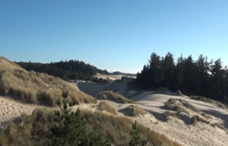
Taylor Dune Trail
Taylor Dune Trail travels through coastal forest, past a marshy lake with a wildlife viewing platform, and then uphill through forest to a second platform at the edge of the sand dunes.
There are views of the Pacific from the upper viewing platform. The trailhead and first more gradual portion of the trail (approximately 800 feet) have a maximum 5% grade.
After the wildlife viewing platform, the trail has 8% grade, some sustained grade sections. The second part of the trail is likely to have some sandy soil spilled onto the trail from eroding banks.
Taylor Dune Trailhead is located adjacent to Highway 101, eight miles south of Florence.
Umpqua Beach Viewing Platform
Umpqua Beach Viewing Platform (at Umpqua Beach Parking # 2) Trail #1335 and Viewpoint
Adjacent to the parking lot, a short trail leads up to a viewing platform to look out to the beach, with a wide view of the Pacific and the sandy beach. Access to the beach is fairly level over soft sand; beach access cannot meet access standards.
Umpqua Beach Trail is further from Highway 101. It is near Winchester Bay, off Salmon Harbor Drive.
South Jetty Crab Dock
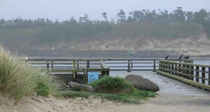 The dock is popular for crabbing.
It does not meet current standards for accessibility, but may well be useable.
The path surface to the dock as constructed is accessible, but there is likely to be blown sand on the pathway which creates an obstacle.
It is located off the South Jetty Road, overlooking the mouth of the Siuslaw River, south of Florence.
- Day Use Description
- Accessible Adventures Videos: Oregon Dunes NRA
Lagoon Trail
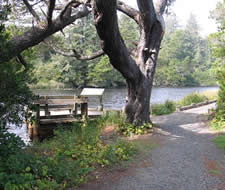 Lagoon Trail offers a beautiful, tranquil setting of slow canal-like water, a former meander of the Siltcoos River. You can sit at viewing platform and watch the water, birds and other wildlife. The area provides outstanding wildlife watching opportunities.
The first 2300 feet of the trail has 0% to 2% grade. The two viewing platforms are accessible.
The Trail leaves from the Stagecoach Trailhead or from within Lagoon Campground, located off Highway 101, seven miles south of Florence.
- Trail Description and Map
- Accessible Adventures Videos: Hidden Gems
Oregon Dunes Day Use & Dunes Loop Trail
Oregon Dunes Day Use offers visitors spectacular natural area views of the Oregon Dunes. There are two levels from which to view the Dunes.
- The main level has picnicking, viewpoints with interpretive signs, and restrooms.
- At the upper overlook viewing deck there is a bench and interpretative signs.
The viewing decks are constructed of wood, and have a level transition from the paved access route.
The asphalt trail leads to individual picnic spurs where sites have extended end tables. The trail also incorporates an occasional “pull out” to allow wheel chair users to pass. Each site has its own unique view of the dunes and the Pacific Ocean.
The upper level is accessed either by stairs or a switch back wooden ramp that has level rest areas every twenty feet. This site does not meet current access standards, but has few barriers to use within the constructed site.
The trails down to the sand are not accessible.
- Day Use Description and Trail Description & Map
- Accessible Adventures Videos: Hidden Gems
Tahkenitch Landing at Tahkenitch Lake
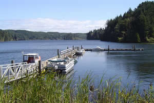 Tahkenitch Lake is one of the large coastal lakes created when sand blocked streams coming from the Coast Range. A number of recreation sites are in this vicinity.
The accessible boat ramp at Tahkenitch Landing offers great boating and fishing access. It is located directly off Highway 101.
- Tahkenitch Landing Boat Ramp Description
- Accessible Adventures Videos: Oregon Dunes NRA
Horsfall Beach Viewing Platform
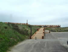
Enjoy a wide view of the Pacific, beach, and dunes from the raised viewing platform at the top of the foredune.
Decking leads directly from the parking lot to the viewing platform. There are benches on which to sit and enjoy the view.
Horsfall Beach Viewing Platform is located off the end of Horsfall Corridor, off Highway 101, north of Coos Bay.
- Day Use & Staging Area Description
- Accessible Adventures Videos: Oregon Dunes NRA
Reedsport Visitor Center
 The Reedsport Visitor Center has interpretive displays about cultural history and people of the area, geology of the dunes, plants, and wildlife.
Guided walks are given in different areas of the Forest, including in dunes settings.
The Reedsport Visitor Center and Oregon Dunes Headquarters is located just off Highway 101, just south of the Umpqua River Bridge in Reedsport.
- Description
- Accessible Adventures Videos: Hidden Gems
What do we mean by "accessible" forest sites?
The Siuslaw National Forest offers a unique range of recreation settings and opportunities from coastal to inland forests, from highly developed campgrounds to primitive settings.
Forest settings are very different from developed urban settings. Developments in forest settings are typically more rustic, with the natural topography and vegetation retained for people to enjoy.
Most forest recreation facilities do not have sidewalks or handrails. Some sites have paved surfaces and some do not. Assistance may be necessary in some places. The best way to plan your trip is to find out the degree of accessibility of the recreation facilities you would like to visit.
How steep are the trails? Is the surface paved, compacted gravel or loose gravel? Are there accessible restrooms and campsites?
- The Accessible Adventures Videos offer a great introduction to accessible destinations on the Central Oregon Coast:
- We’ve provided links to additional information about the sites shown in the videos, and we've also included more unique and wonderful forest places offering accessible options for exploring the Siuslaw National Forest.
By using the descriptions, you can match your interest and ability to available recreation destinations.
- Please let us know how this information meets your needs.
Alerts & Warnings
- UTV Takeover Curfew
- Use northern route to access Drift Creek Falls
- Forest Road 789 - Poor Condition
- High water at several recreation sites (ODNRA)
- Beach restrictions in effect March 15 - Sept. 15 to protect nesting birds
- Sweet Creek Falls Homestead Trail bridge failure
- Central Coast RD: FS Rd 5590 Closed