
Official websites use .gov
A .gov
website belongs to an official government organization in the
United States.
Secure .gov websites use HTTPS
A lock
(
) or https:// means you've safely
connected to the .gov website. Share sensitive information only
on official, secure websites.


Middle Fork Ranger District
The Middle Fork Ranger District office is located in Challis, Idaho. It is one of six districts that comprise the Salmon-Challis National Forest. It administers and oversees over a million acres of land, including over 900,000 acres of the Frank Church – River of No Return Wilderness (FC-RONRW) area, one of the last intact wild places in the lower 48 states.
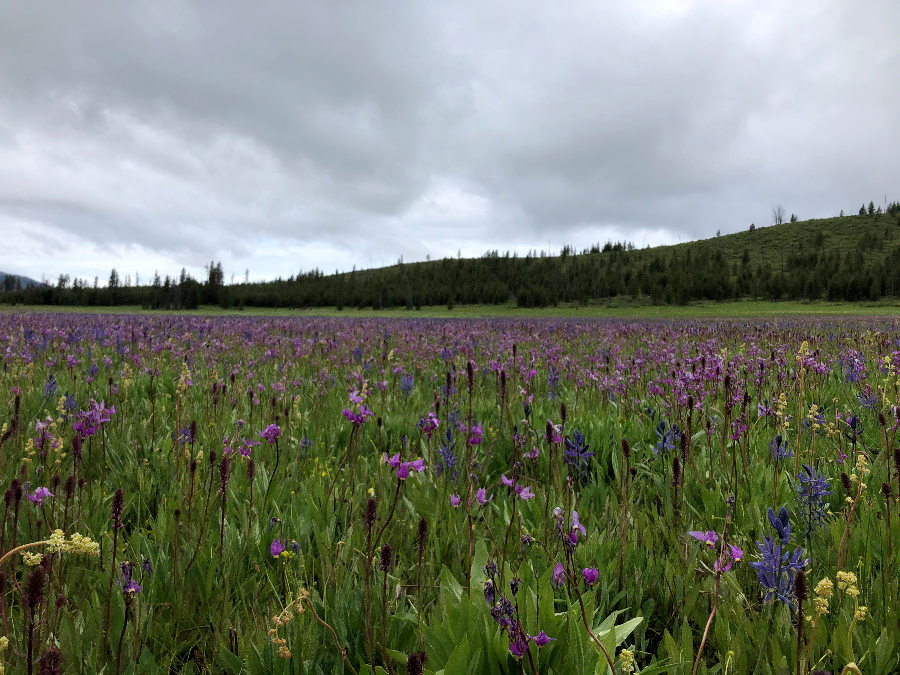
A land of steep mountains, deep canyons, and wild rivers, the Frank Church – River of No Return Wilderness is the second largest Wilderness in the lower 48 states at almost 2.4 million acres. The FC-RONRW provides outstanding opportunities for primitive recreation experiences and is home to the Middle Fork of the Salmon River, a world-renown whitewater river. The District oversees the management of the Middle Fork, 104 miles of free-flowing whitewater, where every bend reveals a new dramatic vista and a challenge to boaters’ skills.
The Middle Fork is also responsible for the administration of the Forest lands within one of the new wilderness areas, the Jim McClure-Jerry Peak Wilderness.
The Middle Fork District has grouped recreation opportunities, such as trails and campgrounds, into several geographic management zones, or areas. These areas are described below, and are generally zoned by access points and/or destinations.
* Camping Opportunities on the Middle Fork District
* Floating the Middle Fork of the Salmon River
* Trails of the Middle Fork District
In the Middle Fork District's Trail Condition Report, trails are sorted by areas, which are identified by a number in the table. These management area numbers are referenced at the bottom of each page of that document.

Sleeping Deer Area (MF1) [yellow]
This area encompasses trails, trailheads, camping and other recreation opportunities originating mainly around the Sleeping Deer Road #086, a “cherry-stem” road west of the Twin Peaks Saddle and surrounded by the Frank Church--River of No Return Wilderness.
This area is roughly bordered on the east by Camas Creek and Meyers Cove, by Loon Creek and Warm Springs Creek to the west, the wilderness boundary to the south, and the Middle Fork of the Salmon River to the north. This area has seen a lot of fire activity over the years.
The Sleeping Deer Road is a single-track, high-elevation dirt road that opens late and closes early due to snow.
Loon Creek Area (MF2) [pink]
This area encompasses trails, trailheads, camping and other recreation opportunities surrounding the Loon Creek Road #007, the Beaver-Loon Road #172, and the Indian Springs Road #004.
This area is roughly bordered by the Middle Fork of the Salmon River to the north, Loon Creek and Warm Springs Creek to the east, the Wilderness boundary to the south, and the Seafoam country to the west.
Access roads are single-track dirt roads with high-elevation passes that are closed by snow during the winter. The Indian Springs Road (FR 004) is steep, narrow, rough, and does not receive regular maintenance. There is a back-country dirt airstrip (Upper Loon) near the end of the Loon Creek Road, near Tin Cup Campground and the Phillips Creek Trailhead.
Seafoam, Marsh Creek, Langer & Soldier Lakes Area (MF3) [purple]
This area encompasses trails, trailheads, camping and other recreation opportunities that are generally accessed from the Seafoam area and the Beaver Creek Road #008 that are on the Middle Fork Ranger District. The Seafoam “bubble” is non-wilderness and contains the Josephus Campground and trailhead for the Soldier Lakes area. Be aware of the Wilderness boundaries.
Access roads are single-track dirt roads with high-elevation passes that are closed by snow during the winter.
Boundary, Sulphur, Pistol, Indian Creek Area (MF4) [blue]
This area encompasses trails, trailheads, camping and other recreation opportunities on the District that are generally reached from or near the Dagger-Boundary Road #568, the Artillery Dome Road #550, or other roads/routes along the western wilderness boundary. Access roads are single-track dirt roads with high-elevation passes that are closed by snow during the winter.
There are two campgrounds, Boundary Creek and Dagger Falls, in this area. Boundary Creek is a popular campground for boaters beginning their float trips on the Middle Fork of the Salmon River. The Transfer Camp is a trailhead for the Middle Fork Trail and a long-term parking area for boaters.
Marble, Sheep and Brush Creek Area (MF5) [orange]
This area generally encompasses trails, trailheads, camping and other recreation opportunities that are west/northwest of the Middle Fork of the Salmon River, from the Marble Creek drainage to Big Creek and the Payette National Forest to the North.
Cape Horn Area (MF6) [green]
This area generally encompasses trails, trailheads, campgrounds and other recreation opportunities in the Cape Horn Country that are outside the Wilderness boundary. Campgrounds in this area include Lola, Beaver, Banner, Bench and Thatcher, all located just off Highway 21, plus Vader Rest Stop. In the winter, the Cape Horn Guard Station may be rented.

Related Links
Highlights
- Guide to an Enjoyable Visit

-
Meet the Middle Fork
Encompassing four national forests and a designated Wild and Scenic River, the Frank Church-River of No Return Wilderness is a 2.3 million acre tract of protected wilderness in central Idaho. Managed by the US Forest Service, this place, sometimes simply called “the Frank”, is full of people doing a great variety of tasks to maintain and preserve this special place. In this series of informational interviews, you will hear from some of the people who work along the trails and on the water to keep the wilderness wild. - User's Guide to the "Frank" (2001)
- Fires & Waste Management when travelling in the River Corridor
- Drones
- Mining in the Middle Fork?