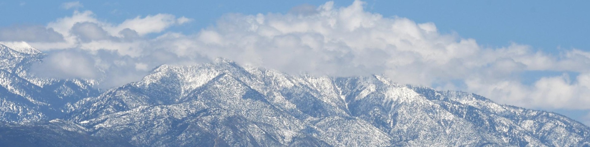
San Gorgonio Wilderness

San Gorgonio Mountain, with ridges of trees in the foreground

Wilderness/Primitive Area Sign for San Gorgonio Wilderness
Wilderness/Primitive Area Sign for San Gorgonio Mountain Wilderness

The San Gorgonio Wilderness is a unique sub-alpine landscape surrounded by desert to the east. It resides within the Sand to Snow National Monument and has a total of 96,595 acres with elevations ranging from 4,400 ft. to 11,502 ft. at San Gorgonio Peak. The isolated environment contains many threatened and endangered plant and animal species, as well as bear, deer, mountain lions and bighorn sheep. The wilderness is co-managed by the Forest Service and the Bureau of Land Management.

Permits

A free wilderness permit is required for day hikes and overnight trips. The requirement is only for portions of the wilderness within San Bernardino National Forest, not areas managed by the Bureau of Land Management.

Day Use

Free permits are available to enter the Wilderness from several locations (see trailhead list below). To obtain a permit, visit the permit page for the San Gorgonio Wilderness Association, a Forest Service partner. Permits can be requested up to 90 days in advance.

Camping

Free permits are available for the 24 backcountry campsites within the Wilderness. To obtain a permit, visit the San Gorgonio Wilderness Association's overnight permit availability webpage to begin the process. Permits can be requested up to 90 days in advance.

Pacific Crest Trail

No permit is required to traverse the short section of the PCT on the side of the San Gorgonio Wilderness managed by the Forest Service (Section 31, Township 1 North, Range 3 East, San Bernardino Base and Meridian).

Other Regulations

  • No campfires allowed at any time.
  • No possessing or using a hang glider or bicycle.
  • Group size limited to 12 people maximum.
  • No possessing or using a motor vehicle, motorboat or motorized equipment except as authorized by Federal Law or regulation.​

Trailheads

There are 81 miles of trails in the San Gorgonio Wilderness, including a small portion of the Pacific Crest Trail.

  • Vivian Creek Trail: The trailhead is reached by turning east off Highway 38 to Forest Falls. An Adventure Pass or Interagency Pass is required to park at the trailhead.
  • Momyer Creek Trail: The trailhead is reached by turning east off Highway 38 to Forest Falls.
  • San Bernardino Peak Trail: From Angelus Oaks, turn east off Highway 38 onto Manzanita. Then turn to the immediate left onto the frontage road that parallels Highway 38. Turn right onto FS road 1W07 and stay to the right up the dirt road 300 yards to the trailhead
  • Forsee Creek Trail: Turn right (southeast) on Jenks Lake Road West off Highway 38. One-quarter mile from Highway 38 is a signed dirt road on your right. This is a rough, rocky road not intended for low-clearance vehicles.
  • South Fork Trail: The trailhead is located on Jenks Lake Road, 2.5 miles from Highway 38. From the large paved parking area, the trail starts on the opposite side of the road across from the vault toilet. An Adventure Pass or Interagency Pass is required to park at the trailhead
  • Lost Creek Trail: The Lost Creek trailhead is across (north of) Highway 38 from the South Fork Campground. This trail was severely damaged in the 2015 Lake Fire and is not advisable for travel.
  • Aspen Grove Trail: Enter via Coon Creek Jumpoff (1N02), follow 1N02 until it forks right to Fish Creek Rd (1N05). Follow 1N05 to the signed Aspen Grove Trail parking. These roads close in the winter after the first significant snowfall.
  • Fish Creek Trail: Enter via Coon Creek Jump-off (1N02), follow 1N02 until it forks right to Fish Creek Rd (1N05). Follow 1N05 about 7 miles to the trailhead. These roads close in the winter after the first significant snowfall.

Safety

Keep yourself safe on the trails while protecting your vehicle and valuables back at the trailhead with the following tips:

  • General Hiking Tips: Trails in Wilderness areas are recommended for the intermediate to expert hiker. Elevations range from approximately 6,200 ft. at the Vivian Creek Trailhead to 11,499 ft. at the summit of San Gorgonio Mountain. Please review the Forest Service's hiking safety tips before heading out on your trip.
  • Winter Hiking: Dangerous conditions exist when snow and ice conditions are present. This is especially dangerous as many trails in the wilderness are exposed to steep terrain. Visitors should take extreme caution and only go with proper gear (e.g. traction devices, ice axe, etc.) and experience/training using that gear.
  • Protect Your Vehicle: You'll be away from your vehicle for a few hours to a few days. Help protect your vehicle and valuables by reading the Protect Your Car section on the Forest Service's crime prevention webpage.

More About the Wilderness

The United States Congress designated the San Gorgonio Wilderness in 1964, making it one of the first designated wilderness areas in the United States. The wilderness is named after San Gorgonio Mountain, which at 11,499 ft. is the highest peak in California south of the Sierra Nevada. San Gorgonio Mountain, however, was originally known as Old Grayback by locals until officially designated by the US Geological Survey on the original topographical map of the area produced in 1899.

The 10,624-foot San Bernardino Peak provided the initial point in 1852 from which all Southern California was surveyed and subsequently mapped.