
Official websites use .gov
A .gov
website belongs to an official government organization in the
United States.
Secure .gov websites use HTTPS
A lock
(
) or https:// means you've safely
connected to the .gov website. Share sensitive information only
on official, secure websites.


Northern California
567 Miles
 North of Donner Summit (elev. 7,200’), old volcanic flows and sediments bury most of the ancient bedrock of the Sierra Nevada crest, making travel in this section potentially dusty in late summer. Beyond the North Fork of the Feather River, the Sierra Nevada yields to the southern Cascade Range.
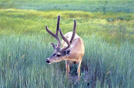
Rich in nutrients, the volcanic soils here are at the right elevation and receive sufficient rainfall to produce exceptional forests. Other plants include lupine, paintbrush, larkspur, columbine, gooseberry, and manzanita. Animals include raccoon, marten, mink, badger, fox, bobcat, and the ever-present deer and black bear. In the fall, the skies are often filled with migrating birds on their journey south along the Pacific coast flyway.
 This is prime logging country (as are most of the PCT’s lands north of here), and the trail crosses many back roads.
Midway through the southern Cascade Range, the PCT crosses Highway 89 and traverses Lassen Volcanic National Park, overseen by Lassen Peak (elev. 10,457’).
North of the park the PCT follows the mostly waterless Hat Creek Rim toward majestic Mt. Shasta, which dominates the north-state skyline.
Rather than continue north through the dry southern Cascades beyond Mt. Shasta, the PCT turns west toward greener lands, dropping to cross the Sacramento River (elev. 2,130’) at Interstate 5 before entering Castle Crags State Park and the Trinity Alps. The trail reaches 7,600’ elevation in the mountains connecting the inland Cascade Range with the coastal ranges.
The trail winds north through the Marble Mountains before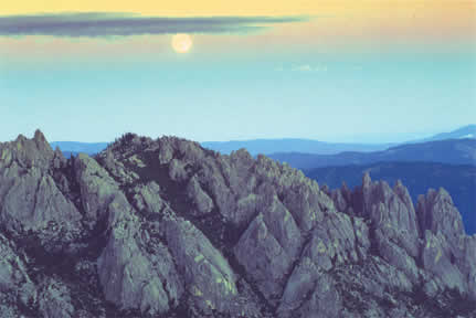 descending to the Klamath River (elev. 1,370’). It climbs again to the crest of the Siskiyou Mountains and traverses east, entering Oregon near this section’s end at Interstate 5 near Siskiyou Summit (elev. 4,310’).